One park, three worlds: glaciers on peaks named for Greek gods, a rainforest that takes twelve-plus feet of rain a year, and 73 miles of wilderness coast. It exists largely because people were shooting elk for their teeth.
Olympic is one of 63 national parks in ParkStamp, and every park in the app carries original stamp designs drawn in the WPA poster tradition, each an illustration of one specific, reachable place rather than a composite.
Logging the visit is free. Check in at the park, enter a trip from any year past, or let the app work out dates and places from photos already on your phone.
The real NPS boundary, with the roads and towns you would actually use to get there.
Olympic, for people who count parks
Saved for its elk, named for its mountain, and famous for its rain.
The elk-tooth fad nearly emptied these mountains. By the early 1900s, poachers were killing the peninsula's elk largely for their canine teeth, which members of the Elks fraternity wore as watch charms. Theodore Roosevelt created Mount Olympus National Monument in 1909, in his final days in office, substantially to stop it. The proposals of the era included an "Elk National Park"; instead the park kept the mountain's name and the elk took Roosevelt's: the Roosevelt elk, largest-bodied of the elk subspecies, whose biggest unmanaged herds still live here.
It took the other Roosevelt to finish the job. The timber industry spent decades trying to keep the big lowland rainforest valleys out of any park. Franklin Roosevelt toured the peninsula in 1937, sided with the trees, and signed Olympic National Park into law on June 29, 1938. The ocean strip came in 1953, giving the park its 73 miles of coast. About 95 percent of it all is now designated wilderness, one of the largest roadless blocks in the lower 48, with no road crossing the interior at all.
The mountain got its name from a passing trader. The English captain John Meares saw the highest peak from his ship in 1788 and named it for the home of the Greek gods. Mount Olympus is just under 8,000 feet, modest on paper, but it catches so much Pacific snow that it carries glaciers a mountain twice its height could envy, Blue Glacier the largest among them.
The park also hosted the largest dam removal in American history. Two century-old dams had walled salmon out of the Elwha River since before the park existed. Elwha Dam came down in 2012, Glines Canyon Dam by 2014, and the river responded faster than almost anyone predicted: salmon pushed into the upper watershed within a few years, and the freed sediment rebuilt the beach at the river's mouth. On the coast at Ozette, a mudslide around 1700, likely triggered by the great Cascadia earthquake, buried part of a Makah village and preserved it; excavations in the 1970s recovered some 55,000 artifacts, the finest window that exists into pre-contact life on this coast.
An island that happens to be attached, with species all its own.
The peninsula works like an island, cut off by saltwater on three sides and, during the ice ages, by glaciers on the fourth. Isolation that long produces species found nowhere else: the Olympic marmot, Washington's official endemic mammal; the Olympic torrent salamander; a violet and a bellflower of its own. The same isolation left gaps: pikas, grizzlies and bighorn, all common in the Cascades, simply never made it across.
The mountain goats were a mistake, and undoing it took helicopters. Goats were introduced here in the 1920s, before the park existed; they are not native to the peninsula, and their numbers grew until they were tearing up alpine plants that evolved without them. Between 2018 and 2020 the park captured hundreds and airlifted them, blindfolded and dangling in slings, to the Cascades, where they belong. Around the same time the park restored a native carnivore, releasing about 90 fishers between 2008 and 2010.
The rain gradient is its own exhibit. The Hoh Valley takes twelve feet and more of rain a year and grows some of the largest hemlock, spruce and cedar on Earth; the northeast corner, in the rain shadow forty-odd miles away, is one of the driest places on the West Coast. One park spans both. Offshore, sea otters, reintroduced to this coast in about 1970 after the fur trade erased them, are back working the kelp beds, and the tidepools at low water are as rich as any in the system.
The Olympic designs
Pick the one that matches the park you actually saw.
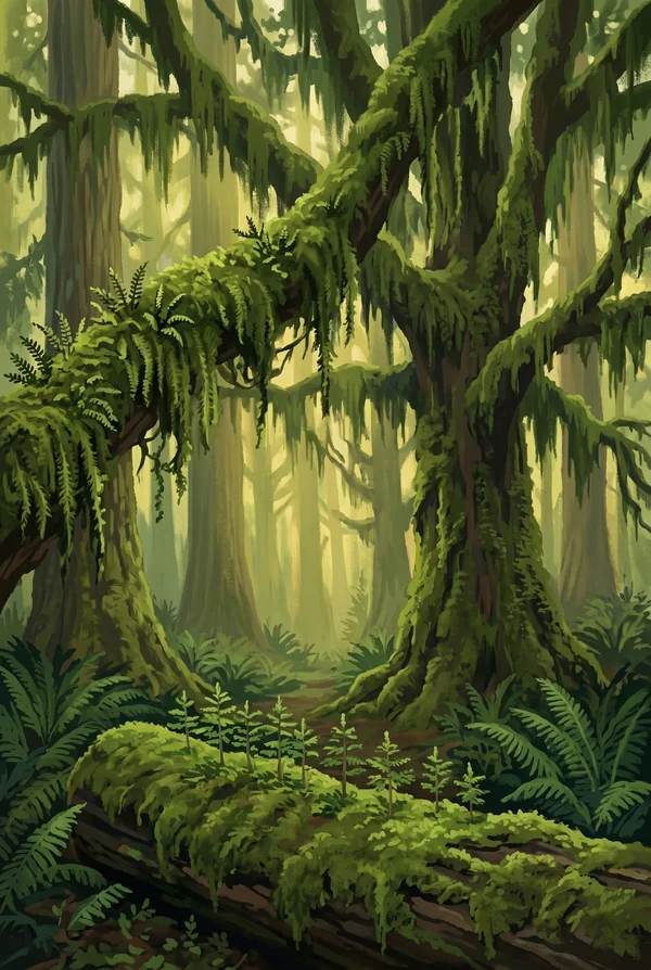
Hoh Rainforest Hall of Mosses
A short loop through the most concentrated version of the temperate rainforest: bigleaf maples so loaded with moss and licorice fern that the trees read as green architecture. This valley takes over twelve feet of rain a year, and the silence under the canopy is famous: a research point in the Hoh is often cited as one of the quietest places in the continental US.
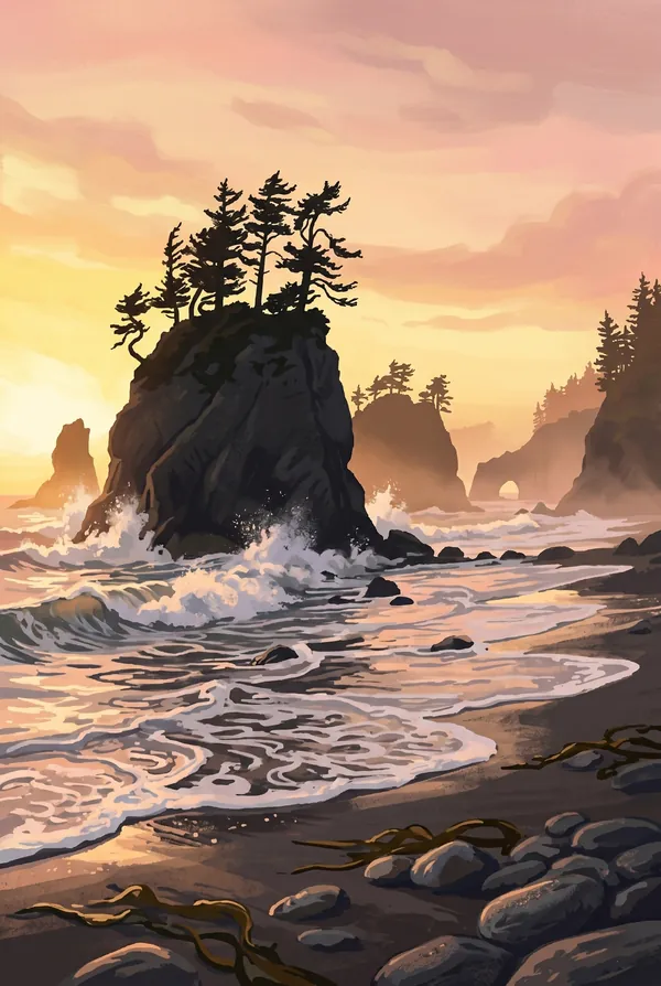
Rialto Beach Sea Stacks
A dark cobble beach stacked with drift logs the size of train cars, facing a line of offshore sea stacks the surf has not finished demolishing. A mile-and-a-half walk north at low tide reaches Hole-in-the-Wall, an arch you can pass through when the water allows. This is the park's wilderness coast at its most reachable.
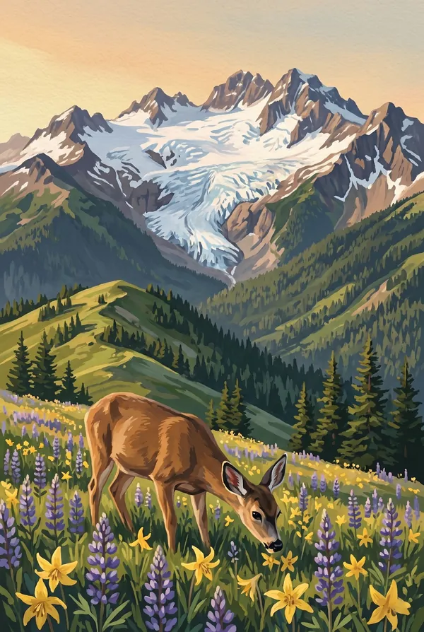
Hurricane Ridge Alpine View
The mile-high ridge above Port Angeles, named for its winds, where the interior Olympics finally show themselves: rank after rank of glaciered peaks across the Bailey Range to Mount Olympus. Deer graze the meadows, marmots whistle from the rocks, and on a clear day you can turn around and see Canada across the strait.
How to record your Olympic visit
Free, and it works whether you are standing there now or remembering a trip from years ago.
1
Check In at the park
Open ParkStamp inside the park boundary and check in. The app confirms you are actually there and logs the date.
2
Or Stamp It later
Already been? Pick the date yourself. Trips from decades ago count the same as last weekend.
3
Or scan your photos
Let ParkStamp read the dates and locations off photos already on your phone. Most people find parks they had forgotten.
Olympic, asked and answered
Quick answers, for people planning a trip and people remembering one.
When is the best time to visit Olympic?
July through September is the dry season, when Hurricane Ridge runs to wildflowers and the rainforest is merely damp; this is the window for the high country. Low tide matters more than season on the coast; time Rialto and the tidepools around it. Winter is the connoisseur's pick: storm-watching on the beaches, and the Hoh in the rain, which is arguably the honest way to see it.
How many days do you need at Olympic?
Three days, one per world, is the honest minimum: the park is a doughnut with no road through the middle, so everything is a drive around the rim. Day one for Hurricane Ridge, day two for the Hoh and the big trees, day three for the coast at Rialto or Kalaloch. A fourth day adds Lake Crescent and the Sol Duc valley.
How busy is Olympic?
Olympic National Park logged 3.58 million visits in 2025, the 9th busiest of the 63 national parks. That makes it one of the busiest parks in the system, and early mornings are the quiet hours.
What does the Olympic stamp show?
The lead Olympic design is Hoh Rainforest Hall of Mosses. A short loop through the most concentrated version of the temperate rainforest: bigleaf maples so loaded with moss and licorice fern that the trees read as green architecture. This valley takes over twelve feet of rain a year, and the silence under the canopy is famous: a research point in the Hoh is often cited as one of the quietest places in the continental US. The other two designs are Rialto Beach Sea Stacks and Hurricane Ridge Alpine View.
Is the Olympic stamp free?
Recording your Olympic visit is always free: check in at the park, add an old trip, or let the photo scan find it. The full-color art is the paid part, $3.99 one-time with three Olympic designs to choose from, and the first stamp you collect in ParkStamp is free.
Can I add a Olympic trip from years ago?
Yes. Open Olympic in ParkStamp, tap Stamp It, and set the date yourself; a visit from decades ago counts the same as last weekend. If you still have photos from the trip, the photo scan can find and date it from their location tags, without your photos ever leaving your phone.
Do I have to be at Olympic to get the stamp?
No. Check In is for when you are standing inside Olympic, and it confirms you are actually there. Stamp It records any past visit on your honor, with your dates. Both are free and put the same stamp in your StampBook.
Start your StampBook with Olympic
Free on iOS and Android. Your first stamp is on us.