On May 22, 1915, Lassen Peak blew ash roughly 30,000 feet into the air and flattened square miles of forest. Congress made it a national park the following year, while the mountain was still erupting, and until Mount St. Helens in 1980 this was the most recent volcanic eruption in the contiguous United States.
Lassen Volcanic is one of the 63 national parks in ParkStamp, each with its own original stamp designs drawn in the WPA poster tradition. Every design shows a specific real place in the park, drawn as a place and not a postcard.
Recording your visit is free. Check in on the spot, add a trip from any past year, or let the app work out dates and locations from photos already on your phone.
The real NPS boundary, with the roads and towns you would actually use to get there.
Lassen Volcanic, for people who count parks
A dead mountain that woke up, and the photographer who was standing there when it did.
It was protected as a curiosity first. Theodore Roosevelt proclaimed two small national monuments here in 1907, Lassen Peak and Cinder Cone, preserving what most geologists of the day regarded as interesting but extinct volcanic scenery. The peak had no recorded eruptions and no particular menace. That held for seven years.
On May 30, 1914, the mountain woke up. Steam explosions opened a new crater near the summit and kept coming, more than a hundred of them over the following year, while a local businessman named B. F. Loomis hauled a large-format camera up the mountain and photographed the blasts as they happened. The climax came on May 22, 1915: lava at the summit, a hot lateral blast that leveled forest for miles on the northeast side, and mudflows that tore down the creek valleys as the eruption melted the snowpack. Remarkably, no one was killed. The scarred fan of ground below the peak is still labeled the Devastated Area on park maps.
Congress moved while the ash was still settling. Woodrow Wilson signed the park into law on August 9, 1916, folding both monuments into a new Lassen Volcanic National Park: an eruption turned into a founding argument, with Loomis's photographs as exhibit A. Loomis spent the rest of his life promoting the park and left it his museum, which still stands near Manzanita Lake.
The peak itself is a plug dome, one of the largest on Earth: a stiff piston of lava about 2,000 feet high squeezed up in a geologic instant some 27,000 years ago. It grew on the flank of something much bigger: Mount Tehama, a stratovolcano that once stood about 11,000 feet here and has since eroded to a ring of remnants, of which Brokeoff Mountain is the largest. Between them, the park holds all four types of volcano found on Earth (shield, stratovolcano, cinder cone and plug dome), which no other national park can say.
One of the rarest mammals in North America, and a forest rebuilding itself on the blast zone.
The Sierra Nevada red fox is barely hanging on, and this is one of its last strongholds. A small, high-elevation subspecies with fur-soled feet for travel over snow, it was thought possibly gone from California's mountains until camera traps confirmed a tiny population in the Lassen area. The animals here number in the dozens at most, which makes a glimpse of one rarer than almost any wildlife sighting the park system offers.
Snow is the other fact of life. Lassen catches Pacific storms at elevation and buries itself under some of the deepest snowpacks in California; drifts around Lake Helen routinely persist into July, and the park's high country is white for more than half the year. Everything living here is organized around a short, intense summer: mountain hemlock bent into krummholz, pikas haying under the talus, frogs breeding in meltwater.
Manzanita Lake exists because a mountain fell down. Around three centuries ago the Chaos Crags, a cluster of young lava domes near the park's northwest corner, shed a series of enormous rock avalanches that ran miles across the valley floor and dammed Manzanita Creek. The debris field is called the Chaos Jumbles; the lake behind it is now the park's front porch, ringed with ponderosa and full of trout.
The Devastated Area is a century-long experiment. The 1915 blast stripped it to mineral soil, and ecologists have watched the forest reassemble ever since: pines seeding into pumice, aspen following water, soil rebuilding from nothing. It is one of the clearer places in America to see how long recovery actually takes: a hundred years on, the trees are still obviously young.
The Lassen Volcanic designs
Pick the one that matches the park you actually saw.
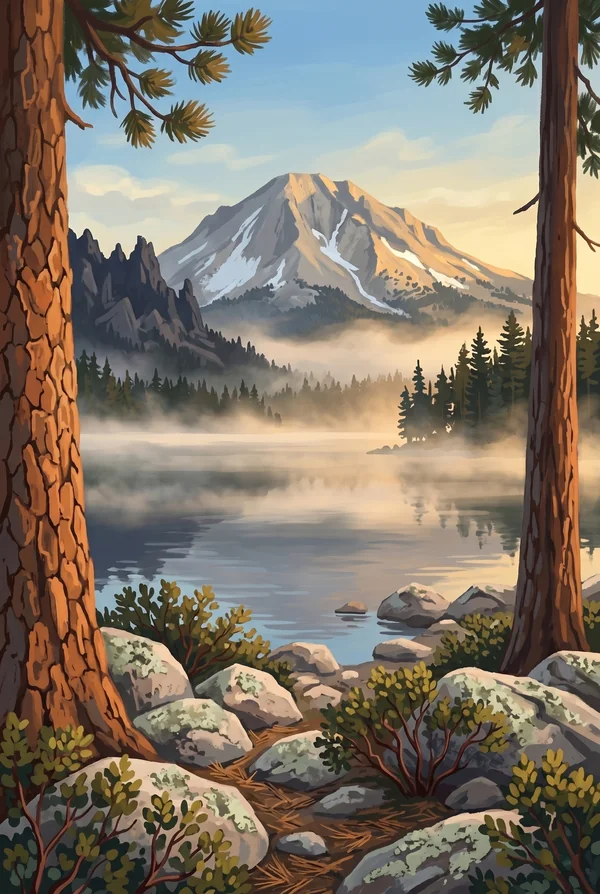
Lassen Peak from Manzanita Lake
The classic view of the park: a 10,457-foot plug dome, among the largest on Earth, doubled in a lake created when rock avalanches from the Chaos Crags dammed the creek about three centuries ago. On a still morning the reflection is nearly perfect. Pick it for the postcard the 1915 eruption made famous.
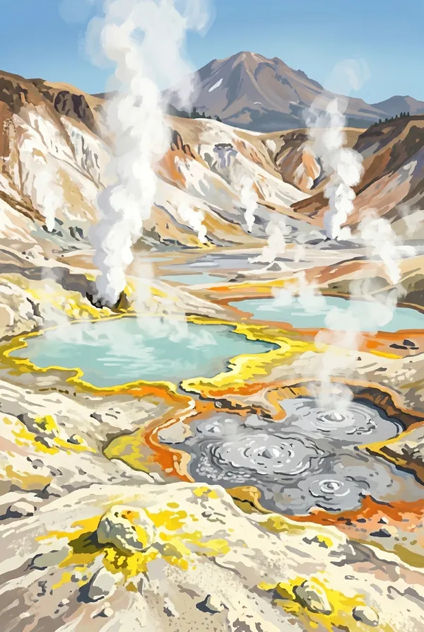
Bumpass Hell Hydrothermal Area
Sixteen acres of boiling springs, mudpots and roaring fumaroles, the largest hydrothermal area in the park, named for Kendall Bumpass, a guide who broke through the crust in the 1860s and lost his leg to the burns. A boardwalk now crosses the basin, past Big Boiler, one of the hottest fumaroles ever measured in the park system.
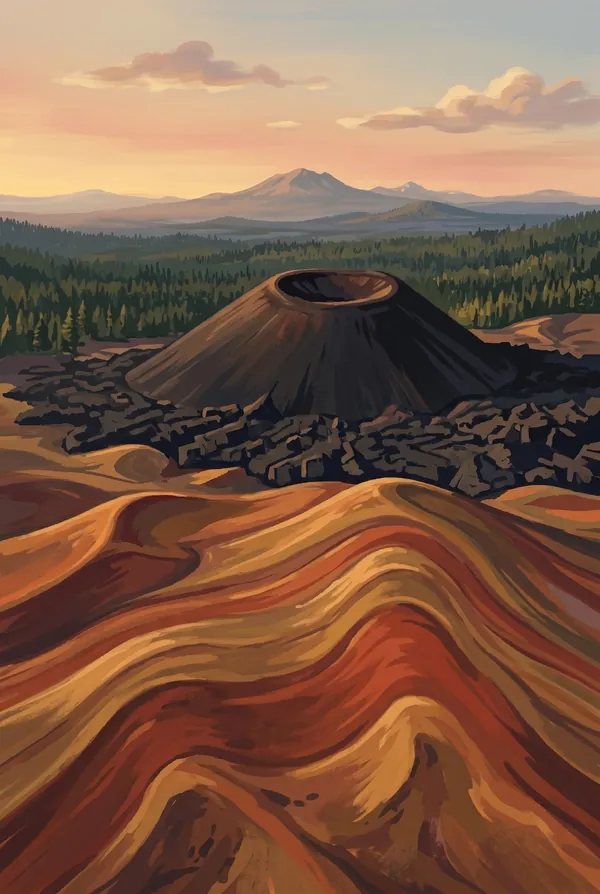
Cinder Cone and Painted Dunes
A 700-foot cone of loose black scoria in the park's remote northeast corner, built by an eruption dated by tree rings to around 1666. The trail goes straight up the cinders to a double-rimmed crater; below spread the Painted Dunes, ash oxidized orange and pink where it fell on still-hot lava. The strangest ground in the park.
How to record your Lassen Volcanic visit
Free, and it works whether you are standing there now or remembering a trip from years ago.
1
Check In at the park
Open ParkStamp inside the park boundary and check in. The app confirms you are actually there and logs the date.
2
Or Stamp It later
Already been? Pick the date yourself. Trips from decades ago count the same as last weekend.
3
Or scan your photos
Let ParkStamp read the dates and locations off photos already on your phone. Most people find parks they had forgotten.
Lassen Volcanic, asked and answered
Quick answers, for people planning a trip and people remembering one.
When is the best time to visit Lassen Volcanic?
July through September, once the high country finally sheds one of the deepest snowpacks in California: drifts near Lake Helen commonly linger into July, and the trail up Lassen Peak is at its best in late summer. Early October can be quiet and golden with aspen color around Manzanita Lake, though the first storms arrive without much notice. Winter buries the park and turns it over to snowshoers and skiers.
How many days do you need at Lassen Volcanic?
One full day covers the main road: Sulphur Works, the Bumpass Hell boardwalk, Lake Helen, the Devastated Area and Manzanita Lake, with a summit hike up Lassen Peak if you start early. Give it a second day for the remote northeast corner (Butte Lake, Cinder Cone and the Painted Dunes), which is a separate drive and worth every mile.
How busy is Lassen Volcanic?
Lassen Volcanic National Park logged 504,777 visits in 2025, the 40th busiest of the 63 national parks. That makes it one of the quieter national parks, and crowds are rarely the problem.
What does the Lassen Volcanic stamp show?
The lead Lassen Volcanic design is Lassen Peak from Manzanita Lake. The classic view of the park: a 10,457-foot plug dome, among the largest on Earth, doubled in a lake created when rock avalanches from the Chaos Crags dammed the creek about three centuries ago. On a still morning the reflection is nearly perfect. Pick it for the postcard the 1915 eruption made famous. The other two designs are Bumpass Hell Hydrothermal Area and Cinder Cone and Painted Dunes.
Is the Lassen Volcanic stamp free?
Recording your Lassen Volcanic visit is always free: check in at the park, add an old trip, or let the photo scan find it. The full-color art is the paid part, $3.99 one-time with three Lassen Volcanic designs to choose from, and the first stamp you collect in ParkStamp is free.
Can I add a Lassen Volcanic trip from years ago?
Yes. Open Lassen Volcanic in ParkStamp, tap Stamp It, and set the date yourself; a visit from decades ago counts the same as last weekend. If you still have photos from the trip, the photo scan can find and date it from their location tags, without your photos ever leaving your phone.
Do I have to be at Lassen Volcanic to get the stamp?
No. Check In is for when you are standing inside Lassen Volcanic, and it confirms you are actually there. Stamp It records any past visit on your honor, with your dates. Both are free and put the same stamp in your StampBook.
Start your StampBook with Lassen Volcanic
Free on iOS and Android. Your first stamp is on us.