This is the only national park whose ground is still being manufactured. Kīlauea, one of the most active volcanoes on Earth, shares the park with Mauna Loa, the largest, and between them they have repaved roads, swallowed forests, added new coastline, and, in 2018, dropped the floor of the summit crater some 1,600 feet while the world watched.
Hawaiʻi Volcanoes is one of the 63 national parks in ParkStamp. Like every park, it gets original stamp designs drawn in the WPA poster tradition, each one an illustration of a specific real place inside the park.
Recording your visits is free. Check in from the park, add trips from past years, or let the app read dates and locations from the photos already on your phone.
The real NPS boundary, with the roads and towns you would actually use to get there.
Hawaiʻi Volcanoes, for people who count parks
Pele's house, Twain's detour, and a summit that fell in on itself in 2018.
It was the first national park in a United States territory. Hawaii National Park was created on August 1, 1916, forty-three years before statehood, largely through the decade-long lobbying of Honolulu publisher Lorrin Thurston, who promoted the volcano the way other boosters promoted railroads. Mark Twain had already done some of the marketing: he visited Kīlauea in 1866 and wrote that the volcano made Vesuvius look like a soup kettle. In 1961 the Hawaiʻi side became its own park under the present name.
The science arrived before the park did. Thomas Jaggar founded the Hawaiian Volcano Observatory on Kīlauea's rim in 1912, making this one of the longest continuously studied volcanoes on Earth. Much of what the world knows about how volcanoes work (how they swell before eruptions, how lava lakes circulate) was learned by people standing at this crater with instruments.
Halemaʻumaʻu is the home of Pele, the Hawaiian volcano deity, and that is not a legend filed under folklore: offerings are still made at the crater rim, and the park is managed as a living sacred landscape. Out in the Kaʻū Desert, human footprints are preserved in hardened volcanic ash from an explosive eruption in 1790 that killed a party of Hawaiians crossing the area, one of the deadliest eruptions in what is now the United States, recorded in both oral history and the ground itself.
Then came 2018. Kīlauea had been erupting almost continuously since 1983: the Puʻu ʻŌʻō eruption, one of the longest of the modern era. In 2018 the plumbing shifted: lava drained to the lower flank and destroyed hundreds of homes outside the park, while the summit, emptied from below, fell in on itself through dozens of discrete collapses. Halemaʻumaʻu grew several times over and deepened by roughly 1,600 feet. Lava has returned to the crater in episodes since, rebuilding a floor the collapse took away.
Mauna Loa looms over all of it. By volume it is the largest active volcano on Earth, on the order of ten thousand cubic miles of rock, and after 38 quiet years it erupted again in 2022. The park runs from the ocean to 13,681 feet at its summit, which means it contains black-sand coastline and alpine stone desert in the same unit.
Forests marooned in lava, and birds holding out above the mosquitoes.
Life here starts on bare rock. The ʻōhiʻa lehua, the tree with the red shaving-brush blossoms, is usually the first thing to root on a new lava flow, sometimes within a few years of the rock cooling. Where younger flows wrapped around pockets of older ground, they left kīpuka: islands of mature forest surrounded by barren lava, each one a natural experiment in isolation that biologists treat like a miniature Galápagos.
The native birds live above an invisible line. Introduced mosquitoes carry avian malaria, which Hawaiian honeycreepers never evolved to survive, so the birds persist mainly in forest high and cool enough that mosquitoes struggle, a boundary that climate warming pushes uphill. In the park's high ʻōhiʻa forest you can still hear ʻapapane working the canopy for nectar, a sound most of Hawaii has lost.
The endemic list runs strange and wonderful: the happy-face spider, with a grinning pattern on its abdomen; the Kamehameha butterfly, one of only two butterflies native to Hawaii; and carnivorous-looking crickets and beetles that colonize fresh lava within weeks, eating windblown debris before plants arrive.
On the remote coast, hawksbill sea turtles nest on black-sand beaches reached only by trail, one of the few nesting populations of this critically endangered turtle in the United States, guarded by monitoring crews through the hatch.
The Hawaiʻi Volcanoes designs
Pick the one that matches the park you actually saw.
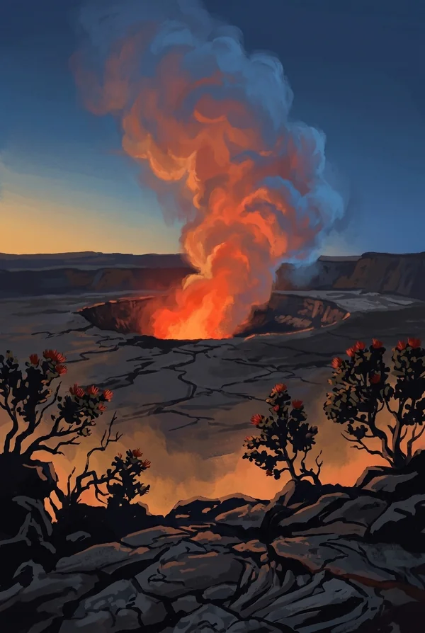
Kilauea Caldera and Halemaumau
The summit crater that is the home of Pele and the most studied piece of volcanic ground on Earth, watched continuously since 1912. The 2018 collapse enlarged it several times over and deepened it by roughly 1,600 feet; when lava returns, the night glow lights the clouds above the rim. The stamp for anyone who stood there after dark.
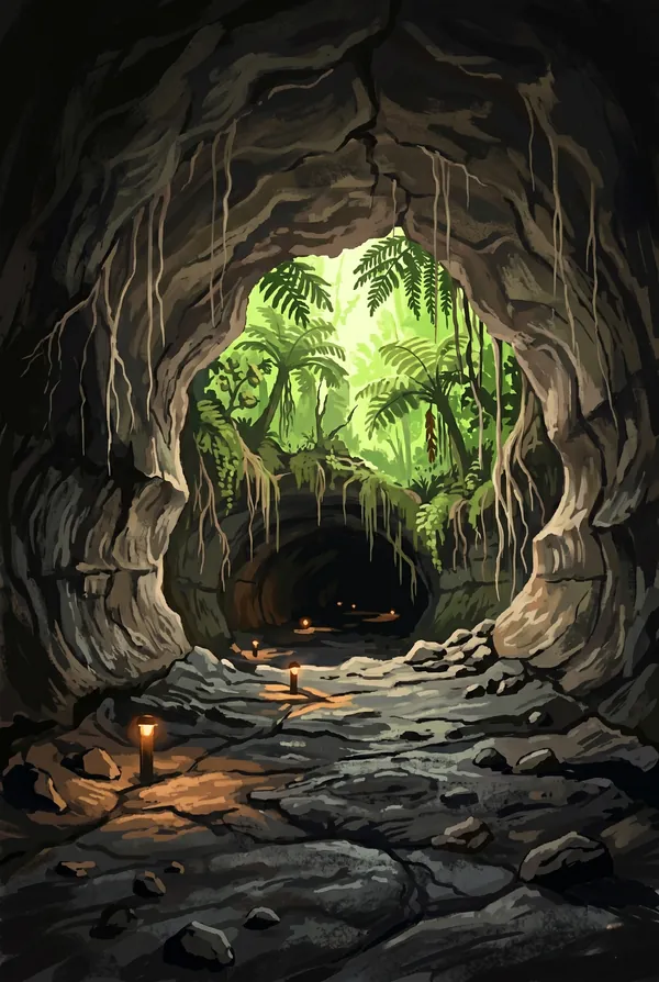
Thurston Lava Tube
Nāhuku, a tunnel left behind when a river of lava roughly five centuries old drained away, leaving a walkable tube in the rainforest. Lorrin Thurston, the publisher who campaigned the park into existence, brought it to attention in 1913 and got the name. Tree ferns and birdsong above, bare volcanic plumbing below: the park's two natures in one short walk.
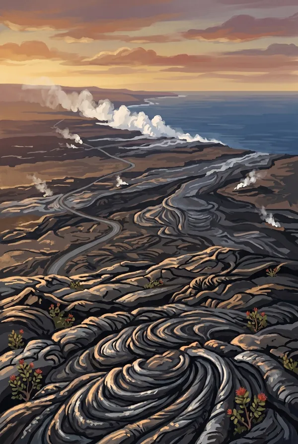
Chain of Craters Road Lava Fields
The park's great descent: about 19 miles dropping 3,700 feet from the summit region to the sea, past pit craters and across whole hillsides of hardened lava from the eruptions of recent decades. The road has been cut and rebuilt as flows kept burying it, and it now dead-ends where lava crossed it, near the Hōlei Sea Arch. Driving it is a tour through dated layers of brand-new Earth.
How to record your Hawaiʻi Volcanoes visit
Free, and it works whether you are standing there now or remembering a trip from years ago.
1
Check In at the park
Open ParkStamp inside the park boundary and check in. The app confirms you are actually there and logs the date.
2
Or Stamp It later
Already been? Pick the date yourself. Trips from decades ago count the same as last weekend.
3
Or scan your photos
Let ParkStamp read the dates and locations off photos already on your phone. Most people find parks they had forgotten.
Hawaiʻi Volcanoes, asked and answered
Quick answers, for people planning a trip and people remembering one.
When is the best time to visit Hawaiʻi Volcanoes?
There is no bad season: this close to the equator the park runs on elevation, not months. The summit area sits near 4,000 feet and is reliably cooler and wetter than the coast, with winter bringing a bit more rain. What matters more than the calendar is what Kīlauea is doing: when lava is in Halemaʻumaʻu, the glow after dark is the sight of a lifetime, so check nps.gov for current activity and plan to be at the rim at night.
How many days do you need at Hawaiʻi Volcanoes?
One full day covers the summit (Crater Rim, steam vents, Nāhuku lava tube) plus the drive down Chain of Craters Road to the sea arch. A second day earns the Kīlauea Iki crater crossing and the Puʻu Loa petroglyphs, and turns a drive-through into a real visit. A third reaches the quieter Mauna Loa side of the park.
How busy is Hawaiʻi Volcanoes?
Hawaiʻi Volcanoes National Park logged 1.88 million visits in 2025, the 18th busiest of the 63 national parks. That puts it in the middle of the pack: busy at the famous spots, quiet a mile past them.
What does the Hawaiʻi Volcanoes stamp show?
The lead Hawaiʻi Volcanoes design is Kilauea Caldera and Halemaumau. The summit crater that is the home of Pele and the most studied piece of volcanic ground on Earth, watched continuously since 1912. The 2018 collapse enlarged it several times over and deepened it by roughly 1,600 feet; when lava returns, the night glow lights the clouds above the rim. The stamp for anyone who stood there after dark. The other two designs are Thurston Lava Tube and Chain of Craters Road Lava Fields.
Is the Hawaiʻi Volcanoes stamp free?
Recording your Hawaiʻi Volcanoes visit is always free: check in at the park, add an old trip, or let the photo scan find it. The full-color art is the paid part, $3.99 one-time with three Hawaiʻi Volcanoes designs to choose from, and the first stamp you collect in ParkStamp is free.
Can I add a Hawaiʻi Volcanoes trip from years ago?
Yes. Open Hawaiʻi Volcanoes in ParkStamp, tap Stamp It, and set the date yourself; a visit from decades ago counts the same as last weekend. If you still have photos from the trip, the photo scan can find and date it from their location tags, without your photos ever leaving your phone.
Do I have to be at Hawaiʻi Volcanoes to get the stamp?
No. Check In is for when you are standing inside Hawaiʻi Volcanoes, and it confirms you are actually there. Stamp It records any past visit on your honor, with your dates. Both are free and put the same stamp in your StampBook.
Start your StampBook with Hawaiʻi Volcanoes
Free on iOS and Android. Your first stamp is on us.