This is the only US national park south of the equator, and the only one the federal government does not own. The land belongs to Samoan villages, as it has for some three thousand years, and the Park Service holds it on a 50-year lease.
American Samoa is one of the 63 national parks in ParkStamp, each with original stamp art in the WPA poster tradition. Every design illustrates a specific real place: a beach, an island, a ridgeline you can actually reach.
Recording that you made it here is free, which seems only fair given the flights involved. Check in on the spot, log a trip from years ago, or let the app lift dates and locations from the photos on your phone.
The real NPS boundary, with the roads and towns you would actually use to get there.
American Samoa, for people who count parks
A park on leased land, three islands, and the most remote stamp in the book.
Congress authorized the park on October 31, 1988, and then nothing happened for five years. The reason is the founding fact of the place: under fa'a Samoa, the Samoan way, land is held communally by families and villages and mostly cannot be sold to anyone, including Washington. So the Park Service did something it does nowhere else: it negotiated a 50-year lease, signed in 1993 with the villages, and runs the park as a tenant. Villagers still live in and use the land in traditional ways. It is less a park carved out of a place than a park layered over one.
The park spreads across three volcanic islands, with units on Tutuila, the main island wrapped around Pago Pago Harbor, and on Ta'u and Ofu in the Manu'a group sixty-odd miles east. It totals about 13,500 acres, roughly 4,000 of them underwater. On Ta'u, the south coast stairsteps some 3,000 feet from the sea to the summit of Lata Mountain, among the tallest sea cliffs in the world. Margaret Mead did the fieldwork for Coming of Age in Samoa on Ta'u in 1925 and 1926, when the islands were a US naval station.
The forest here belongs to the Old World. This is the only paleotropical rainforest in the American park system: its trees, birds and bats trace to Southeast Asia, carried island to island across the Pacific, rather than to the Americas. One of the strongest arguments for the park in the 1980s was protecting the flying foxes that keep that forest alive, after commercial hunting for export had cut them down badly. Protecting a forest by protecting its bats was, at the time, a novel idea for the Park Service.
Samoans have been here around three thousand years, which makes this one of the oldest continuously inhabited places in Polynesia. The islands are a plausible staging ground from which the rest of the eastern Pacific was settled. The park's trails pass star mounds and old village sites, and its rules are village rules: dress modestly, ask before crossing land, and expect everything to pause on Sunday.
Bats that fly in daylight, and corals that shrug off water warm enough to kill most reefs.
The only native mammals are bats. Two species of flying fox, fruit bats with wingspans approaching three feet, cruise over the canopy in broad daylight, which almost no other bat on Earth does. They are the forest's pollinators and seed carriers; many Samoan trees fruit specifically for them. Watching one row across the sky over Amalau Valley is the signature wildlife sighting of the park.
The corals of Ofu are famous among scientists. The shallow back-reef pools behind Ofu Beach heat up to around 35°C, bleaching temperature almost anywhere else, and the corals there tolerate it, which has made the lagoon a natural laboratory for decades of research into how reefs might survive warming oceans. Park waters hold more than 250 coral species overall, and in the waters off Ta'u stands one of the largest known coral colonies on Earth, a dome centuries in the making.
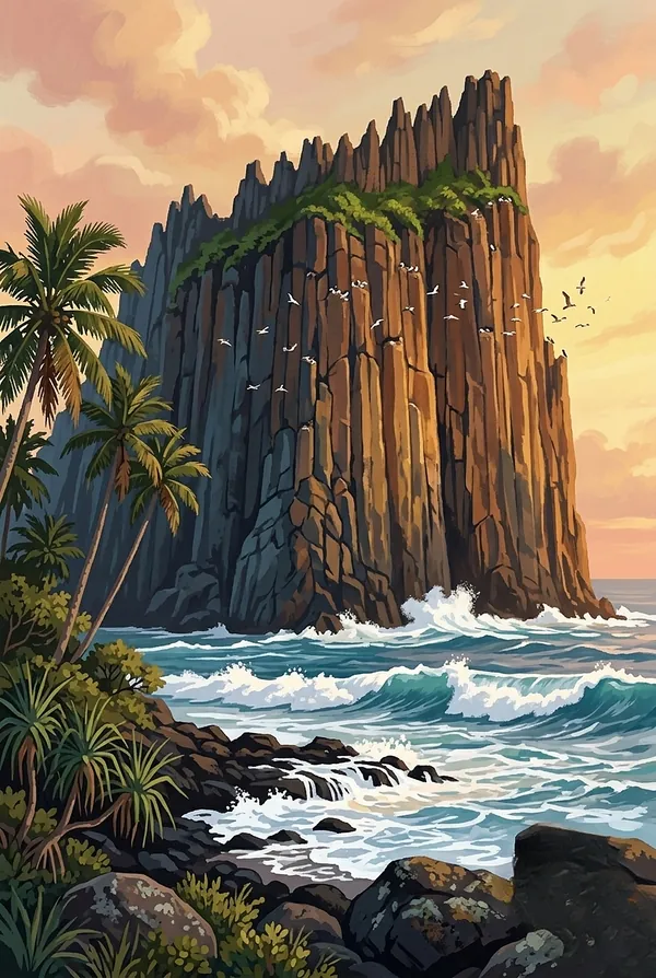
Pola Island is the seabird high-rise: boobies, frigatebirds, noddies and white terns nesting on sheer cliffs off Tutuila's north shore, with tropicbirds trailing streamers offshore. Green and hawksbill turtles work the reefs, and in the austral winter and spring, humpback whales pass through on their way between Antarctic feeding grounds and tropical calving waters.
The American Samoa designs
Pick the one that matches the park you actually saw.
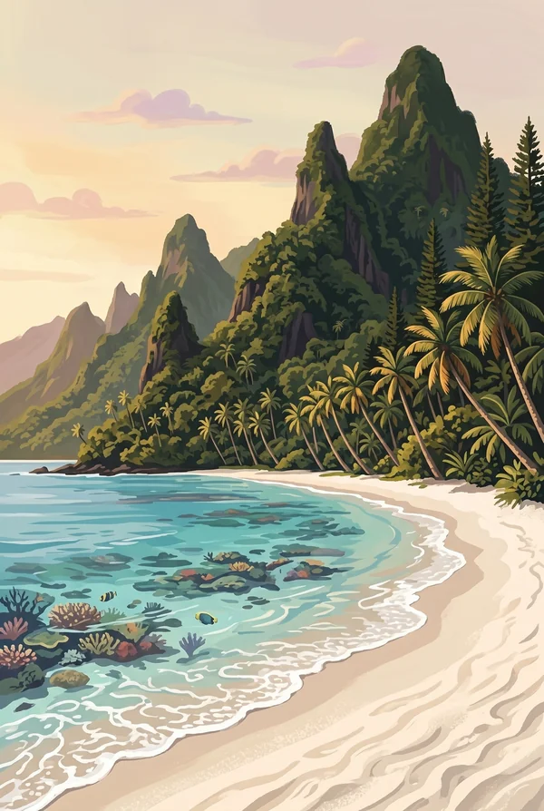
Ofu Beach
A regular on lists of the most beautiful beaches in the Pacific, and the hardest one on those lists to reach: coral sand, leaning palms, and the ridgeline of Sunu'itao behind. The lagoon's pools hold the heat-tolerant corals scientists study as a preview of future reefs. Getting here takes a small plane and some planning, which is exactly why this stamp means something.
Pola Island
A sheer-sided islet off the village of Vatia, its cliffs rising more than 400 feet straight from the sea, whitewashed by the seabird colonies that nest on every ledge. The classic view is from the shoreline past Vatia or the Lower Sauma Ridge trail, with frigatebirds hanging motionless in the updraft.
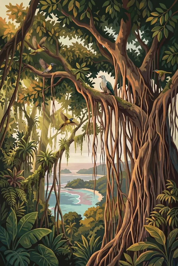
Tutuila Rainforest
The paleotropical forest on the ridges above Pago Pago Harbor, walked on the Mount Alava trail from Fagasa Pass: a ridgeline tunnel of green with flying foxes overhead and the harbor a thousand-plus feet below. It is the only rainforest of its kind in the American park system, closer kin to Borneo than to anything in Washington or Hawai'i.
How to record your American Samoa visit
Free, and it works whether you are standing there now or remembering a trip from years ago.
1
Check In at the park
Open ParkStamp inside the park boundary and check in. The app confirms you are actually there and logs the date.
2
Or Stamp It later
Already been? Pick the date yourself. Trips from decades ago count the same as last weekend.
3
Or scan your photos
Let ParkStamp read the dates and locations off photos already on your phone. Most people find parks they had forgotten.
American Samoa, asked and answered
Quick answers, for people planning a trip and people remembering one.
When is the best time to visit American Samoa?
June through September, the austral winter: drier, slightly cooler, and the season when humpback whales pass through. The wet season, roughly November to April, is hotter, stickier and stormier; it is also cyclone season, worth weighing for a trip this far. The rainforest is green and the water warm year-round; this is a park without a cold season, only a wetter one.
How many days do you need at American Samoa?
Budget more days than the trails need, because the flights set the pace. Two days cover the Tutuila unit: Mount Alava, the Pola Island viewpoints past Vatia, the Amalau Valley flying foxes. Reaching Ofu Beach or Ta'u means inter-island hops that do not run daily, so give the Manu'a islands several days and let the schedule breathe.
How busy is American Samoa?
National Park of American Samoa logged 43,258 visits in 2025, the 58th busiest of the 63 national parks. That makes it one of the quieter national parks, and crowds are rarely the problem.
What does the American Samoa stamp show?
The lead American Samoa design is Ofu Beach. A regular on lists of the most beautiful beaches in the Pacific, and the hardest one on those lists to reach: coral sand, leaning palms, and the ridgeline of Sunu'itao behind. The lagoon's pools hold the heat-tolerant corals scientists study as a preview of future reefs. Getting here takes a small plane and some planning, which is exactly why this stamp means something. The other two designs are Pola Island and Tutuila Rainforest.
Is the American Samoa stamp free?
Recording your American Samoa visit is always free: check in at the park, add an old trip, or let the photo scan find it. The full-color art is the paid part, $3.99 one-time with three American Samoa designs to choose from, and the first stamp you collect in ParkStamp is free.
Can I add a American Samoa trip from years ago?
Yes. Open American Samoa in ParkStamp, tap Stamp It, and set the date yourself; a visit from decades ago counts the same as last weekend. If you still have photos from the trip, the photo scan can find and date it from their location tags, without your photos ever leaving your phone.
Do I have to be at American Samoa to get the stamp?
No. Check In is for when you are standing inside American Samoa, and it confirms you are actually there. Stamp It records any past visit on your honor, with your dates. Both are free and put the same stamp in your StampBook.
Start your StampBook with American Samoa
Free on iOS and Android. Your first stamp is on us.