Kings Canyon holds the second-largest tree on Earth and a canyon that, measured from the summit of Spanish Mountain to the Kings River, drops about 8,200 feet, deeper than the Grand Canyon. The park exists in its present form partly because of a book of photographs, and it spent its first 25 years missing its own canyon floor.
Kings Canyon is one of 63 national parks in ParkStamp. Like every park, it has original stamp art drawn in the WPA poster tradition, and each design is an illustration of a real, specific place in the park.
Recording that you went is free. Check in on the spot, enter a trip from years ago, or let the app lift the dates and places from photos already on your phone.
The real NPS boundary, with the roads and towns you would actually use to get there.
Kings Canyon, for people who count parks
A giant sequoia shrine, a dam fight, and the photographs that helped end it.
The oldest piece of this park dates to the first year national parks existed in number. General Grant National Park was created on October 1, 1890, the same day as Yosemite and six days after Sequoia: four square miles wrapped around one grove of giant sequoias. John Muir was already arguing in print that the deep canyon of the Kings to the east rivaled Yosemite Valley, but the canyon itself stayed unprotected for another fifty years while irrigation and power interests eyed the river for dams.
The 1940 park was won partly with a book. Interior Secretary Harold Ickes wanted the Kings country preserved as wilderness, and Ansel Adams' photographs of the high Sierra, sent to Washington in his book on the John Muir Trail, became part of the campaign that moved the administration. Franklin Roosevelt signed Kings Canyon National Park into law on March 4, 1940, absorbing little General Grant National Park. The compromise showed on the map: Cedar Grove and Tehipite Valley, the canyon floors the dam builders wanted, were left out of the park until 1965, when the fight finally ended and they were added. Since the 1940s the park has been administered jointly with Sequoia, its neighbor along a shared boundary.
The General Grant Tree carries more titles than any tree alive. It is the second-largest tree on Earth by trunk volume; only the General Sherman, over in Sequoia, is bigger. Calvin Coolidge named it the Nation's Christmas Tree in 1926, and a ceremony has been held at its base each December for generations. In 1956 Eisenhower declared it a national shrine honoring America's war dead, the only living thing so designated. It stands a short walk from a parking lot, which does nothing to prepare people for the size.
The canyon is the part most visitors never reach. One road descends to the floor at Cedar Grove and stops at a place called Roads End, where the pavement simply quits and some of the largest roadless wilderness in the lower 48 begins. The deepest stretch of the canyon lies just downstream of the boundary, which is worth being honest about; the depth belongs to the river more than to the park line. The river's name is older than any of it: Spanish explorers called it El Río de los Santos Reyes, the river of the holy kings.
Trees that need fire, sheep that came back, and frogs rescued from trout.
Giant sequoias are a fire-dependent species, and this park helped prove it. Their cones are sealed shut and open with heat; fire clears the ground and thins the competition their seedlings cannot survive. Decades of fire suppression nearly stopped sequoia reproduction cold, and in the late 1960s some of the park system's first deliberate prescribed burns were set in this park to bring fire back as a tool. Redwood Mountain, inside Kings Canyon, holds the largest giant sequoia grove on Earth.
Sierra Nevada bighorn sheep are a recovery running in the high country. The Sierra's own subspecies was reduced to a remnant by disease from domestic sheep and other pressures, and is federally endangered. Reintroduced and managed herds now hold terrain in and around the park's alpine zone, and seeing one above treeline is among the rarest wildlife sightings in California.
The frog story is a quiet success. Mountain yellow-legged frogs once teemed in Sierra lakes, then vanished from most of them, hit by a lethal fungus and by decades of trout stocked into naturally fishless waters, where the fish ate the tadpoles. Crews have removed introduced trout from selected high lakes here, and frog populations have rebounded in them, one basin at a time.
Black bears run the middle elevations, mule deer summer in the meadows, and the park's vertical sweep, from foothill chaparral to alpine rock, stacks several distinct ecosystems into one map. The canyon floor at Cedar Grove and the summit plateaus above it are different worlds sharing a watershed.
The Kings Canyon designs
Pick the one that matches the park you actually saw.
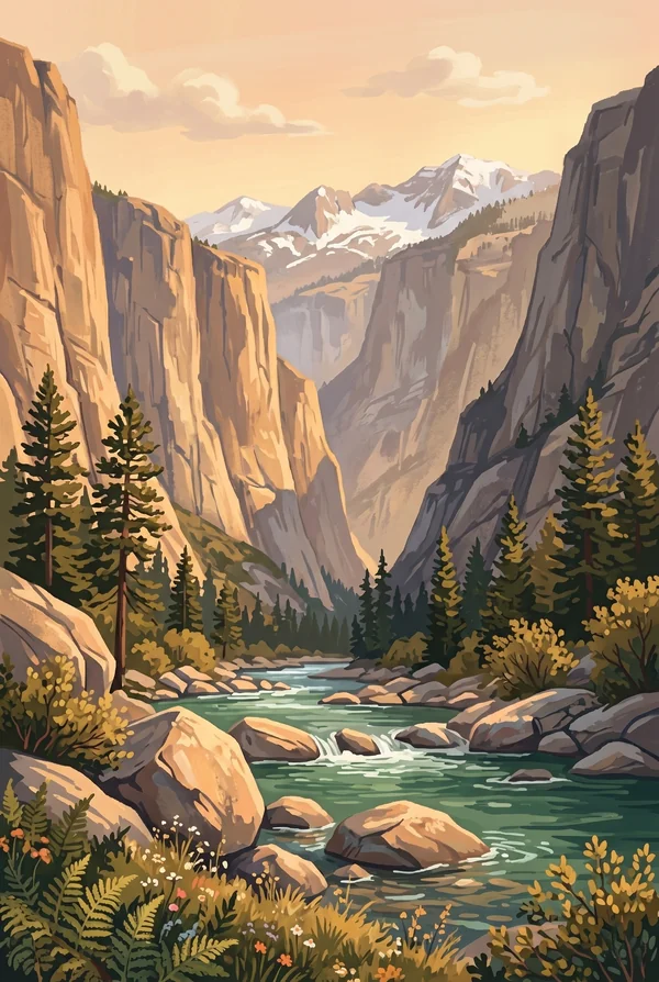
Kings Canyon from Roads End
The end of the road on the canyon floor, granite walls standing thousands of feet overhead and the Kings River running by. Beyond the last parking area there is only trail, into some of the largest roadless wilderness in the lower 48. For backpackers this spot is a threshold, and the stamp means the far side of it.
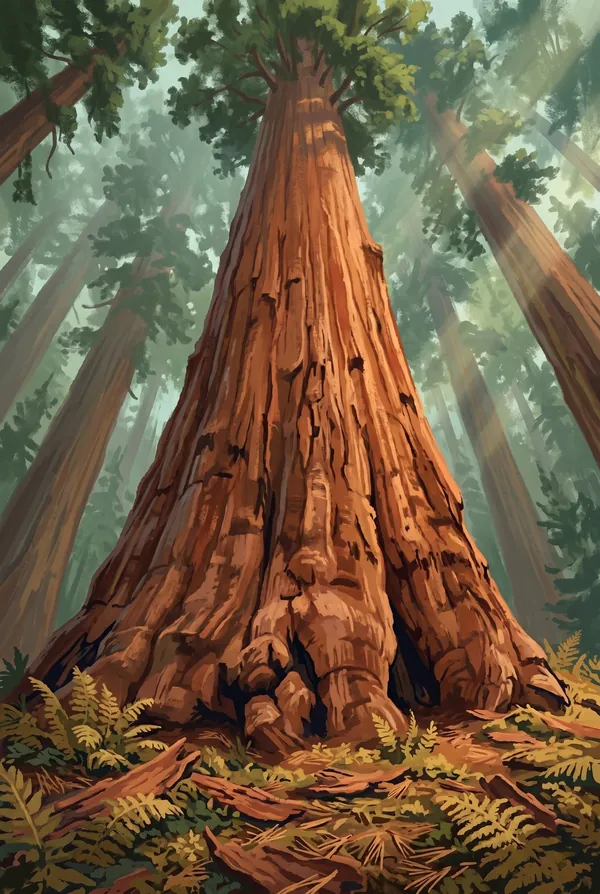
General Grant Tree
The second-largest tree on Earth: the Nation's Christmas Tree since 1926, a national shrine to America's war dead since 1956, and the centerpiece of the little 1890 park that Kings Canyon grew from. Photographs fail it on purpose; the only fix is to stand at the fence and look up.
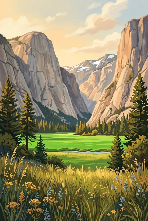
Zumwalt Meadow
A green meadow on the canyon floor with the Kings River sliding past and the granite faces of the Grand Sentinel and North Dome rising some 3,500 feet on either side. It is the easy walk that shows why Muir compared this canyon to Yosemite, and on a still morning it is the best argument in the park.
How to record your Kings Canyon visit
Free, and it works whether you are standing there now or remembering a trip from years ago.
1
Check In at the park
Open ParkStamp inside the park boundary and check in. The app confirms you are actually there and logs the date.
2
Or Stamp It later
Already been? Pick the date yourself. Trips from decades ago count the same as last weekend.
3
Or scan your photos
Let ParkStamp read the dates and locations off photos already on your phone. Most people find parks they had forgotten.
Kings Canyon, asked and answered
Quick answers, for people planning a trip and people remembering one.
When is the best time to visit Kings Canyon?
Late May and June for water: the snowmelt Kings River runs loud and full, and the waterfalls along the canyon road are at their best. July and August open the high country for backpackers. October puts fall color along the river at Cedar Grove. Grant Grove sits near 6,600 feet and holds snow in winter, and the sequoias carry it well; the canyon bottom is a summer place, the grove is year-round.
How many days do you need at Kings Canyon?
Two days splits the park the natural way: one for Grant Grove (the General Grant Tree, the fallen Monarch, Panoramic Point) and one for the long drive down to Cedar Grove for Zumwalt Meadow, Roads End and the walk toward Mist Falls. Backpackers should think in weeks, not days; the Rae Lakes Loop alone is usually four or five.
How busy is Kings Canyon?
Kings Canyon National Park logged 779,791 visits in 2025, the 30th busiest of the 63 national parks. That puts it in the middle of the pack: busy at the famous spots, quiet a mile past them.
What does the Kings Canyon stamp show?
The lead Kings Canyon design is Kings Canyon from Roads End. The end of the road on the canyon floor, granite walls standing thousands of feet overhead and the Kings River running by. Beyond the last parking area there is only trail, into some of the largest roadless wilderness in the lower 48. For backpackers this spot is a threshold, and the stamp means the far side of it. The other two designs are General Grant Tree and Zumwalt Meadow.
Is the Kings Canyon stamp free?
Recording your Kings Canyon visit is always free: check in at the park, add an old trip, or let the photo scan find it. The full-color art is the paid part, $3.99 one-time with three Kings Canyon designs to choose from, and the first stamp you collect in ParkStamp is free.
Can I add a Kings Canyon trip from years ago?
Yes. Open Kings Canyon in ParkStamp, tap Stamp It, and set the date yourself; a visit from decades ago counts the same as last weekend. If you still have photos from the trip, the photo scan can find and date it from their location tags, without your photos ever leaving your phone.
Do I have to be at Kings Canyon to get the stamp?
No. Check In is for when you are standing inside Kings Canyon, and it confirms you are actually there. Stamp It records any past visit on your honor, with your dates. Both are free and put the same stamp in your StampBook.
Start your StampBook with Kings Canyon
Free on iOS and Android. Your first stamp is on us.