The deepest lake in the United States, 1,943 feet, fills the shell of a volcano that destroyed itself about 7,700 years ago, an eruption the Klamath people watched, and still tell. No river feeds the lake and none drains it. It is snow and rain, sitting in a closed stone bowl, and it is bluer than you have been led to expect.
Crater Lake is one of 63 national parks in ParkStamp, and like every one of them it carries original stamp designs in the WPA poster tradition, each design a picture of a specific place you can actually go look at.
Recording the visit is free. Check in on the rim, enter a trip from any year you like, or let the app pull dates and locations from the photos already on your phone.
The real NPS boundary, with the roads and towns you would actually use to get there.
Crater Lake, for people who count parks
A mountain that removed itself, and a man who spent seventeen years on the paperwork.
There used to be a mountain here. Mount Mazama stood roughly 12,000 feet tall until, about 7,700 years ago, it emptied its magma chamber in one of the largest eruptions in North America since the ice age, ejecting dozens of times more material than Mount St. Helens did in 1980, and the summit collapsed into the void. The result is a caldera five to six miles across, which centuries of snow and rain slowly filled. Klamath oral tradition preserves the event as a battle between the spirit of the underworld and the spirit of the sky, ending with the mountain falling in: an eyewitness account carried across nearly eight millennia.
The lake is a closed system. No stream enters and none leaves; input is snowmelt and rain, output is evaporation and seepage, and the surface rides within a surprisingly narrow band. With no rivers delivering sediment, the water is among the clearest on the planet (a standard clarity disk was once read at a record 143 feet down), and clear, deep water absorbs every color but blue. The color in the postcards is not enhanced. That is what it does.
William Gladstone Steel made it a park by simple refusal to stop. By his own telling he first read of the lake as a Kansas schoolboy and resolved on the spot; he finally stood on the rim in 1885 and spent the next seventeen years lobbying, funding surveys, and wearing down Congress. He helped haul a survey boat up the mountain for the 1886 expedition that sounded the lake with lead line and piano wire and called it 1,996 feet deep, startlingly close to the modern sonar figure of 1,943. Theodore Roosevelt signed the park into law on May 22, 1902, making Crater Lake one of the oldest national parks in the system.
The other constant is snow. The rim catches Pacific storms at 7,000-plus feet and averages on the order of forty feet of snowfall a year, making park headquarters one of the snowiest inhabited places in the country. The deep drifts linger far into summer, which compresses the ordinary visitor season into a few months. And yet the lake itself, a vast heat reservoir, has not frozen over since 1949.
A lake born sterile, a log that will not sink, and a newt with nowhere else to go.
The lake started with nothing in it. A caldera lake with no inlet stream has no way to receive fish, so for most of its history Crater Lake was fishless. Between 1888 and 1941 it was stocked repeatedly (William Steel himself carried in the first fingerlings), and two introductions took: rainbow trout and kokanee salmon, which sustain themselves to this day. Stocking ended decades ago, and the park now leaves the lake alone.
The Old Man of the Lake has been floating for well over a century. A bleached hemlock trunk about thirty feet long bobs vertically in the lake, a few feet of it above the surface, and has been documented since 1896. The cold, pure water preserves the wood, and wind sails it all over the lake; boat crews genuinely track its position. It is probably the most famous log in the park system.
The caldera has its own newt. The Mazama newt, a form of the rough-skinned newt found only within Crater Lake's rim, evolved in a lake without predators. Signal crayfish introduced a century ago to feed the stocked fish are now its problem: as the crayfish spread along the shoreline, the newts retreat, and park biologists monitor what has become a slow-motion siege inside a closed bowl.
Light goes absurdly deep here, and life follows it. Because the water is so clear, thick colonies of moss grow on the caldera walls at depths that would be pitch dark in an ordinary lake, well beyond three hundred feet down, among the deepest plant communities known in fresh water. Around the rim, meanwhile, it is ordinary high Cascades: whitebark pines, Clark's nutcrackers, marmots in the rockslides.
The Crater Lake designs
Pick the one that matches the park you actually saw.
Crater Lake
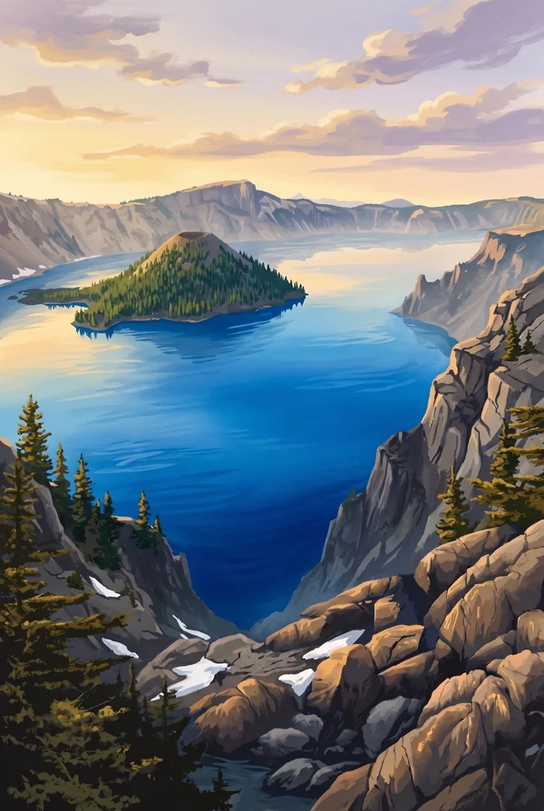
The whole thing at once: the five-by-six-mile caldera from the rim, water of a blue that no photograph quite survives, cliffs dropping up to 2,000 feet to the surface. Every overlook on the 33-mile Rim Drive frames it differently. The honest default stamp, because the first sight of it over the rim is the memory everyone actually keeps.
Wizard Island
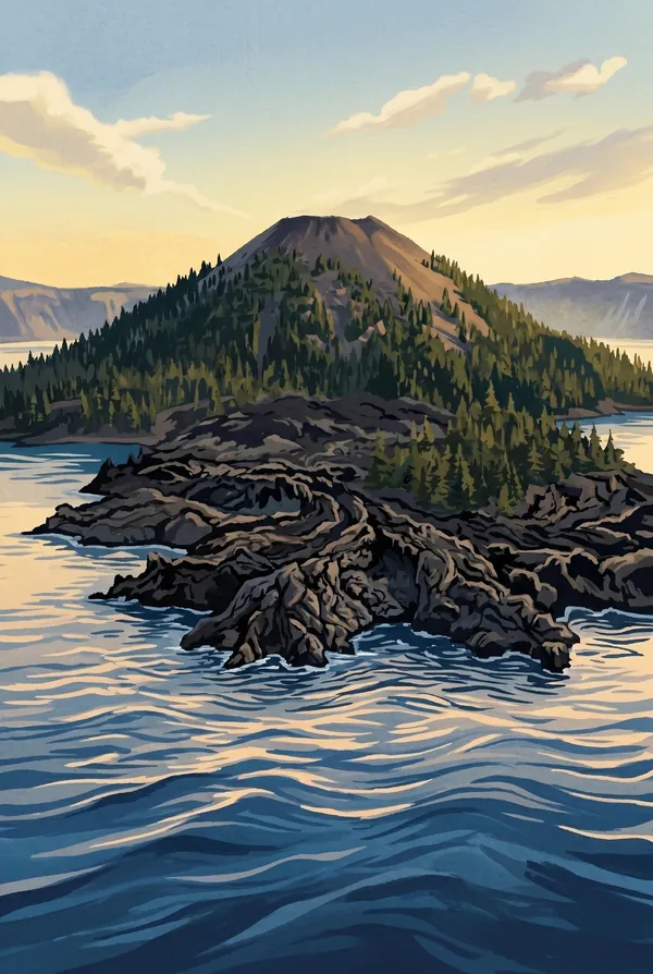
A volcano inside the volcano: a cinder cone that grew from the caldera floor after the collapse, rising about 760 feet above the water, with a crater at its summit called the Witches Cauldron. William Steel named it for its sorcerer's-hat shape. In summer, boats cross to it and a trail climbs the cone; pick it if you stood on top.
Phantom Ship
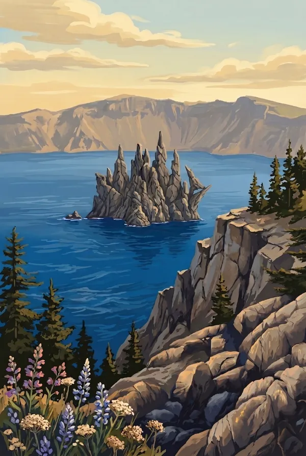
A jagged little island near the south shore, rigged like a square-rigger in silhouette and taller than it looks, at about sixteen stories. It is a remnant of Mazama's oldest exposed lava, roughly 400,000 years old, and in certain light it vanishes against the dark caldera wall, which is how it earned the name. Best seen from Sun Notch.
How to record your Crater Lake visit
Free, and it works whether you are standing there now or remembering a trip from years ago.
1
Check In at the park
Open ParkStamp inside the park boundary and check in. The app confirms you are actually there and logs the date.
2
Or Stamp It later
Already been? Pick the date yourself. Trips from decades ago count the same as last weekend.
3
Or scan your photos
Let ParkStamp read the dates and locations off photos already on your phone. Most people find parks they had forgotten.
Crater Lake, asked and answered
Quick answers, for people planning a trip and people remembering one.
When is the best time to visit Crater Lake?
July through September is the real season: Rim Drive fully open, wildflowers in the meadows in late July, and water calm enough for the swim from Cleetwood Cove that brave people insist on. Snow buries the park for the other eight-odd months. It is beautiful, and workable on skis or snowshoes when the road to Rim Village is passable, but plan around winter, not through it. The lake itself has not frozen since 1949.
How many days do you need at Crater Lake?
One well-used day covers it: circle the 33-mile Rim Drive with long stops, walk out to Sun Notch for Phantom Ship, and catch evening light from Watchman Overlook. A second summer day earns the lake itself, whether the steep drop to Cleetwood Cove for a swim or a boat across to climb Wizard Island, plus oddities like the Pinnacles fossil fumaroles.
How busy is Crater Lake?
Crater Lake National Park logged 632,242 visits in 2025, the 36th busiest of the 63 national parks. That makes it one of the quieter national parks, and crowds are rarely the problem.
What does the Crater Lake stamp show?
The lead Crater Lake design is Crater Lake. The whole thing at once: the five-by-six-mile caldera from the rim, water of a blue that no photograph quite survives, cliffs dropping up to 2,000 feet to the surface. Every overlook on the 33-mile Rim Drive frames it differently. The honest default stamp, because the first sight of it over the rim is the memory everyone actually keeps. The other two designs are Wizard Island and Phantom Ship.
Is the Crater Lake stamp free?
Recording your Crater Lake visit is always free: check in at the park, add an old trip, or let the photo scan find it. The full-color art is the paid part, $3.99 one-time with three Crater Lake designs to choose from, and the first stamp you collect in ParkStamp is free.
Can I add a Crater Lake trip from years ago?
Yes. Open Crater Lake in ParkStamp, tap Stamp It, and set the date yourself; a visit from decades ago counts the same as last weekend. If you still have photos from the trip, the photo scan can find and date it from their location tags, without your photos ever leaving your phone.
Do I have to be at Crater Lake to get the stamp?
No. Check In is for when you are standing inside Crater Lake, and it confirms you are actually there. Stamp It records any past visit on your honor, with your dates. Both are free and put the same stamp in your StampBook.
Start your StampBook with Crater Lake
Free on iOS and Android. Your first stamp is on us.