Zion is the second busiest national park in America now, ahead of Yellowstone and the Grand Canyon. It is also the only one whose original name was thrown out because a federal official could not spell it.
Zion is one of 63 national parks in ParkStamp, and like every park it has original stamp designs drawn in the WPA poster tradition. Each one is an illustration of a specific place you can go stand.
Recording the visit is free. Check in at the park, add a trip from years ago, or let the app read the dates off photos already on your phone.
The real NPS boundary, with the roads and towns you would actually use to get there.
Zion, for people who count parks
A canyon you stand at the bottom of, and a name that got erased.
It was Mukuntuweap National Monument first. Taft protected it under that name in 1909, from a Southern Paiute word that the Park Service translates as "straight canyon." In 1917 Horace Albright, then acting director of the brand-new Park Service, visited and pushed to change it. His stated reason, quoted years later: he felt the name was "too difficult to pronounce and really tough to spell." The historian Hal Rothman put the institutional thinking more plainly, that Spanish and Indian names were believed to deter visitors who might not bother going somewhere they could not say out loud. The rename went through in 1918 and Zion became a national park on November 19, 1919.
1919 was a three-park year, the biggest of any single year. Grand Canyon and Acadia both arrived on February 26. Zion came nine months later, last of the three.
You start at the bottom here. That is the real difference from the Grand Canyon, and it is not just a matter of where they put the road. The rock stacks: the oldest layer exposed at Zion is the youngest layer at the Grand Canyon, and the bottom layer at Bryce is the top layer at Zion. Three parks, one continuous sequence of about two billion years. At the Grand Canyon you stand on the rim and look down. At Zion the road, the lodge and nearly every trailhead sit on the canyon floor, and you look up at 2,000-foot walls.
Those walls are Navajo Sandstone, which is lithified sand dunes from a Sahara-scale desert that covered 150,000 square miles of North America. The Park Service handout calls them possibly the tallest sandstone cliffs in the world. The Virgin River cut through them at one of the steepest stream gradients in North America, removing 1,300 feet of rock in about a million years.
Including one animal whose entire world is three miles of riverbank.
The Zion snail. Somewhere between a sixteenth and an eighth of an inch long, and it lives on roughly three miles of the Virgin River in this canyon and one side canyon, and nowhere else on the planet. It grips wet vertical rock in the hanging gardens using what is proportionally the largest foot of any snail in the world. It was long described as the world's smallest snail; the Park Service has since walked that back to "very small." You can see them in the seeps along the Riverside Walk. Do not touch them.
California condors, breeding here again. In September 2019, the park's centennial year, a chick that had hatched in Zion fledged successfully. The Park Service called it the first in the park in probably a hundred years. A second followed in 2021, from the same parents. Roughly 82 condors now fly free over northern Arizona and southern Utah, from a world population of 22 birds in 1982. Lead fragments in carcasses remain the biggest obstacle to recovery.
Desert bighorn sheep, from zero to a problem worth having. Wiped out of the Zion area by the mid-20th century and reintroduced in 1973. There are now more than 500. The herd worked so well that Zion functions as a source, with sheep trapped and moved out to seed herds elsewhere, partly to keep density down: at close quarters a single contact with domestic sheep can start a respiratory die-off.
Peregrine falcons, which close the walls every spring. Angels Landing, the Great White Throne, the Streaked Wall and a dozen other faces shut to climbers from around March 1 until the chicks fledge, usually late July. Disturb a pair and they may not try again for a full year. Hiking trails stay open.
The Zion designs
Pick the one that matches the park you actually saw.
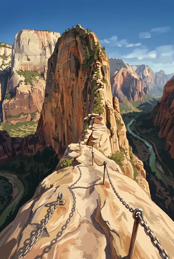
Angels Landing
A freestanding sandstone fin standing 1,488 feet above the canyon floor. The route was cut into solid rock in 1926 by the park's first superintendent, whose 21 switchbacks are still called Walter's Wiggles. The final half-mile is a chained knife-edge less than three feet wide in places, with drops of up to a thousand feet on both sides. Access to the final stretch is now metered; nps.gov has the current rules.
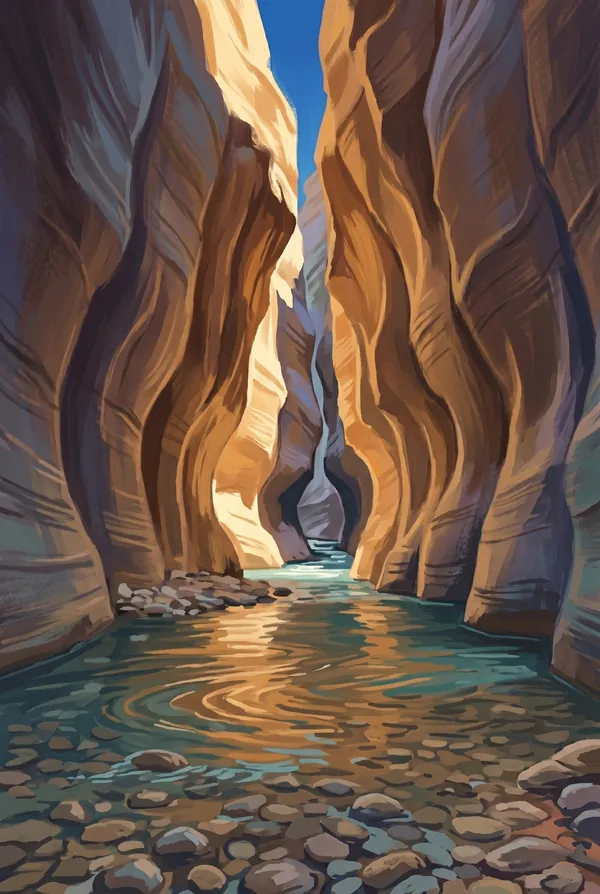
The Narrows
The place the canyon closes down to nothing. Walls a thousand feet tall with the river running twenty to thirty feet wide between them, and no trail, because at least 60% of the hike is spent walking in the water. Flash floods are the real danger and there is no high ground to climb to.
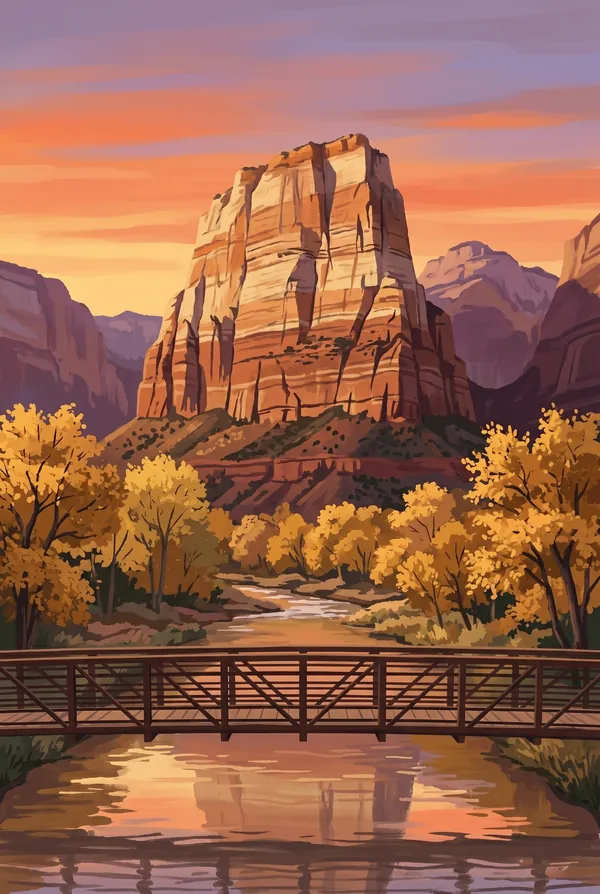
The Watchman
The peak standing over the south entrance, 2,600 feet above Springdale, red Kayenta shale below and pale Navajo Sandstone above. Everyone sees it first and last. The classic photograph is from the bridge over the Virgin River at sunset, and it takes almost no effort to reach, which is why it may be the most reproduced view in the park.
How to record your Zion visit
Free, and it works whether you are standing there now or remembering a trip from years ago.
1
Check In at the park
Open ParkStamp inside the park boundary and check in. The app confirms you are actually there and logs the date.
2
Or Stamp It later
Already been? Pick the date yourself. Trips from decades ago count the same as last weekend.
3
Or scan your photos
Let ParkStamp read the dates and locations off photos already on your phone. Most people find parks they had forgotten.
Zion, asked and answered
Quick answers, for people planning a trip and people remembering one.
When is the best time to visit Zion?
Spring and fall, for opposite reasons. April and May send waterfalls off the canyon walls and run the Virgin River high; October cools the canyon floor and turns the cottonwoods yellow. Summer works if you start at dawn, since the canyon regularly passes 100°F by afternoon. Winter is quiet and mostly open, snow on the rim while the floor stays walkable.
How many days do you need at Zion?
Two days does the canyon properly: one for the heights and one for the river. Walk up toward Scout Lookout or Observation Point the first day, wade the Narrows the second. A third day buys you the east side slickrock and Kolob Canyons, which most of Zion's five million visitors never see.
How busy is Zion?
Zion National Park logged 4.98 million visits in 2025, the 2nd busiest of the 63 national parks. That makes it one of the busiest parks in the system, and early mornings are the quiet hours.
What does the Zion stamp show?
The lead Zion design is Angels Landing. A freestanding sandstone fin standing 1,488 feet above the canyon floor. The route was cut into solid rock in 1926 by the park's first superintendent, whose 21 switchbacks are still called Walter's Wiggles. The final half-mile is a chained knife-edge less than three feet wide in places, with drops of up to a thousand feet on both sides. Access to the final stretch is now metered; nps.gov has the current rules. The other two designs are The Narrows and The Watchman.
Is the Zion stamp free?
Recording your Zion visit is always free: check in at the park, add an old trip, or let the photo scan find it. The full-color art is the paid part, $3.99 one-time with three Zion designs to choose from, and the first stamp you collect in ParkStamp is free.
Can I add a Zion trip from years ago?
Yes. Open Zion in ParkStamp, tap Stamp It, and set the date yourself; a visit from decades ago counts the same as last weekend. If you still have photos from the trip, the photo scan can find and date it from their location tags, without your photos ever leaving your phone.
Do I have to be at Zion to get the stamp?
No. Check In is for when you are standing inside Zion, and it confirms you are actually there. Stamp It records any past visit on your honor, with your dates. Both are free and put the same stamp in your StampBook.
Start your StampBook with Zion
Free on iOS and Android. Your first stamp is on us.