The Great Sand Dunes National Park & Preserve Stamp
The tallest dunes in North America stand not in a lowland desert but at 8,000 feet in Colorado, piled against the Sangre de Cristo Mountains, with a creek at their base that flows in waves like a tide. Twice in one century, ordinary residents of the valley organized to save them: first from miners, then from a plan to sell the water underneath.
Great Sand Dunes is one of the 63 national parks in ParkStamp. Every park in the app gets original stamp designs in the WPA poster tradition, and each design is an illustration of a specific real place inside the park.
The record-keeping part is free: check in when you visit, add trips from any year past, or let the app work out dates and locations from the photos already on your phone.
The real NPS boundary, with the roads and towns you would actually use to get there.
Great Sand Dunes, for people who count parks
Saved twice by the neighbors: once from gold miners, once from a water deal.
The first rescue was organized over tea. In the 1920s there was serious talk of mining the dunes; the sand carries flecks of gold, and there were schemes to sluice it out at industrial scale, along with proposals to haul the sand off for concrete. Women of the San Luis Valley's P.E.O. chapters ran the campaign to stop it, petitioning Congress until Herbert Hoover proclaimed Great Sand Dunes National Monument in 1932.
The second rescue was about water you cannot see. The dunes survive because of the aquifer and creeks beneath and around them. In the 1990s, developers proposed pumping San Luis Valley groundwater over the mountains to Front Range cities, and the valley fought back for years. Protecting the whole hydrologic system, not just the photogenic sand, is what drove Congress to authorize a full national park and preserve in 2000. When enough of the surrounding ranchland had been acquired, including a former ranch of nearly a hundred thousand acres, the designation took effect on September 13, 2004.
The sand is a closed loop. Most of it started as sediment from the San Juan Mountains, sixty-five miles west, spread across the valley floor by ancient lakes and streams. Prevailing southwest winds push it toward the Sangre de Cristos; storm winds pour back through the mountain passes and shove it the other way. Opposing winds build height instead of motion, which is how you get dunes over 700 feet tall that barely move. Medano and Sand creeks catch sand off the edges and carry it around to be blown in again. The main dunefield covers about 30 square miles; the whole sand system is roughly ten times that.
The park runs from sand to summits. With the preserve, protection now extends from the valley grasslands up through aspen and spruce to alpine peaks above 13,000 feet: nearly the full vertical range of Colorado in one contiguous unit, which is easy to miss when every photograph is of the dunes.
Insects that exist nowhere else, on sand that hits 150 degrees.
The dunefield has its own endemic insects. The best known is the Great Sand Dunes tiger beetle, found on this one dunefield and nowhere else on Earth, and it is not alone: a handful of insect species here are known from no other place. They make a living on a surface that can reach 150 degrees Fahrenheit on a summer afternoon, mostly by being somewhere else (under the sand, or out at dawn) when it does.
Ord's kangaroo rat never drinks. It metabolizes all the water it needs from dry seeds, sleeps out the heat in burrows, and moves in two-legged hops that leave some of the more distinctive tracks you will see on the morning sand, along with those of the coyotes that hunt it.
The valley around the dunes is big-animal country. Elk herds work the grasslands and shrublands at the dunefield's edge, bison have long grazed conservation ranchland on the park's west side, and pronghorn cross the flats. Twice a year the San Luis Valley hosts one of the great wildlife spectacles in Colorado, when many thousands of sandhill cranes stage here on migration, filling the sky between the dunes and the peaks.
Above it all, the preserve is normal Colorado high country, with bighorn sheep, black bears, and pika in the talus, all of it stacked directly over a desert of sand, two worlds separated by a few miles of trail.
The Great Sand Dunes designs
Pick the one that matches the park you actually saw.
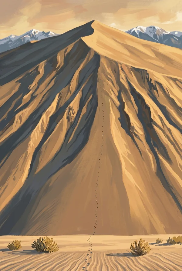
Star Dune
Long the record-holder among North American dunes at about 750 feet, recently resurveyed at roughly 741; wind trimmed it into a tie with remote Hidden Dune. A true star dune, built by winds from every direction into a many-armed pyramid, and reaching it is an unmarked multi-hour slog up the creek bed and along the ridges. The connoisseur's pick.
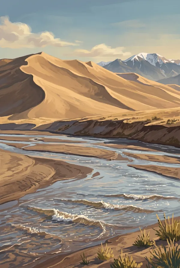
Medano Creek
The seasonal creek at the foot of the dunes that flows in pulses: sand ridges build on the creek bed, collapse, and send waves rippling down a beach at 8,000 feet. The phenomenon, called surge flow, occurs in this near-ideal form in only a few places on Earth. It runs highest in the weeks of peak snowmelt, then thins and sinks into the sand.
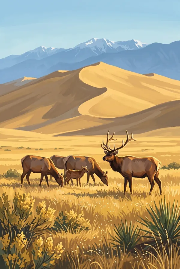
Dune Elk
The park's signature wildlife image: elk in the grasslands at the dunefield's edge, antlers against a wall of sand at first light. The herds move between the valley floor and the mountain front with the seasons, and the open ground west of the dunes is one of the more reliable places in Colorado to watch them in numbers. For visitors who came for the animals.
How to record your Great Sand Dunes visit
Free, and it works whether you are standing there now or remembering a trip from years ago.
1
Check In at the park
Open ParkStamp inside the park boundary and check in. The app confirms you are actually there and logs the date.
2
Or Stamp It later
Already been? Pick the date yourself. Trips from decades ago count the same as last weekend.
3
Or scan your photos
Let ParkStamp read the dates and locations off photos already on your phone. Most people find parks they had forgotten.
Great Sand Dunes, asked and answered
Quick answers, for people planning a trip and people remembering one.
When is the best time to visit Great Sand Dunes?
Late May into early June if you want Medano Creek at full surge, waves and all; the whole valley knows it, so expect company. September and October may be the smarter play: cool sand, gold cottonwoods and aspens, and sandhill cranes staging in the valley. In summer, climb dunes at morning or evening, since the sand surface can reach 150 degrees by afternoon and thunderstorms build over the peaks. Winter dusts the dunes with snow.
How many days do you need at Great Sand Dunes?
One day does the essentials: wade the creek in season, climb High Dune on the first ridge, and stay for a sky full of stars. A second day is for the committed, the long unmarked push to Star Dune or the four-wheel-drive country toward Medano Pass, and it converts a roadside wonder into an actual backcountry trip.
How busy is Great Sand Dunes?
Great Sand Dunes National Park & Preserve logged 432,498 visits in 2025, the 44th busiest of the 63 national parks. That makes it one of the quieter national parks, and crowds are rarely the problem.
What does the Great Sand Dunes stamp show?
The lead Great Sand Dunes design is Star Dune. Long the record-holder among North American dunes at about 750 feet, recently resurveyed at roughly 741; wind trimmed it into a tie with remote Hidden Dune. A true star dune, built by winds from every direction into a many-armed pyramid, and reaching it is an unmarked multi-hour slog up the creek bed and along the ridges. The connoisseur's pick. The other two designs are Medano Creek and Dune Elk.
Is the Great Sand Dunes stamp free?
Recording your Great Sand Dunes visit is always free: check in at the park, add an old trip, or let the photo scan find it. The full-color art is the paid part, $3.99 one-time with three Great Sand Dunes designs to choose from, and the first stamp you collect in ParkStamp is free.
Can I add a Great Sand Dunes trip from years ago?
Yes. Open Great Sand Dunes in ParkStamp, tap Stamp It, and set the date yourself; a visit from decades ago counts the same as last weekend. If you still have photos from the trip, the photo scan can find and date it from their location tags, without your photos ever leaving your phone.
Do I have to be at Great Sand Dunes to get the stamp?
No. Check In is for when you are standing inside Great Sand Dunes, and it confirms you are actually there. Stamp It records any past visit on your honor, with your dates. Both are free and put the same stamp in your StampBook.
Start your StampBook with Great Sand Dunes
Free on iOS and Android. Your first stamp is on us.