The Black Canyon of the Gunnison National Park Stamp
Parts of the Black Canyon receive about half an hour of direct sunlight a day, which is how it got its name. The Gunnison River that cut it drops an average of 96 feet per mile through the park; the Colorado, through the Grand Canyon, manages about seven and a half.
Black Canyon is one of 63 national parks in ParkStamp. Every park in the app carries original stamp art in the WPA poster tradition, and every design shows a specific real place, not a generic vista.
The visit record is free. Check in at the rim, add a trip from years ago, or let the app read dates and locations out of the photos already on your phone.
The real NPS boundary, with the roads and towns you would actually use to get there.
Black Canyon, for people who count parks
Two men on rubber mattresses, a minister, and the steepest big canyon in the country.
The surveys kept going around it. Captain John Gunnison's 1853 railroad survey skirted the gorge (he was killed in Utah later that year, and the river took his name anyway), and the Hayden survey of the 1870s pronounced the canyon inaccessible. Of the 48 miles the river spends in the Black Canyon, the park protects the deepest and sheerest 14. The name is literal: the walls are dark rock, and the gorge is so narrow that parts of it get about half an hour of direct sun a day.
In 1901 two men went through on rubber mattresses. Farmers in the neighboring Uncompahgre Valley needed water, and the only supply worth having was locked in the canyon. Government engineer Abraham Lincoln Fellows and Montrose local William Torrence floated and swam the gorge on rubber air mattresses, crossing the river dozens of times, and came out declaring a diversion tunnel feasible. The Gunnison Tunnel opened in 1909: nearly six miles bored through the canyon wall, at the time the longest irrigation tunnel in the world. It still waters the valley.
A Montrose minister got it protected. Reverend Mark Warner spent years in the 1920s and 30s organizing locals, walking visitors to the rim and lobbying for the canyon; Herbert Hoover proclaimed the national monument in 1933, and Civilian Conservation Corps crews built the North Rim road soon after. National park status came on October 21, 1999. The point above the canyon's deepest reach, 2,722 feet, is named for Warner.
The geometry is the exhibit. The walls are gneiss and schist about 1.7 billion years old, some of the oldest rock exposed in any national park, and nearly erosion-proof. The river was set in its course by soft volcanic deposits that once buried this block; when it cut down into the hard basement it was trapped, and all it could do was keep sawing. Hence the proportions: 40 feet wide at river level in the Narrows, 1,100 feet rim to rim at Chasm View, and walls that drop rather than slope.
Falcons on the big wall, and poison ivy as tall as you are.
Peregrine falcons nest on the Painted Wall. The biggest cliff in Colorado comes with the fastest animal on Earth, hitting well over 200 miles an hour in a dive. They share the airspace with white-throated swifts, which feed, drink and even mate on the wing along the rims, and with canyon wrens, whose falling-scale song is the sound of the inner gorge.
The inner canyon grows its forest upside down. Shaded, north-facing walls hold Douglas-fir far below the elevation where you would expect it, while the sunny rims above carry pinyon, juniper and Gambel oak. Down along the river, poison ivy grows chest-high and higher in solid thickets; every account of the inner-canyon routes mentions it, because there is no avoiding it.
The rim country carries the big animals. Mule deer and black bear work the oak brush, bighorn sheep pick their way along ledges that look like typos, and below them the Gunnison runs cold and clear and holds large trout, which is why herons and eagles patrol the river.
The Black Canyon designs
Pick the one that matches the park you actually saw.
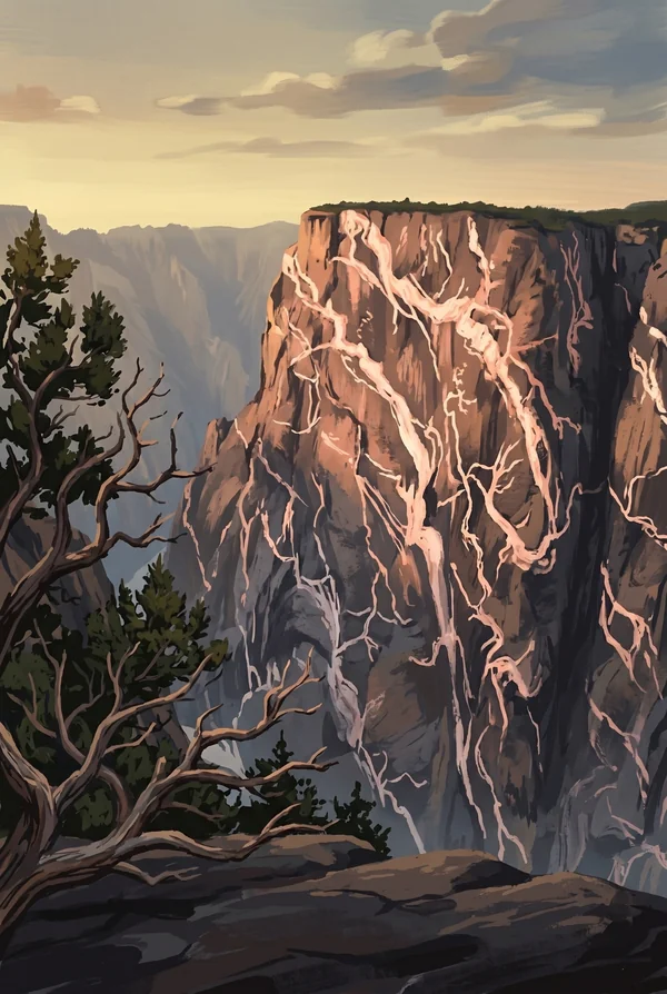
Painted Wall
Colorado's tallest cliff, 2,250 feet from river to rim; the Empire State Building would not reach two-thirds of the way up. The face is dark gneiss shot through with pink pegmatite veins, molten rock that squeezed into cracks more than a billion years ago. Peregrine falcons nest on it. It is the image most people mean when they say Black Canyon.
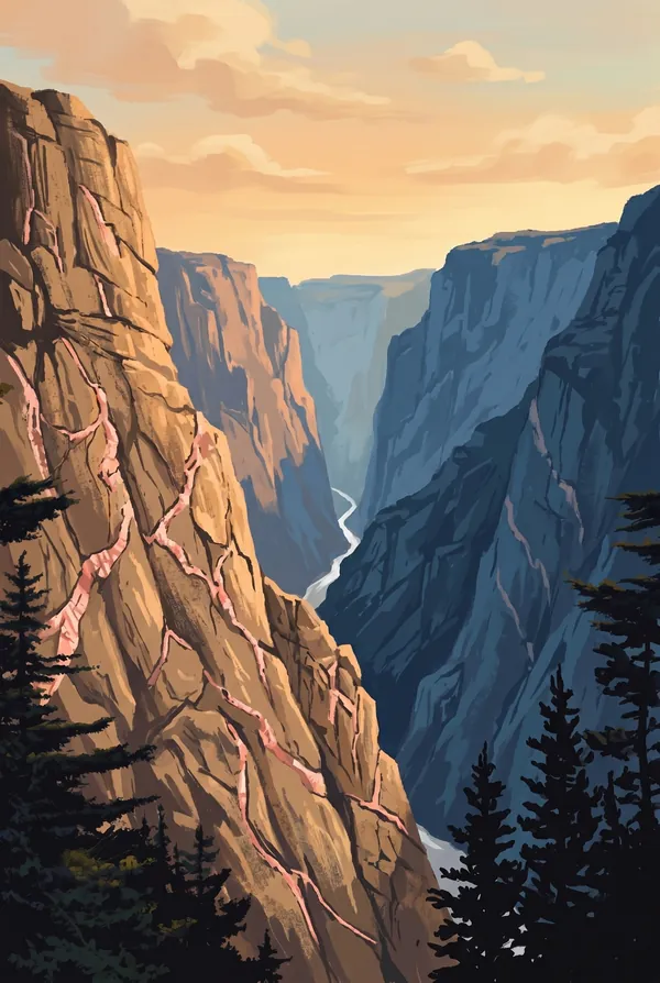
The Narrows
The canyon at its tightest, where the rims pinch toward each other and the river below runs through a gap only about forty feet wide, a stone hallway holding an entire river. It is best seen from the North Rim, where the road runs close to the edge and the drop reads almost as an optical error.
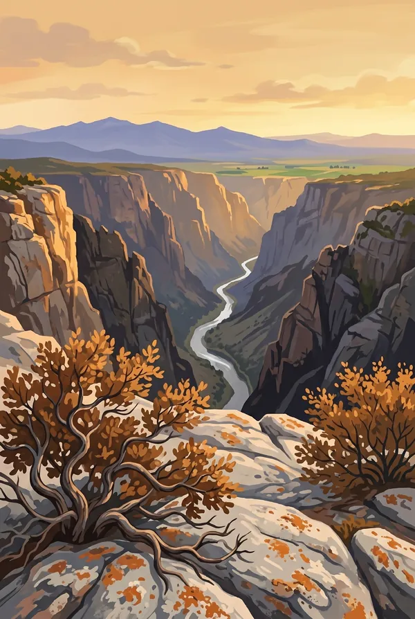
Warner Point Panorama
The view from the end of a mile-and-a-half nature trail at the top of the South Rim road, named for Mark Warner, the Montrose minister who spent years campaigning to protect the canyon. Below the point the gorge reaches its greatest depth, 2,722 feet, and the long view runs from the San Juan Mountains to the Uncompahgre Valley.
How to record your Black Canyon visit
Free, and it works whether you are standing there now or remembering a trip from years ago.
1
Check In at the park
Open ParkStamp inside the park boundary and check in. The app confirms you are actually there and logs the date.
2
Or Stamp It later
Already been? Pick the date yourself. Trips from decades ago count the same as last weekend.
3
Or scan your photos
Let ParkStamp read the dates and locations off photos already on your phone. Most people find parks they had forgotten.
Black Canyon, asked and answered
Quick answers, for people planning a trip and people remembering one.
When is the best time to visit Black Canyon?
Summer into early fall. The rims sit above 8,000 feet, so July days are warm rather than brutal and evenings go cold. Late September and October turn the Gambel oak and serviceberry rust and gold along the rim drives. Spring runoff puts the river at its loudest, audible from the rim. Winter buries the roads in snow and hands the park to skiers and snowshoers, which is a fine, silent way to see it.
How many days do you need at Black Canyon?
One day does the South Rim honestly: the overlooks along the rim drive, the Painted Wall at more than one time of day, and the short walk out to Warner Point. A second day is for circling around to the North Rim (hours by road, a few hundred yards as the raven flies), where the road is gravel, the crowds are gone, and the walls somehow look steeper.
How busy is Black Canyon?
Black Canyon of the Gunnison National Park logged 250,086 visits in 2025, the 50th busiest of the 63 national parks. That makes it one of the quieter national parks, and crowds are rarely the problem.
What does the Black Canyon stamp show?
The lead Black Canyon design is Painted Wall. Colorado's tallest cliff, 2,250 feet from river to rim; the Empire State Building would not reach two-thirds of the way up. The face is dark gneiss shot through with pink pegmatite veins, molten rock that squeezed into cracks more than a billion years ago. Peregrine falcons nest on it. It is the image most people mean when they say Black Canyon. The other two designs are The Narrows and Warner Point Panorama.
Is the Black Canyon stamp free?
Recording your Black Canyon visit is always free: check in at the park, add an old trip, or let the photo scan find it. The full-color art is the paid part, $3.99 one-time with three Black Canyon designs to choose from, and the first stamp you collect in ParkStamp is free.
Can I add a Black Canyon trip from years ago?
Yes. Open Black Canyon in ParkStamp, tap Stamp It, and set the date yourself; a visit from decades ago counts the same as last weekend. If you still have photos from the trip, the photo scan can find and date it from their location tags, without your photos ever leaving your phone.
Do I have to be at Black Canyon to get the stamp?
No. Check In is for when you are standing inside Black Canyon, and it confirms you are actually there. Stamp It records any past visit on your honor, with your dates. Both are free and put the same stamp in your StampBook.
Start your StampBook with Black Canyon
Free on iOS and Android. Your first stamp is on us.