The park is built on a single geologic fact: a hundred-mile wrinkle in the earth's crust called the Waterpocket Fold. Settlers named it a reef because it blocked travel like one. It is also the only national park where the Park Service runs orchards, and in season you can walk in and pick the fruit.
Capitol Reef is one of 63 national parks in ParkStamp, and every park in the app carries original stamp designs in the WPA poster tradition, each one an illustration of an actual place you can stand in front of.
Logging the visit is free. Check in on the spot, backfill a trip from any year, or let the app read the dates and locations off the photos your phone already has.
The real NPS boundary, with the roads and towns you would actually use to get there.
Capitol Reef, for people who count parks
A wrinkle in the crust, a Mormon fruit town, and a name that is half building, half ocean.
Start with the Fold. Around 50 to 70 million years ago, the same mountain-building episode that raised the Rockies buckled this stretch of crust into a step nearly a hundred miles long, a monocline with the layers on the west side lifted thousands of feet above the same layers on the east. Erosion has since carved the step into a ridged barrier of domes, cliffs and slot canyons. Pioneers called any impassable ridge a reef; the white Navajo Sandstone domes along the crest reminded them of the US Capitol. Hence the name, half building and half ocean, for a place with neither.
The campaign for the park was a local production. In the 1920s two Wayne County brothers-in-law, Ephraim Pectol and Joseph Hickman (a shopkeeper and a school principal, both of whom served in the state legislature), promoted the country as "Wayne Wonderland" and pushed for federal protection. Franklin Roosevelt proclaimed Capitol Reef a national monument in 1937, and Congress made it a national park on December 18, 1971, stretching the boundary to take in nearly the whole Fold.
Fruita is why this desert park smells like orchards. Mormon settlers arrived in the 1880s where the Fremont River breaks through the Fold, and the sheltered floodplain proved absurdly good for fruit: never more than about ten families, but thousands of trees. The Park Service kept the orchards when it took over the town, still maintains them, and lets visitors pick apples, cherries, peaches and pears in harvest season. The one-room schoolhouse and the Gifford farmhouse still stand under the red cliffs.
People were growing food here a thousand years before that. The Fremont culture, named by archaeologists for this river, farmed corn along it and left petroglyph panels of horned figures and bighorn sheep that you can see today from a boardwalk beside the highway. They moved on around seven centuries ago; the rock art stayed.
Plants that exist nowhere else on Earth, and one of the darkest night skies in the country.
The Fold grows its own species. The exposed layers weather into unusual soils, and a handful of plants have specialized themselves onto them so tightly that they grow in this corner of Utah and nowhere else on the planet, among them Wright's fishhook cactus and the Barneby reed-mustard, both federally protected. A plant that needs one particular crumbling shale is safe exactly as far as that shale runs.
Desert bighorn are back on the cliffs. The native herds were gone by the mid-20th century, lost to hunting and to diseases carried by domestic sheep. Reintroductions beginning in the 1980s, with animals from Canyonlands country, took hold, and bighorn now work the broken rock of the Fold again, most often seen in the canyons south of the Fremont River.
The park is named for its rain barrels. The waterpockets of the Waterpocket Fold are basins dissolved into bare sandstone that hold rainwater for days or weeks. In a desert this dry they function as oases in miniature: spadefoot toads, fairy shrimp and tadpole shrimp run entire life cycles in them between storms, and everything with legs or wings comes to drink.
After dark the park changes jobs. Capitol Reef sits in one of the emptiest quarters of the lower 48, and it holds a gold-tier International Dark Sky Park designation. On a moonless night the Milky Way casts shadows, and the nearest serious dome of city light is a hundred-plus miles away in any direction.
The Capitol Reef designs
Pick the one that matches the park you actually saw.
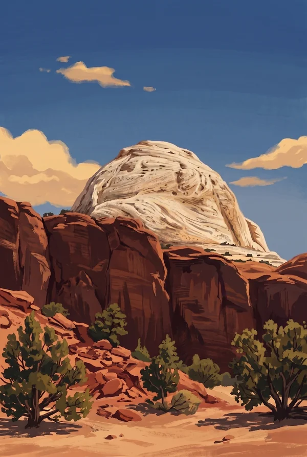
Capitol Dome
The park's namesake: a rounded summit of white Navajo Sandstone, petrified dune sand, standing above the Fremont River canyon along the highway corridor. Early travelers thought it looked like the Capitol rotunda. It is the emblem of the whole Fold, and you pass directly beneath it on the way to Hickman Bridge.
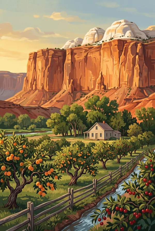
Fruita Historic District
The green heart of the park: orchards of a couple thousand fruit trees on the Fremont River floodplain, with the 1896 one-room schoolhouse and the Gifford farmhouse under 1,000-foot red walls. Mule deer graze between the trees. Pick this one if what you remember is pie, shade and the strangeness of a farm town inside a desert park.
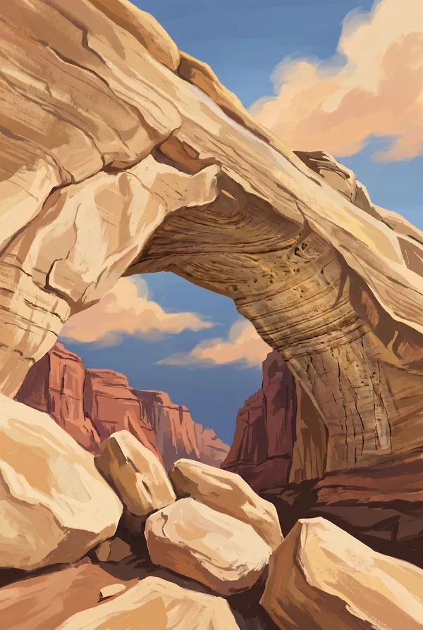
Hickman Bridge
A natural bridge of Kayenta sandstone spanning 133 feet, reached by a mile-ish trail climbing from the Fremont River. It is named for Joseph Hickman, the local school principal and legislator who spent the 1920s arguing this country deserved protection. He drowned in 1925, twelve years before the monument came through.
How to record your Capitol Reef visit
Free, and it works whether you are standing there now or remembering a trip from years ago.
1
Check In at the park
Open ParkStamp inside the park boundary and check in. The app confirms you are actually there and logs the date.
2
Or Stamp It later
Already been? Pick the date yourself. Trips from decades ago count the same as last weekend.
3
Or scan your photos
Let ParkStamp read the dates and locations off photos already on your phone. Most people find parks they had forgotten.
Capitol Reef, asked and answered
Quick answers, for people planning a trip and people remembering one.
When is the best time to visit Capitol Reef?
Spring and fall are the walking seasons: April and May for bloom on the desert benches, September and October for cool air and the cottonwoods turning along the Fremont River. Summer works with an early start, but late-summer monsoon storms make slot canyons like Grand Wash a real flash-flood risk. The orchards pay out from early summer cherries through fall apples. Winter is quiet, cold and mostly snow-light at park elevation.
How many days do you need at Capitol Reef?
One day covers the core: the Fruita orchards, the petroglyph panels, the scenic drive to Capitol Gorge, and the walk to Hickman Bridge. A second day is for the long dirt roads, meaning Cathedral Valley's monoliths to the north, or the Burr Trail switchbacks and the lower Waterpocket Fold to the south, which is where the park gets big and empty.
How busy is Capitol Reef?
Capitol Reef National Park logged 1.39 million visits in 2025, the 22nd busiest of the 63 national parks. That puts it in the middle of the pack: busy at the famous spots, quiet a mile past them.
What does the Capitol Reef stamp show?
The lead Capitol Reef design is Capitol Dome. The park's namesake: a rounded summit of white Navajo Sandstone, petrified dune sand, standing above the Fremont River canyon along the highway corridor. Early travelers thought it looked like the Capitol rotunda. It is the emblem of the whole Fold, and you pass directly beneath it on the way to Hickman Bridge. The other two designs are Fruita Historic District and Hickman Bridge.
Is the Capitol Reef stamp free?
Recording your Capitol Reef visit is always free: check in at the park, add an old trip, or let the photo scan find it. The full-color art is the paid part, $3.99 one-time with three Capitol Reef designs to choose from, and the first stamp you collect in ParkStamp is free.
Can I add a Capitol Reef trip from years ago?
Yes. Open Capitol Reef in ParkStamp, tap Stamp It, and set the date yourself; a visit from decades ago counts the same as last weekend. If you still have photos from the trip, the photo scan can find and date it from their location tags, without your photos ever leaving your phone.
Do I have to be at Capitol Reef to get the stamp?
No. Check In is for when you are standing inside Capitol Reef, and it confirms you are actually there. Stamp It records any past visit on your honor, with your dates. Both are free and put the same stamp in your StampBook.
Start your StampBook with Capitol Reef
Free on iOS and Android. Your first stamp is on us.