Bryce Canyon is not a canyon: no river runs through it, and nothing carved it but weather. It is named for a Scottish immigrant carpenter who ran cattle below the rim in the 1870s and is remembered for one review of the scenery: a hell of a place to lose a cow.
Bryce Canyon is one of the 63 national parks in ParkStamp, all of them with original stamp designs drawn in the WPA poster tradition. Each design is an illustration of one specific, real place in the park.
Recording that you were here is free. Check in from the rim, log a visit from any year past, or let the app lift the dates and locations from photos already in your pocket.
The real NPS boundary, with the roads and towns you would actually use to get there.
Bryce Canyon, for people who count parks
A plateau edge dissolving into hoodoos, and a name that almost did not stick.
Ebenezer Bryce just wanted his cattle back. A Scottish-born Mormon carpenter, he homesteaded below the amphitheater in the 1870s and ran stock in the broken country behind his place, which neighbors took to calling Bryce's Canyon. He moved to Arizona within a few years and left nothing here but the name and a line he may or may not have actually said: that it was a hell of a place to lose a cow. The Park Service repeats the quote with a straight face, sourced to legend.
For four years this was Utah National Park. Warren Harding protected it as a national monument in 1923, Congress authorized a park under the name Utah National Park in 1924, and sense prevailed with final establishment on February 25, 1928, under the name everyone already used. The Union Pacific was assembling its southwestern loop of rail-and-bus tourism at the time, and the lodge its architect Gilbert Stanley Underwood built here in the 1920s still stands near the rim.
There is no canyon. No river runs through Bryce and none carved it. The amphitheaters are bites taken out of the eastern edge of the Paunsaugunt Plateau (Paiute for home of the beaver) by frost. Water seeps into cracks in the Claron Formation limestone by day and freezes at night, and the rim gets about 200 of those freeze-thaw cycles a year. Walls become fins, fins become windows, windows collapse into hoodoos, and hoodoos thin until they fall. The rock retreats on the order of two to four feet a century, with new hoodoos forming behind as old ones drop, and nowhere on Earth holds a larger concentration of them.
The Paiute account got there first. A story recorded from a Paiute elder in the 1930s describes the hoodoos as the Legend People, To-when-an-ung-wa, who behaved badly and were turned to stone by Coyote where they stood, which is why the rocks stand in crowds, and why some of them still seem to have faces. As a description of the place, it has not been improved on.
Life on a high, cold rim, from prairie dogs to trees sixteen centuries old.
The Utah prairie dog exists only in southwestern Utah. Federally protected for decades, it holds some of its most secure colonies in the park's high meadows and sleeps through the plateau winter underground. The colonies you pass driving in are not an amenity; they are a large part of why this park matters to biologists.
Bristlecone pines take the worst seats. At the southern end of the road, around Rainbow and Yovimpa Points, bristlecones up to roughly 1,600 years old grow directly on the exposed rim edge: dry, thin, wind-scoured ground where nothing else competes. That is the species' whole strategy: claim the spot nobody wants and hold it for a millennium or two.
Clark's nutcracker plants the forest. A single bird caches tens of thousands of pine seeds a season in thousands of small burials, then retrieves them from memory through the winter. The forgotten fraction becomes trees; whole stands of limber and bristlecone pine on this plateau were effectively planted by birds.
The air is part of the exhibit. The rim stands between 8,000 and 9,100 feet, and on clear days the view from Yovimpa Point runs well over a hundred miles. At night the same clarity makes Bryce one of the best-known dark-sky parks in the country; the Milky Way here is a routine sight, not an occasion.
The Bryce Canyon designs
Pick the one that matches the park you actually saw.
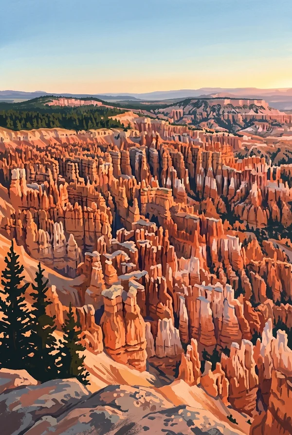
Bryce Amphitheater
The main bowl between Sunrise and Bryce Points, holding the densest concentration of hoodoos on Earth. At dawn the spires light up in sequence, orange to pink, which is why people stand at the rim in the cold. The Rim Trail links every classic viewpoint, and after snowfall the orange-on-white version may be the best thing in the park.
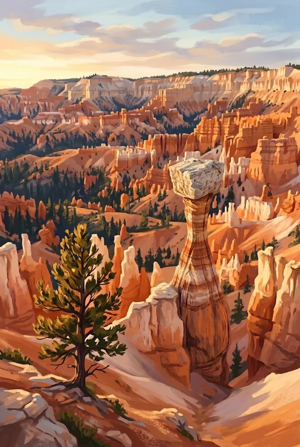
Thor's Hammer
A single hoodoo below Sunset Point with a massive caprock balanced on a thinning pedestal: the entire life cycle of a hoodoo told in one rock, since the hammer head is the harder stone protecting everything under it, for now. The Navajo Loop switchbacks drop right past it, so you see it from the rim and then from its feet.
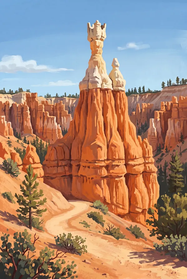
Queens Garden
The gentlest trail below the rim, dropping from Sunrise Point through the spires to a hoodoo whose silhouette earned the name Queen Victoria. Walking among the hoodoos instead of above them changes the scale of the place entirely. Combined with the Navajo Loop it makes the standard circuit, and the standard circuit is standard for a reason.
How to record your Bryce Canyon visit
Free, and it works whether you are standing there now or remembering a trip from years ago.
1
Check In at the park
Open ParkStamp inside the park boundary and check in. The app confirms you are actually there and logs the date.
2
Or Stamp It later
Already been? Pick the date yourself. Trips from decades ago count the same as last weekend.
3
Or scan your photos
Let ParkStamp read the dates and locations off photos already on your phone. Most people find parks they had forgotten.
Bryce Canyon, asked and answered
Quick answers, for people planning a trip and people remembering one.
When is the best time to visit Bryce Canyon?
Every season works; pick your temperature. Summer stays mild at 8,000-plus feet, with afternoon thunderstorms in July and August that usually clear by evening. September and October are crisp, stable and quieter. Winter may be the best version of the park (orange hoodoos under snow), though it brings real cold at this altitude. Spring swings between all of the above, sometimes in a single day.
How many days do you need at Bryce Canyon?
One well-planned day covers it: sunrise from the amphitheater rim, the Queens Garden and Navajo Loop circuit below the rim, then the drive south to Rainbow Point in the afternoon. A second day adds the Fairyland Loop, the least crowded of the classic hikes, and a night for the famous dark sky. Bryce is compact; it rewards hours, not mileage.
How busy is Bryce Canyon?
Bryce Canyon National Park logged 1.97 million visits in 2025, the 16th busiest of the 63 national parks. That puts it in the middle of the pack: busy at the famous spots, quiet a mile past them.
What does the Bryce Canyon stamp show?
The lead Bryce Canyon design is Bryce Amphitheater. The main bowl between Sunrise and Bryce Points, holding the densest concentration of hoodoos on Earth. At dawn the spires light up in sequence, orange to pink, which is why people stand at the rim in the cold. The Rim Trail links every classic viewpoint, and after snowfall the orange-on-white version may be the best thing in the park. The other two designs are Thor's Hammer and Queens Garden.
Is the Bryce Canyon stamp free?
Recording your Bryce Canyon visit is always free: check in at the park, add an old trip, or let the photo scan find it. The full-color art is the paid part, $3.99 one-time with three Bryce Canyon designs to choose from, and the first stamp you collect in ParkStamp is free.
Can I add a Bryce Canyon trip from years ago?
Yes. Open Bryce Canyon in ParkStamp, tap Stamp It, and set the date yourself; a visit from decades ago counts the same as last weekend. If you still have photos from the trip, the photo scan can find and date it from their location tags, without your photos ever leaving your phone.
Do I have to be at Bryce Canyon to get the stamp?
No. Check In is for when you are standing inside Bryce Canyon, and it confirms you are actually there. Stamp It records any past visit on your honor, with your dates. Both are free and put the same stamp in your StampBook.
Start your StampBook with Bryce Canyon
Free on iOS and Android. Your first stamp is on us.