Two rivers cut Canyonlands into three districts, and no road or bridge inside the park connects any of them. You can stand at an overlook and see country that would take you half a day of driving to reach. It is the largest national park in Utah and by a wide margin the emptiest.
Canyonlands is one of 63 national parks in ParkStamp, and like all of them it gets original stamp art drawn in the WPA poster tradition. Every design is a picture of a specific, real place inside the park.
Recording a visit costs nothing. Check in from the park itself, log a trip from years back, or let the app pull the dates and places out of photos already sitting on your phone.
The real NPS boundary, with the roads and towns you would actually use to get there.
Canyonlands, for people who count parks
A park lobbied into existence over Dutch-oven dinners in the desert.
The father of Canyonlands was the superintendent of a different park. Bates Wilson ran Arches, then a national monument, and spent the 1950s exploring the maze of canyons to the southwest by jeep. His method for winning converts was to drive officials into the backcountry, cook them dinner in a Dutch oven, and let the country make the argument. In 1961 Interior Secretary Stewart Udall flew over the spot where the Green and Colorado rivers meet and came down convinced. Senator Frank Moss introduced the bill in 1962, and Lyndon Johnson signed Canyonlands into law on September 12, 1964.
The fight was over how much to leave out. Utah politicians wanted a smaller park that kept the door open for mining and grazing; conservationists wanted the whole canyon system. The 1964 compromise ran to about 257,000 acres, and a 1971 expansion brought it to roughly 337,000, still the biggest park in a state with five of them.
The rivers are the map. The Green and the Colorado meet in the middle of the park at the Confluence, and between them they split it into three named districts: Island in the Sky, a mesa in the wedge between the rivers; the Needles, southeast of the Colorado; and the Maze, west of the Green. There are no bridges. Districts that sit a few miles apart as the raven flies are hours apart by road, which is why most visitors only ever see one.
The Maze is the remote one, and the reputation is earned. It is routinely described as one of the most inaccessible corners of the lower 48, reached by long dirt roads that demand a serious vehicle and self-sufficiency. The surrounding Robbers Roost country served as a hideout for Butch Cassidy's Wild Bunch in the 1890s, for exactly the reasons that keep it empty now: nobody could follow them in.
The park also holds one of the great rock-art panels in North America. In Horseshoe Canyon, a detached unit northwest of the Maze, the Great Gallery carries life-size painted figures in the Barrier Canyon style: ghostly, armless, hollow-eyed forms up to seven feet tall. They are at least a couple of thousand years old, and some estimates run much older. The style is named for this canyon's former name.
A desert held together by a living crust you can kill with one footstep.
One valley here has never been grazed. Virginia Park, a grassland in the Needles sealed on every side by rock walls, was never reached by the cattle that worked over the rest of canyon country, and scientists treat it as a baseline for what this desert looked like untouched. What holds it together is cryptobiotic crust, a living skin of cyanobacteria and lichen that glues the sand down and feeds it nitrogen. A footprint kills it for decades, which is why the baseline stays closed to feet.
The potholes hatch on a deadline. Rain pools in shallow basins in the slickrock, and the dried mud on the bottom is full of the eggs of fairy shrimp and tadpole shrimp, which can wait out years of drought. When a storm finally fills the pothole, they hatch, mature, and lay the next round of eggs in a matter of days, racing the evaporation. A puddle that lasts two weeks is an entire generation.
The desert bighorn here never left. While most of Utah's herds were wiped out in the 19th and 20th centuries, the canyons of Canyonlands sheltered one of the few remnant native populations, and it became the stock that seeded reintroductions elsewhere in the region. Look for them on the talus below the rims, where the terrain is too broken for anything that cannot jump.
The collared lizard runs on two legs. When it commits to a sprint it stands up, tucks its front limbs, and runs across the slickrock like a very small theropod, which fits an animal that eats other lizards. Males wear a green and turquoise that looks wrong for a desert until you see one on red rock in full sun. Look for them in the boulder fields of the Needles, sunning at eye level and gone the moment you point.
The Canyonlands designs
Pick the one that matches the park you actually saw.
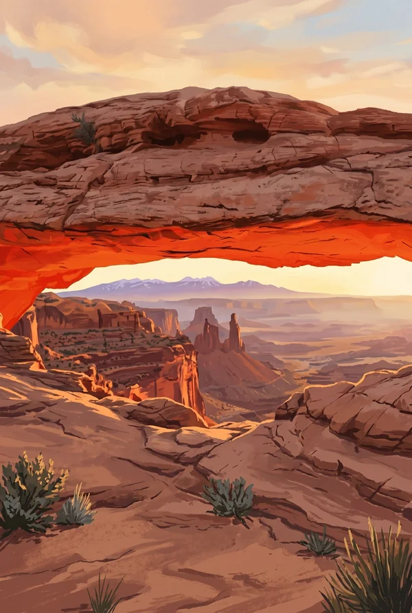
Mesa Arch
A pothole arch lying right at the edge of the Island in the Sky cliff, framing the canyons and the La Sal Mountains beyond. At dawn, light bouncing off the cliff face below sets the underside of the arch glowing red. It is the most photographed sunrise in canyon country, and it costs you only a half-mile walk.
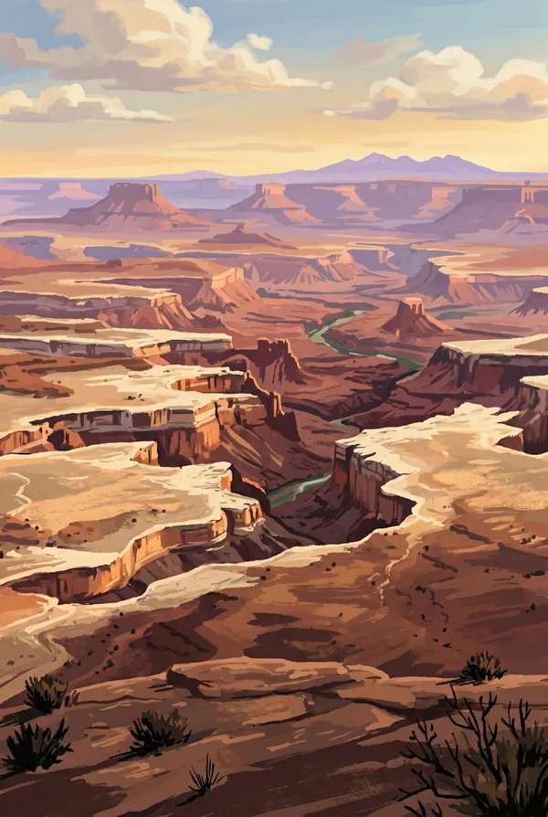
Grand View Point
The end of the road on Island in the Sky, and the place the park explains itself. You look down on the White Rim, a sandstone bench about 1,200 feet below, and the rivers have cut a thousand feet below that: a canyon system two stories deep, with the spires of Monument Basin standing in the middle distance.
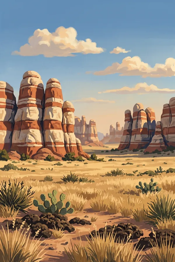
The Needles
The southeast district, named for its spires of Cedar Mesa Sandstone banded in red and white like candy. This is the hiker's side of the park, where trails thread between the pinnacles to places like Chesler Park, a grass meadow ringed entirely by stone. Pick it if your Canyonlands was earned on foot.
How to record your Canyonlands visit
Free, and it works whether you are standing there now or remembering a trip from years ago.
1
Check In at the park
Open ParkStamp inside the park boundary and check in. The app confirms you are actually there and logs the date.
2
Or Stamp It later
Already been? Pick the date yourself. Trips from decades ago count the same as last weekend.
3
Or scan your photos
Let ParkStamp read the dates and locations off photos already on your phone. Most people find parks they had forgotten.
Canyonlands, asked and answered
Quick answers, for people planning a trip and people remembering one.
When is the best time to visit Canyonlands?
April, May, September and October, like the rest of Utah canyon country. Spring brings cactus bloom and full potholes; fall brings stable air and long views from the rims. Summer regularly passes 100°F on the trails, with afternoon monsoon storms in late summer that turn slickrock drainages dangerous. Winter is cold, quiet and open, with snow dusting the red rock and almost nobody at the overlooks.
How many days do you need at Canyonlands?
One day covers the Island in the Sky overlooks: Mesa Arch at dawn, Grand View Point, Green River Overlook. Give the Needles its own full day; it is a separate entrance hours away, and its best country, like Chesler Park, is only reached on foot. The Maze is not a day trip at all: people plan it like an expedition.
How busy is Canyonlands?
Canyonlands National Park logged 796,057 visits in 2025, the 29th busiest of the 63 national parks. That puts it in the middle of the pack: busy at the famous spots, quiet a mile past them.
What does the Canyonlands stamp show?
The lead Canyonlands design is Mesa Arch. A pothole arch lying right at the edge of the Island in the Sky cliff, framing the canyons and the La Sal Mountains beyond. At dawn, light bouncing off the cliff face below sets the underside of the arch glowing red. It is the most photographed sunrise in canyon country, and it costs you only a half-mile walk. The other two designs are Grand View Point and The Needles.
Is the Canyonlands stamp free?
Recording your Canyonlands visit is always free: check in at the park, add an old trip, or let the photo scan find it. The full-color art is the paid part, $3.99 one-time with three Canyonlands designs to choose from, and the first stamp you collect in ParkStamp is free.
Can I add a Canyonlands trip from years ago?
Yes. Open Canyonlands in ParkStamp, tap Stamp It, and set the date yourself; a visit from decades ago counts the same as last weekend. If you still have photos from the trip, the photo scan can find and date it from their location tags, without your photos ever leaving your phone.
Do I have to be at Canyonlands to get the stamp?
No. Check In is for when you are standing inside Canyonlands, and it confirms you are actually there. Stamp It records any past visit on your honor, with your dates. Both are free and put the same stamp in your StampBook.
Start your StampBook with Canyonlands
Free on iOS and Android. Your first stamp is on us.