There are more than 2,000 documented stone arches here, the densest collection on Earth, and every one of them is falling down; dozens have collapsed in the past half-century. The Park Service does not consider this a problem. Erosion built the arches, erosion takes them, and the park is simply where you catch the process mid-act.
Arches is one of the 63 national parks in ParkStamp, and every park in the app gets original stamp art drawn in the WPA poster tradition, each design an illustration of a specific, real place inside the park.
Recording your visit costs nothing. Check in from the park itself, log a trip from years back, or let the app read the dates and places off the photos already on your phone.
The real NPS boundary, with the roads and towns you would actually use to get there.
Arches, for people who count parks
A salt bed doing slow demolition, and the ranger who wrote the book on it.
The whole park stands on salt. Around 300 million years ago an inland sea evaporated here, over and over, leaving salt beds thousands of feet thick in places. Buried under later rock, salt behaves less like a mineral than a liquid: it flowed, domed upward, and cracked the overlying Entrada Sandstone into long parallel fins. Water and ice have been picking the fins apart ever since, and where a soft layer fails before the harder rock above it, an opening forms. That is why the densest arch field on Earth is here and not somewhere else: not better scenery, better salt.
A prospector sold a railroad on it. In 1923 Alexander Ringhoffer, a Hungarian-born miner working nearby, wrote to officials of the Denver and Rio Grande Western hoping arch scenery would put tourists on their trains. Railroad men came, were persuaded, and pushed the idea up the chain; Herbert Hoover proclaimed Arches National Monument in 1929. It took until November 12, 1971 for Congress to make it a national park.
Edward Abbey was a ranger here. He spent the seasons of 1956 and 1957 in a trailer at the end of a dirt road, back when the monument saw a trickle of visitors, and turned his journals into Desert Solitaire in 1968, a book that argues, at length, against paving the place. The road got paved anyway. About a million and a half people a year now drive it, and the book stays in print, still making its case.
Everything here is temporary, on a schedule you can almost watch. Wall Arch, a landmark on the Devils Garden trail, collapsed overnight in August 2008; nobody saw it go. In 1991 a sixty-foot slab dropped from the underside of Landscape Arch in front of hikers. The park inventory counts an opening as an arch once it spans three feet, and new ones are opening as old ones fall, so the count above 2,000 is a snapshot, not a fact about a permanent landscape.
Do not step on the black crust. Much of the ground between the fins is biological soil crust, a living skin of cyanobacteria, lichens and mosses that cements the sand, soaks up rain and fixes nitrogen for everything else. It is the foundation of the desert food web, and one bootprint can take decades to heal. The rule in the park is simple: walk on rock, trail, or wash.
The rattlesnake here is small, pale, and stronger than it needs to be. The midget faded rattlesnake is a Colorado Plateau specialty: a rattler the color of weathered Entrada sandstone that rarely reaches two feet, hunts at night, and carries venom more potent, drop for drop, than nearly any other rattlesnake in North America. Almost nobody sees one. It would prefer to keep it that way.
Potholes are timed events. Rain pools in bare-rock basins and starts a race: spadefoot toads go from egg to toadlet in weeks, fairy shrimp hatch from eggs that may have waited dry for years, and everything must finish before the water does. A pothole that looks like a puddle is an ecosystem on a deadline, which is why you should never wade or stir one.
Desert bighorn are back. Gone from this stretch of canyon country by the mid-20th century, they were reintroduced in the 1980s and now hold the cliffs along the park's southern edge. The highway corridor near the entrance is one of the more reliable places in Utah to see one standing on rock that looks unstandable.
The Arches designs
Pick the one that matches the park you actually saw.
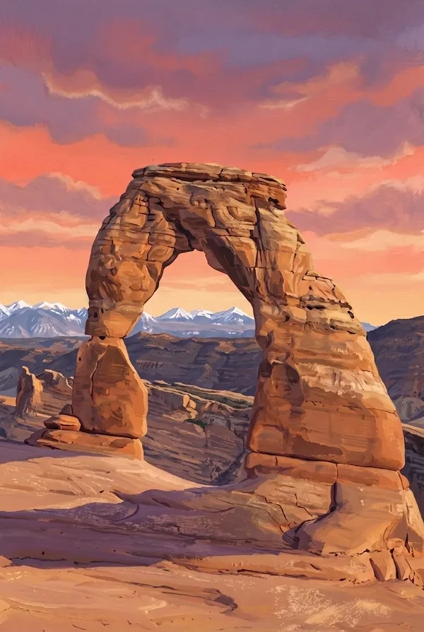
Delicate Arch
The park's largest freestanding arch, and the one on Utah's license plate. It stands alone on the lip of a sandstone bowl with the La Sal Mountains behind it; cowboys are said to have called it the Schoolmarm's Bloomers. The trail is three miles round trip across bare slickrock with no shade, and the arch stays hidden until the last turn.
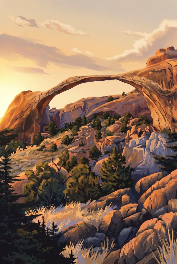
Landscape Arch
A 306-foot ribbon of rock, the longest natural arch in North America and among the longest on Earth. In September 1991 a slab sixty feet long peeled off its underside while hikers watched from the trail below; the path beneath has been closed ever since, which is honest advertising. It hangs at the end of an easy walk through Devils Garden.
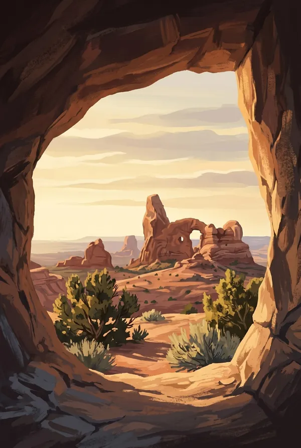
The Windows
North Window, South Window and Turret Arch stand together in one of the densest clusters of big openings in the park, reached by a short walk from the road. Photographers come before dawn to shoot Turret Arch framed inside North Window. From a distance the two Windows read as a pair of spectacles, nose and all.
How to record your Arches visit
Free, and it works whether you are standing there now or remembering a trip from years ago.
1
Check In at the park
Open ParkStamp inside the park boundary and check in. The app confirms you are actually there and logs the date.
2
Or Stamp It later
Already been? Pick the date yourself. Trips from decades ago count the same as last weekend.
3
Or scan your photos
Let ParkStamp read the dates and locations off photos already on your phone. Most people find parks they had forgotten.
Arches, asked and answered
Quick answers, for people planning a trip and people remembering one.
When is the best time to visit Arches?
April, May, September and October are the sweet spots: warm days, cold nights, and light that makes the red rock work. Summer regularly passes 100°F with almost no shade anywhere in the park, so hikes like Delicate Arch happen at dawn or not at all. Winter is underrated: snow dusts the fins, the crowds vanish, and the La Sal Mountains stay white behind every arch.
How many days do you need at Arches?
One full day covers the essentials: the paved road end to end, the Windows, and Delicate Arch timed for late light. A second day earns you Devils Garden out to Landscape Arch and beyond, where the crowds thin at every junction. Arches is compact; pair it with Canyonlands, half an hour away, if you have more time in Moab.
How busy is Arches?
Arches National Park logged 1.51 million visits in 2025, the 21st busiest of the 63 national parks. That puts it in the middle of the pack: busy at the famous spots, quiet a mile past them.
What does the Arches stamp show?
The lead Arches design is Delicate Arch. The park's largest freestanding arch, and the one on Utah's license plate. It stands alone on the lip of a sandstone bowl with the La Sal Mountains behind it; cowboys are said to have called it the Schoolmarm's Bloomers. The trail is three miles round trip across bare slickrock with no shade, and the arch stays hidden until the last turn. The other two designs are Landscape Arch and The Windows.
Is the Arches stamp free?
Recording your Arches visit is always free: check in at the park, add an old trip, or let the photo scan find it. The full-color art is the paid part, $3.99 one-time with three Arches designs to choose from, and the first stamp you collect in ParkStamp is free.
Can I add a Arches trip from years ago?
Yes. Open Arches in ParkStamp, tap Stamp It, and set the date yourself; a visit from decades ago counts the same as last weekend. If you still have photos from the trip, the photo scan can find and date it from their location tags, without your photos ever leaving your phone.
Do I have to be at Arches to get the stamp?
No. Check In is for when you are standing inside Arches, and it confirms you are actually there. Stamp It records any past visit on your honor, with your dates. Both are free and put the same stamp in your StampBook.
Start your StampBook with Arches
Free on iOS and Android. Your first stamp is on us.