The sand at White Sands is gypsum, a mineral that dissolves in water and therefore almost never survives long enough to pile into dunes. Here it forms the largest gypsum dunefield on Earth, 275 square miles of it. And pressed into the old lakebed at its edge are human footprints between 21,000 and 23,000 years old, the oldest known in North America.
White Sands is one of 63 national parks in ParkStamp, and like all of them it has its own original stamp art drawn in the WPA poster tradition, each design an illustration of a particular real place inside the park.
The record-keeping part is free. Check in from the dunes, backfill a visit from years ago, or let the app read the dates and places off the photos already on your phone.
The real NPS boundary, with the roads and towns you would actually use to get there.
White Sands, for people who count parks
A dunefield that should not exist, and footprints that moved a timeline.
Gypsum dunes are a geologic loophole. Rain dissolves gypsum and rivers carry it to the sea, which is why beaches are quartz. But the Tularosa Basin has no river out. Gypsum washed down from the surrounding mountains collects in Lake Lucero, a shallow playa that dries after every wet spell, growing selenite crystals as long as your arm. Wind and weather break the crystals into sand and the prevailing southwest wind heaps it downwind. The whole dunefield is young, built within roughly the last ten thousand years, and it only exists because the water here has nowhere to go.
The footprints are the biggest archaeology story in the park system. Along the margins of the ancient lake, researchers found human trackways dated to between 21,000 and 23,000 years ago, first from seeds in the same layers and then confirmed by two independent methods. That puts people in North America during the height of the last ice age, thousands of years earlier than the old textbook date. One trackway follows a young person hurrying across the mud with a toddler, setting the child down and picking it up again; mammoth and giant ground sloth tracks cross the same surfaces.
It was a monument for 86 years first. Herbert Hoover proclaimed White Sands National Monument on January 18, 1933, after a long local campaign led by an Alamogordo insurance man named Tom Charles, who believed in the dunes so completely that he became the monument's first custodian. Redesignation as a national park came on December 20, 2019, tucked into a defense bill, which is fitting: the park is surrounded by White Sands Missile Range, and the Trinity site, where the first atomic bomb was detonated in July 1945, lies at the north end of this same basin. The gleaming dunes and the military have shared the Tularosa since the 1940s.
Animals that turned white in a few thousand years, and plants that race the sand.
The dunes are a running experiment in natural selection. The dunefield is only thousands of years old, yet several animals have already evolved pale forms to match it: the bleached earless lizard, a whitish pocket mouse, pale crickets and moths. On white ground a dark animal is lunch. It is one of the textbook cases of rapid evolution, happening at a pace you can almost watch, and it happened here because the background changed color.
The plants are in a slow-motion footrace. A dune advances, and most plants simply drown in sand. The soaptree yucca elongates its stem instead, keeping its crown above the rising surface year after year, so that a modest-looking plant on a crest may have a trunk buried the full height of the dune. Skunkbush sumac holds sand in its roots so firmly that when the dune moves on, the plant is left standing on a pedestal of its own making.
There is even a fish. The White Sands pupfish lives in a handful of salty streams and springs scattered across the Tularosa Basin and nowhere else on Earth, a leftover from the ice-age lake that once filled the valley floor. The basin that has no river out also has no way in, so what survives here survives alone.
And the sand itself behaves strangely. Gypsum does not soak up heat the way quartz does, so even on a hot afternoon the sand is cool enough to walk barefoot. It is also faintly damp a few inches down, because the water table under the dunefield sits close to the surface; that moisture is part of what holds the dunes together.
The White Sands designs
Pick the one that matches the park you actually saw.
Soaptree Yucca on Dune Crest
The signature image of the park: a lone yucca holding its green crown above a white crest, backlit at dusk. What the picture hides is that the plant is racing the dune, stretching its buried stem upward for decades to keep from being swallowed. When the sand finally moves on, the exposed stalk topples. Pick it for the fight in it.
Dune Field
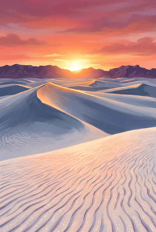
The 275-square-mile heart of the park, the largest gypsum dunefield on Earth, white enough to be picked out from orbit and cool enough to cross barefoot. The active dunes creep steadily downwind, burying and uncovering as they go. From a high crest it is white to the horizon in every direction, with the San Andres Mountains floating beyond.
Dunes Drive
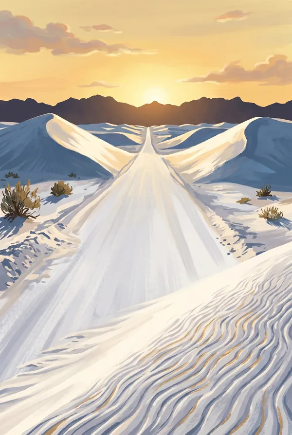
The eight-mile road from the visitor center into the middle of the dunefield. Partway in, the pavement gives out and the road becomes hard-packed gypsum, graded and plowed after storms like a snow road, which is exactly what it looks like. Families sled the slopes beside the pullouts. It is the rare park road that is itself the destination.
How to record your White Sands visit
Free, and it works whether you are standing there now or remembering a trip from years ago.
1
Check In at the park
Open ParkStamp inside the park boundary and check in. The app confirms you are actually there and logs the date.
2
Or Stamp It later
Already been? Pick the date yourself. Trips from decades ago count the same as last weekend.
3
Or scan your photos
Let ParkStamp read the dates and locations off photos already on your phone. Most people find parks they had forgotten.
White Sands, asked and answered
Quick answers, for people planning a trip and people remembering one.
When is the best time to visit White Sands?
October through November and March through April, when afternoons are mild and the light on the gypsum is at its best; spring adds strong afternoon winds, which is what built the dunes in the first place. Summer days pass 100°F with no shade anywhere, so go at morning or evening; the July and August monsoon skies make the sunsets. Winter brings cold nights, quiet dunes, and occasionally real snow on the white sand, a genuinely confusing sight.
How many days do you need at White Sands?
Half a day covers the essentials: Dunes Drive, a barefoot climb, sledding, and a sunset, which is not optional here. A full day adds the Alkali Flat Trail, a five-mile loop through the barest, whitest heart of the dunefield; carry more water than feels reasonable, since there is none past the visitor center and no shade at all.
How busy is White Sands?
White Sands National Park logged 659,742 visits in 2025, the 35th busiest of the 63 national parks. That puts it in the middle of the pack: busy at the famous spots, quiet a mile past them.
What does the White Sands stamp show?
The lead White Sands design is Soaptree Yucca on Dune Crest. The signature image of the park: a lone yucca holding its green crown above a white crest, backlit at dusk. What the picture hides is that the plant is racing the dune, stretching its buried stem upward for decades to keep from being swallowed. When the sand finally moves on, the exposed stalk topples. Pick it for the fight in it. The other two designs are Dune Field and Dunes Drive.
Is the White Sands stamp free?
Recording your White Sands visit is always free: check in at the park, add an old trip, or let the photo scan find it. The full-color art is the paid part, $3.99 one-time with three White Sands designs to choose from, and the first stamp you collect in ParkStamp is free.
Can I add a White Sands trip from years ago?
Yes. Open White Sands in ParkStamp, tap Stamp It, and set the date yourself; a visit from decades ago counts the same as last weekend. If you still have photos from the trip, the photo scan can find and date it from their location tags, without your photos ever leaving your phone.
Do I have to be at White Sands to get the stamp?
No. Check In is for when you are standing inside White Sands, and it confirms you are actually there. Stamp It records any past visit on your honor, with your dates. Both are free and put the same stamp in your StampBook.
Start your StampBook with White Sands
Free on iOS and Android. Your first stamp is on us.