The highest mountains in Texas are a reef. Not like a reef: an actual fossil reef, built cell by cell in a Permian sea about 260 million years ago, buried, and then hoisted 8,000 feet into the desert air. Geologists come from around the world to walk on it; an entire epoch of Earth history, the Guadalupian, is named for these mountains.
Guadalupe Mountains is one of 63 national parks in ParkStamp, all of them with original stamp designs drawn in the WPA poster tradition. Every design illustrates a specific real place in the park, somewhere you can stand.
Recording the visit is free. Check in on site, add a trip from any year you like, or let the app read dates and locations from the photos already on your phone.
The real NPS boundary, with the roads and towns you would actually use to get there.
Guadalupe Mountains, for people who count parks
A Permian reef, a stagecoach road, and an oil geologist who gave his favorite canyon away.
The mountains are the reef. In the Permian, a tropical inland sea covered this part of the continent, ringed by a reef some 400 miles long built mostly by sponges and algae rather than corals. The sea closed off and evaporated, sediments buried the reef, and much later, faulting pushed a section of it back to the surface almost intact. El Capitan and Guadalupe Peak are cross-sections of that structure, which is why stratigraphers named the Guadalupian epoch of the Permian after these mountains and why field trips from universities on several continents keep showing up here.
The fastest mail in America once ran under El Capitan. The Butterfield Overland Mail, the first transcontinental mail line, came through Guadalupe Pass starting in 1858 on its roughly 2,800-mile run between St. Louis and San Francisco. The ruins of the Pinery, one of its high mountain stations, still stand near the park visitor center, one of the few Butterfield stations with anything left to look at.
These were Mescalero Apache mountains, a stronghold and a food supply. The range is full of roasting pits where mescal agave was baked for days under heated stones, and they are still visible. After the Civil War the Army campaigned here specifically to drive the Mescalero from this range, one of their last refuges in Texas.
The park exists because a petroleum geologist fell for a canyon. Wallace Pratt, Humble Oil's first staff geologist, saw McKittrick Canyon in the 1920s and reportedly called it the most beautiful spot in Texas. He bought land in it, built a stone cabin at the fork of the canyon, and eventually donated around six thousand acres to the federal government. Combined with the purchase of the Hunter family ranch covering most of the high country, that gift became the park: authorized in 1966, formally established and dedicated in 1972.
It is still a hiker's park, full stop. No lodge, no restaurant, no scenic drive to the top: just trailheads, the wind, and the highest ground in Texas. The wind deserves its billing: spring gusts here are notorious, and the park is one of the windier places in the state.
The high country is a leftover from the Pleistocene. When the ice ages ended and the lowlands dried into the Chihuahuan Desert, the forest retreated uphill and stayed. The Bowl, a basin on top of the range, still holds Douglas-fir, ponderosa, and southwestern white pine: a relict conifer forest marooned a vertical mile above the desert floor, with mule deer, black bears, and mountain lions moving between the two worlds.
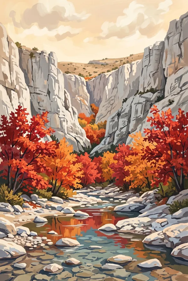
McKittrick Canyon does fall color in the desert. A spring-fed stream keeps the canyon floor alive year-round, rare in the Chihuahuan Desert, and shelters bigtooth maples, another ice-age relict, that turn scarlet and orange in late autumn. It is the most famous foliage display in Texas, in a state not otherwise known for one.
The elk are replacements. The native Merriam's elk of these mountains was hunted to extinction; in the 1920s the ranching family that owned the high country shipped in a few dozen elk from elsewhere, and their descendants still graze the meadows and canyons of the park.
West of the peaks, the ecosystem flips again: the Salt Basin, with white gypsum dunes on the park's remote west side (the same blinding mineral as White Sands, in miniature) and creosote flats where the reef towers a mile overhead.
The Guadalupe Mountains designs
Pick the one that matches the park you actually saw.
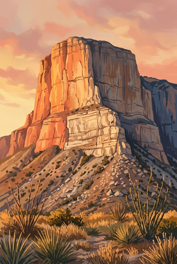
El Capitan
The southern prow of the range, 8,085 feet, a sheer limestone face that is the exposed edge of the Permian reef itself. It has been the landmark of this desert for centuries: for the Mescalero, for the Butterfield stage drivers who steered on it, for everyone driving the highway below today. The most recognizable rock in Texas, and it earns the stamp.
McKittrick Canyon
The stream-fed canyon Wallace Pratt loved enough to buy and give away, with his 1930s stone cabin still standing at the fork. Fossil reef walls, a rare year-round desert stream, and bigtooth maples that turn the canyon red in late autumn, the celebrated fall color of Texas. Choose it if you were here in the good weeks.
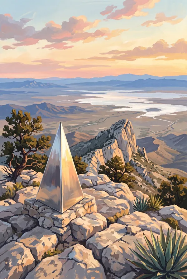
Guadalupe Peak
The top of Texas at 8,751 feet, reached by a steady switchbacking climb of about 3,000 vertical feet. On the summit stands a stainless-steel pyramid placed by American Airlines in 1958 to mark the centennial of the Butterfield mail route below. The view runs down the back of El Capitan and out over the salt flats. The earned stamp.
How to record your Guadalupe Mountains visit
Free, and it works whether you are standing there now or remembering a trip from years ago.
1
Check In at the park
Open ParkStamp inside the park boundary and check in. The app confirms you are actually there and logs the date.
2
Or Stamp It later
Already been? Pick the date yourself. Trips from decades ago count the same as last weekend.
3
Or scan your photos
Let ParkStamp read the dates and locations off photos already on your phone. Most people find parks they had forgotten.
Guadalupe Mountains, asked and answered
Quick answers, for people planning a trip and people remembering one.
When is the best time to visit Guadalupe Mountains?
Fall, by a wide margin. Late October into early November brings the bigtooth maples of McKittrick Canyon into full color, the signature event of the park's year. Winter is quiet and can be sharply cold up high; spring is infamous for wind, with gusts that can make ridgeline hiking genuinely unpleasant. Summer runs hot in the lowlands, though the high forest of the Bowl stays noticeably cooler.
How many days do you need at Guadalupe Mountains?
Two days fits the park's two signatures: one for the climb to Guadalupe Peak, the top of Texas, and one for a walk up McKittrick Canyon to Pratt Cabin and beyond. A third day opens up Devil's Hall or the relict forest of the Bowl. Many visitors pair the park with Carlsbad Caverns, less than an hour up the road.
How busy is Guadalupe Mountains?
Guadalupe Mountains National Park logged 206,423 visits in 2025, the 52nd busiest of the 63 national parks. That makes it one of the quieter national parks, and crowds are rarely the problem.
What does the Guadalupe Mountains stamp show?
The lead Guadalupe Mountains design is El Capitan. The southern prow of the range, 8,085 feet, a sheer limestone face that is the exposed edge of the Permian reef itself. It has been the landmark of this desert for centuries: for the Mescalero, for the Butterfield stage drivers who steered on it, for everyone driving the highway below today. The most recognizable rock in Texas, and it earns the stamp. The other two designs are McKittrick Canyon and Guadalupe Peak.
Is the Guadalupe Mountains stamp free?
Recording your Guadalupe Mountains visit is always free: check in at the park, add an old trip, or let the photo scan find it. The full-color art is the paid part, $3.99 one-time with three Guadalupe Mountains designs to choose from, and the first stamp you collect in ParkStamp is free.
Can I add a Guadalupe Mountains trip from years ago?
Yes. Open Guadalupe Mountains in ParkStamp, tap Stamp It, and set the date yourself; a visit from decades ago counts the same as last weekend. If you still have photos from the trip, the photo scan can find and date it from their location tags, without your photos ever leaving your phone.
Do I have to be at Guadalupe Mountains to get the stamp?
No. Check In is for when you are standing inside Guadalupe Mountains, and it confirms you are actually there. Stamp It records any past visit on your honor, with your dates. Both are free and put the same stamp in your StampBook.
Start your StampBook with Guadalupe Mountains
Free on iOS and Android. Your first stamp is on us.