The hottest air temperature ever measured on Earth, 134°F, was recorded here in July 1913, and the lowest ground in North America is here too, 282 feet below sea level within sight of an 11,000-foot peak. It waited six decades as a monument before 1994 made it the largest national park outside Alaska.
Death Valley is one of 63 national parks in ParkStamp. Every park in the app carries original stamp art drawn in the WPA poster tradition, and every design is a picture of a specific real place, somewhere with a name, that you can stand in front of.
The record-keeping part is free: check in while you're in the valley, backfill a trip from any year, or let the app work out dates and locations from photos already on your phone.
The real NPS boundary, with the roads and towns you would actually use to get there.
Death Valley, for people who count parks
Named by people who barely got out, made famous by a soap company.
The name comes from the winter of 1849. Wagon parties bound for the gold fields tried a shortcut and spent weeks trapped in the valley, burning their wagons for fuel and eating their oxen before finding a way over the Panamints. In the usual telling, someone looked back from the crest and said "goodbye, Death Valley," and the name stuck, even though the place had already been home to the Timbisha Shoshone for around a thousand years.
Borax made it famous before any park did. From 1883 the twenty-mule teams hauled borax from the Harmony works near Furnace Creek 165 miles across the desert to the railhead at Mojave, in wagon rigs that were among the largest ever pulled by animals. The operation lasted only about five years, but the brand built on it advertised Death Valley into American living rooms for generations.
Hoover made it a monument in February 1933, days before leaving office, and the CCC spent the Depression building its roads and buildings. The upgrade took another 61 years: the California Desert Protection Act of October 31, 1994 redesignated it a national park and added about 1.3 million acres, bringing it to roughly 3.4 million, the largest national park in the contiguous United States by a wide margin.
The Timbisha Shoshone never left. The tribe that was living at Furnace Creek when the monument was declared around them fought for decades for a legal homeland, and in 2000 Congress passed the Timbisha Shoshone Homeland Act, putting tribal trust land inside the park boundary. The tribe's name for the valley refers to the red ochre paint found in its hills, a rather different summary of the place than "Death Valley."
Ice-age fish in the driest place in North America.
There are fish here, and they are ancient residents. When the ice-age lake that filled this valley dried up, its fish were stranded in the few springs and creeks that remained, and they have been evolving in isolation ever since. Salt Creek pupfish live in water saltier than the ocean; the Devils Hole pupfish, in a single water-filled cavern in a detached unit of the park, is one of the rarest fish on Earth, with a population counted by divers a few dozen to a few hundred at a time. In 1976 the Supreme Court ruled that the monument designation reserved the groundwater keeping them alive, a landmark water case decided over a fish shorter than your thumb.
The sailing stones were real, and the answer took 100 years. Rocks on Racetrack Playa leave long trails behind them as they move across the dry lakebed. Ideas ranged from hurricane winds to magnetism; in 2014 researchers with GPS-tagged rocks finally watched it happen. On rare winter mornings the playa floods, freezes into thin sheets of ice, and a light breeze pushes the breaking panels against the rocks, sliding them along the mud a few inches per minute.
Most residents never drink. The kangaroo rat gets all its water by metabolizing dry seeds and can go its whole life without a sip; it is also a champion at not sweating. Desert bighorn sheep work the springs, coyotes work everything, and in the rare winters when the rain comes right, seeds that have waited years in the ground detonate into a valley-floor bloom that briefly makes this one of the best wildflower shows in the country.
The Death Valley designs
Pick the one that matches the park you actually saw.
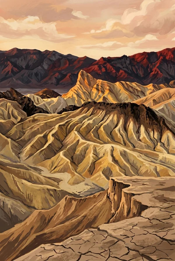
Zabriskie Point
The classic badlands overlook: golden mudstone hills laid down as lakebed sediment millions of years ago, folded and gullied into a landscape with no straight lines in it, with the ridge of Manly Beacon standing up front. Named for a borax company executive. It faces the sunrise, which is when the whole formation turns to gold leaf; it is the most-painted view in the park.
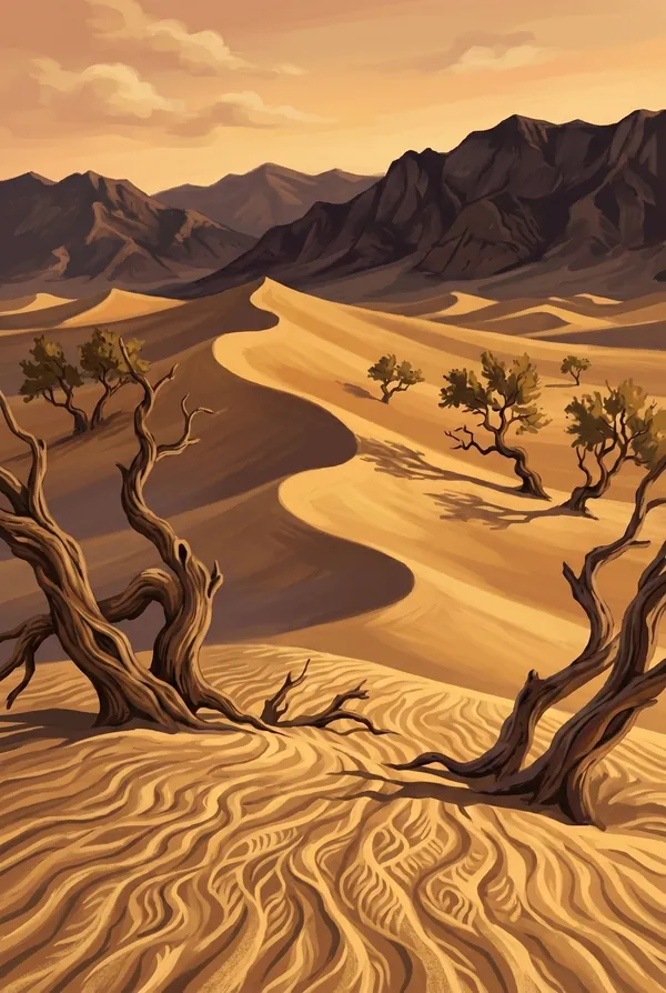
Mesquite Flat Sand Dunes
The dunes everyone pictures when they hear "Death Valley," rising about a hundred feet near Stovepipe Wells, even though dunes cover less than one percent of the park. Dawn is the show: overnight tracks of sidewinders, kit foxes and beetles written across freshly wind-smoothed sand. These dunes also stood in for a galaxy far, far away in the original Star Wars films.
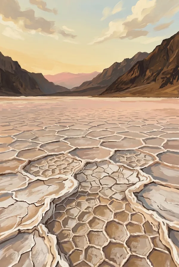
Badwater Basin
The lowest ground in North America, 282 feet below sea level, a white floor of salt polygons that re-crystallize after every rare flood. A sign bolted to the cliff high above marks sea level. The spring-fed pool at the edge (the "bad water" itself) supports an endemic snail, and in exceptional wet years the basin briefly becomes a lake again, a ghost of ice-age Lake Manly.
How to record your Death Valley visit
Free, and it works whether you are standing there now or remembering a trip from years ago.
1
Check In at the park
Open ParkStamp inside the park boundary and check in. The app confirms you are actually there and logs the date.
2
Or Stamp It later
Already been? Pick the date yourself. Trips from decades ago count the same as last weekend.
3
Or scan your photos
Let ParkStamp read the dates and locations off photos already on your phone. Most people find parks they had forgotten.
Death Valley, asked and answered
Quick answers, for people planning a trip and people remembering one.
When is the best time to visit Death Valley?
November through March, when the valley floor runs mild and the light is long and low; this is a winter park. Late February into April brings wildflowers in the years the rains cooperate, occasionally a full superbloom. Summer is the world-record heat the park is named for: sightseeing happens at dawn and from high ground like Dante's View, not on the salt flats at noon.
How many days do you need at Death Valley?
Two days covers the core: Badwater Basin, Artists Drive, Zabriskie Point and the Mesquite Flat dunes make a full first day, sunrise to sunset. Day two goes up, to Dante's View and the Panamint high country, or way out, to the Racetrack or the backcountry, where the driving distances are the real cost. This is the largest park in the Lower 48; the map is the thing to respect.
How busy is Death Valley?
Death Valley National Park logged 1.32 million visits in 2025, the 24th busiest of the 63 national parks. That puts it in the middle of the pack: busy at the famous spots, quiet a mile past them.
What does the Death Valley stamp show?
The lead Death Valley design is Zabriskie Point. The classic badlands overlook: golden mudstone hills laid down as lakebed sediment millions of years ago, folded and gullied into a landscape with no straight lines in it, with the ridge of Manly Beacon standing up front. Named for a borax company executive. It faces the sunrise, which is when the whole formation turns to gold leaf; it is the most-painted view in the park. The other two designs are Mesquite Flat Sand Dunes and Badwater Basin.
Is the Death Valley stamp free?
Recording your Death Valley visit is always free: check in at the park, add an old trip, or let the photo scan find it. The full-color art is the paid part, $3.99 one-time with three Death Valley designs to choose from, and the first stamp you collect in ParkStamp is free.
Can I add a Death Valley trip from years ago?
Yes. Open Death Valley in ParkStamp, tap Stamp It, and set the date yourself; a visit from decades ago counts the same as last weekend. If you still have photos from the trip, the photo scan can find and date it from their location tags, without your photos ever leaving your phone.
Do I have to be at Death Valley to get the stamp?
No. Check In is for when you are standing inside Death Valley, and it confirms you are actually there. Stamp It records any past visit on your honor, with your dates. Both are free and put the same stamp in your StampBook.
Start your StampBook with Death Valley
Free on iOS and Android. Your first stamp is on us.