There are about 25 square miles of active sand dunes in this park, and all of it sits north of the Arctic Circle. No road reaches Kobuk Valley, no trail crosses it, and in most recent years it has recorded the fewest visitors of any national park in the country. People have been coming anyway for nine thousand years, for the caribou.
Kobuk Valley is one of the 63 national parks in ParkStamp, and like all of them it gets its own original stamp art, drawn in the WPA poster tradition. Every design is an illustration of a specific real place. Here that means places most people will only ever reach by bush plane.
Recording a visit costs nothing. Check in from the park itself, log a trip from years back, or let the app pull the dates and locations off photos already sitting on your phone.
The real NPS boundary, with the roads and towns you would actually use to get there.
Kobuk Valley, for people who count parks
A park with no roads, no trails, and a hunting ground older than agriculture.
It arrived in a batch. On December 2, 1980, Jimmy Carter signed the Alaska National Interest Lands Conservation Act, which protected over a hundred million acres of Alaska in a single stroke and roughly doubled the size of the national park system. Kobuk Valley became a national park that day alongside Gates of the Arctic, Lake Clark, Kenai Fjords and Wrangell-St. Elias. No other day in American history created so much parkland, and it is safe to say none ever will again.
There is nothing here that most parks have. No road touches the boundary. There are no trails, no campgrounds, no entrance station, and no visitor center inside the park; the nearest one is in Kotzebue, an Iñupiat town on the coast reachable only by air. Getting in means chartering a small plane, and getting around means walking, floating the Kobuk River, or in winter traveling by snowmachine or dog team. The annual visitor count runs in the low thousands: fewer people in a year than Grand Canyon sees before lunch.
Empty is the wrong word, though. At a bend in the river called Onion Portage, people have been intercepting migrating caribou for roughly nine thousand years. The archaeologist J. Louis Giddings began digging there in the early 1960s and found cultural layers stacked one on top of another, a nearly continuous record of Arctic life that made the site a National Historic Landmark. It is not a ruin. Iñupiat families still hunt the crossing every fall, and the law that created the park explicitly protects that subsistence way of life.
The dunes are ice age leftovers. Glaciers ground the surrounding mountains into sand, meltwater carried it into the valley, and wind piled it into a dune field that once covered a far larger area. Vegetation has since locked most of it down; the Great Kobuk Sand Dunes are the active remnant, about 25 square miles of open sand with ridges up to 100 feet high, sitting incongruously in the middle of the western Arctic.
A quarter-million caribou at the peak counts, and a fish they call the tarpon of the north.
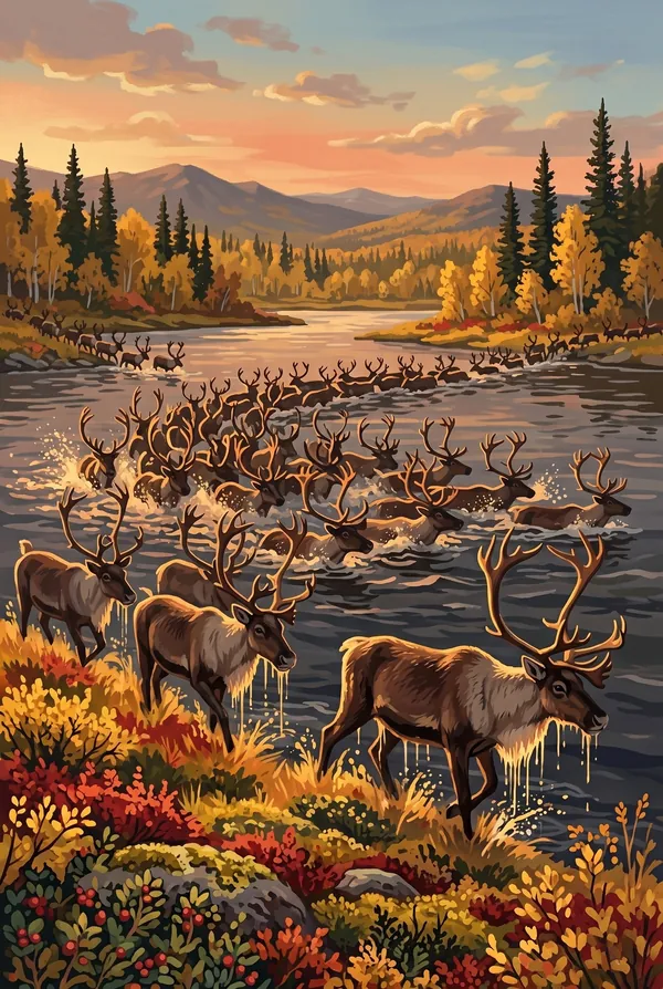
In September, the river fills with swimming caribou. The Western Arctic Herd funnels out of the Brooks Range each fall and crosses the Kobuk at the same fords it has used since before the pyramids, thousands of animals in the water at once. The crossing at Onion Portage is the reason people have stood on that bank for nine thousand years, and it is still the surest spectacle in a park with no crowds to share it with.
Sheefish. The Kobuk River holds an oversized whitefish with an underslung jaw that anglers call the tarpon of the north. The Kobuk fish are among the largest anywhere, regularly topping forty pounds, and they run up the river toward fall spawning gravel near the headwaters. For the villages along the river they have been a staple food for as long as anyone can trace.
One plant grows on these dunes and nowhere else on Earth. The Kobuk locoweed, a small purple-flowered legume, is endemic to the sandy country of the Kobuk valley. It is the kind of species you get when a patch of habitat sits isolated long enough: a desert plant whose entire world range fits inside one Arctic park.
The dunes run hot. On a clear July afternoon the open sand can pass 100 degrees while permafrost sits in the ground a short walk away, and the midnight sun means the heat barely lets up. Walk the dune margins and the sand reads like a ledger: tracks of bears, wolves, moose and caribou crossing between the river and the trees.
The Kobuk Valley designs
Pick the one that matches the park you actually saw.
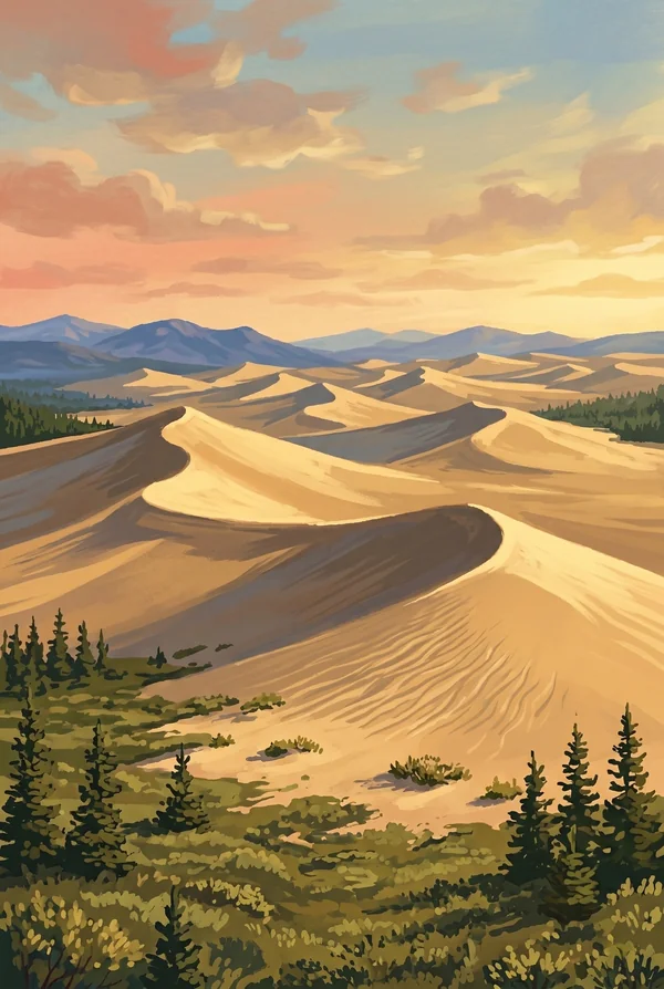
Great Kobuk Sand Dunes
The largest active sand dunes in the Arctic: about 25 square miles of open sand with ridges up to 100 feet high, ground from mountains by ice age glaciers and piled here by wind. Bush planes land directly on the sand, which is how nearly everyone who stands here arrives. Pick it for the sheer unlikeliness of a desert 35 miles north of the Arctic Circle.
Caribou Crossing the Kobuk River
Every September the Western Arctic Herd comes south and swims the river, antlers up, at crossings like Onion Portage that people have hunted for roughly nine thousand years. It is one of the oldest continuously used hunting grounds in North America, and the hunt still happens. This is the stamp for the park's real story, which is movement.
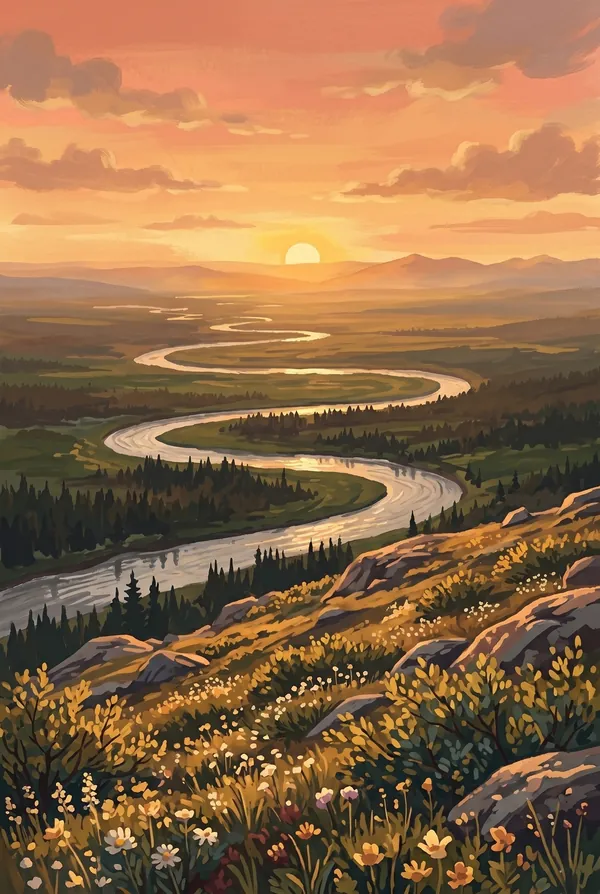
Midnight Sun over Kobuk Valley
The entire park lies above the Arctic Circle, so around the summer solstice the sun does not set for about a month; it just circles, dragging long gold light across the river and the dunes at an hour that would be night anywhere else. The stamp for anyone who wants the Arctic itself on the page.
How to record your Kobuk Valley visit
Free, and it works whether you are standing there now or remembering a trip from years ago.
1
Check In at the park
Open ParkStamp inside the park boundary and check in. The app confirms you are actually there and logs the date.
2
Or Stamp It later
Already been? Pick the date yourself. Trips from decades ago count the same as last weekend.
3
Or scan your photos
Let ParkStamp read the dates and locations off photos already on your phone. Most people find parks they had forgotten.
Kobuk Valley, asked and answered
Quick answers, for people planning a trip and people remembering one.
When is the best time to visit Kobuk Valley?
Late August into early September is the classic window: the tundra turns red and gold, the mosquitoes have collapsed, the caribou begin crossing the Kobuk River at Onion Portage, and the returning night brings a chance of aurora. June and July offer the midnight sun and warm sand on the dunes, at the price of ferocious bugs. Winter is profoundly cold and dark, and travel then is for the experienced or the guided.
How many days do you need at Kobuk Valley?
Most visitors see it in one long day: an air taxi from Kotzebue that lands on the Great Kobuk Sand Dunes, a few hours walking the ridges, and the flight home. The fuller trip is a float: five to seven days paddling the Kobuk River past Onion Portage, camping on gravel bars, with the dunes reached on foot from the bank.
How busy is Kobuk Valley?
Kobuk Valley National Park logged 7,786 visits in 2025, the 63rd busiest of the 63 national parks. That makes it one of the quieter national parks, and crowds are rarely the problem.
What does the Kobuk Valley stamp show?
The lead Kobuk Valley design is Great Kobuk Sand Dunes. The largest active sand dunes in the Arctic: about 25 square miles of open sand with ridges up to 100 feet high, ground from mountains by ice age glaciers and piled here by wind. Bush planes land directly on the sand, which is how nearly everyone who stands here arrives. Pick it for the sheer unlikeliness of a desert 35 miles north of the Arctic Circle. The other two designs are Caribou Crossing the Kobuk River and Midnight Sun over Kobuk Valley.
Is the Kobuk Valley stamp free?
Recording your Kobuk Valley visit is always free: check in at the park, add an old trip, or let the photo scan find it. The full-color art is the paid part, $3.99 one-time with three Kobuk Valley designs to choose from, and the first stamp you collect in ParkStamp is free.
Can I add a Kobuk Valley trip from years ago?
Yes. Open Kobuk Valley in ParkStamp, tap Stamp It, and set the date yourself; a visit from decades ago counts the same as last weekend. If you still have photos from the trip, the photo scan can find and date it from their location tags, without your photos ever leaving your phone.
Do I have to be at Kobuk Valley to get the stamp?
No. Check In is for when you are standing inside Kobuk Valley, and it confirms you are actually there. Stamp It records any past visit on your honor, with your dates. Both are free and put the same stamp in your StampBook.
Start your StampBook with Kobuk Valley
Free on iOS and Android. Your first stamp is on us.