The Gates of the Arctic National Park & Preserve Stamp
No roads reach this park and no trails cross it: 8.4 million acres of the Brooks Range, all of it north of the Arctic Circle. Most years fewer than fifteen thousand people set foot in it, fewer than many parks admit in a single afternoon.
Gates of the Arctic is one of 63 national parks in ParkStamp, and like all of them it carries original stamp designs in the WPA poster tradition. Each design is an illustration of a specific real place, even here, where the places have no signs.
Recording a visit is free. Check in from the tundra if you make it, add an expedition from years back, or let the app pull dates and locations from the photos already on your phone.
The real NPS boundary, with the roads and towns you would actually use to get there.
Gates of the Arctic, for people who count parks
Named from a single view in 1929, and left deliberately without a trail.
The name is one man's field note. In 1929 the forester Bob Marshall traveled up the North Fork of the Koyukuk and found the valley framed by two peaks, which he named Frigid Crags and Boreal Mountain and called, together, the Gates of the Arctic. Marshall wrote the bestseller Arctic Village about the nearby settlement of Wiseman, co-founded The Wilderness Society, and died at 38. The park that took his phrase for its name is arguably his monument.
It arrived in the great Alaska land settlement. After a decade of fighting over the fate of federal Alaska, President Carter protected the area by proclamation in 1978, and the Alaska National Interest Lands Conservation Act of December 2, 1980 made it a national park and preserve: the second largest in the system, around four Yellowstones' worth of mountains, and contiguous with the Noatak country to the west in one of the largest blocks of protected wild land on the continent.
People are part of the design. The Nunamiut, inland Iñupiat whose lives were built around caribou, settled the village of Anaktuvuk Pass in the mountains the park now surrounds; the name translates, with complete Arctic practicality, as "the place of caribou droppings." Subsistence hunting and fishing continue inside the park by law, which is the standing difference between Alaska's parks and almost everywhere else in the system.
The emptiness is the policy, not a budget problem. There are no trails because none were ever built, and none will be; travel is by bush plane, then on foot or by water down one of six designated wild rivers, navigating the way Marshall did. Congress preserved not just the land but the difficulty: this is the park system's working definition of wilderness, kept on purpose.
A caribou nation on the move, and a squirrel that chills below freezing.
The caribou are the engine of the place. The Western Arctic Herd, one of the largest in North America, moves through these mountains twice a year between calving grounds and wintering range: close to half a million animals at its early-2000s peak, though the herd swings by hundreds of thousands over the decades, as caribou herds always have. The migrations thread the same passes the Nunamiut have hunted for generations.
The arctic ground squirrel breaks a rule of mammals. Hibernating in frozen ground, it lets its core body temperature fall below the freezing point of water (the lowest ever measured in a mammal), supercooled without turning to ice, rewarming itself every few weeks by shivering. Grizzlies excavate whole hillsides to eat them.
Nothing is missing. Wolves, wolverines, grizzly and black bears, Dall sheep, moose, lynx, fox: the full cast of predators and prey that occupied this range when humans first arrived is still here, still sorting itself out over an area the size of a small country, with no roads to divide it.
The park straddles the last treeline. Its southern valleys hold boreal spruce forest; cross the crest of the Brooks Range and trees stop entirely, giving way to tundra that runs to the Arctic Ocean. At the limit, a white spruce the thickness of your wrist can be a century or two old, the far edge of trees on this continent, drawn through the middle of one park.
The Gates of the Arctic designs
Pick the one that matches the park you actually saw.
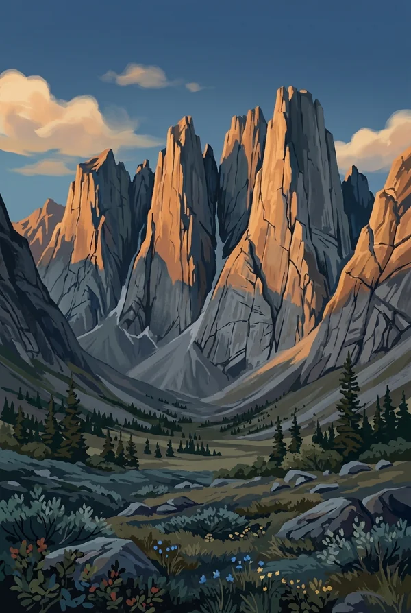
Arrigetch Peaks
A cluster of bare granite spires whose Nunamiut name means, roughly, "fingers of the outstretched hand," which is exactly what they look like rising out of the tundra. The Arrigetch are an intrusion of granite in a range otherwise built of limestone and schist, which is why they alone are sheer. Reaching them takes a bush plane and days of walking; that is much of the appeal.
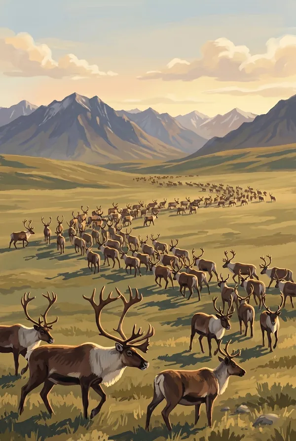
Caribou Migration
The oldest recurring event in the park: lines of caribou from the Western Arctic Herd pouring through the mountain passes in spring and fall, a river of animals crossing a landscape with no fences and no roads for it to interrupt. The Nunamiut built a culture on this movement. Pick it as the stamp for what the park actually protects: motion, at continental scale.
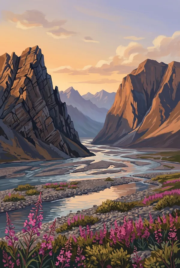
Frigid Crags and Boreal Mountain
The two peaks flanking the North Fork of the Koyukuk that Bob Marshall named in 1929 and called the Gates of the Arctic, the single view that later named 8.4 million acres. Floating or walking the valley between them means passing through the park's front door, in the one place it can be said to have one.
How to record your Gates of the Arctic visit
Free, and it works whether you are standing there now or remembering a trip from years ago.
1
Check In at the park
Open ParkStamp inside the park boundary and check in. The app confirms you are actually there and logs the date.
2
Or Stamp It later
Already been? Pick the date yourself. Trips from decades ago count the same as last weekend.
3
Or scan your photos
Let ParkStamp read the dates and locations off photos already on your phone. Most people find parks they had forgotten.
Gates of the Arctic, asked and answered
Quick answers, for people planning a trip and people remembering one.
When is the best time to visit Gates of the Arctic?
Late June through early September is the whole window this far north. June and July bring round-the-clock daylight, high rivers and the worst of the mosquitoes; the connoisseur's pick is mid-August, when the tundra turns red across whole valleys, the bugs collapse with the first frosts, and the returning night brings aurora over the Brooks Range. By mid-September the passes are catching snow and the bush planes are wrapping up.
How many days do you need at Gates of the Arctic?
This is not a day-trip park. A typical visit is five to ten days: bush plane in from Bettles or Coldfoot, then backpacking the open tundra or floating one of the wild rivers like the Alatna or the North Fork of the Koyukuk. The honest minimum is a flightseeing day over the range, which still shows you more roadless country than most people see in a lifetime.
How busy is Gates of the Arctic?
Gates of the Arctic National Park & Preserve logged 14,923 visits in 2025, the 62nd busiest of the 63 national parks. That makes it one of the quieter national parks, and crowds are rarely the problem.
What does the Gates of the Arctic stamp show?
The lead Gates of the Arctic design is Arrigetch Peaks. A cluster of bare granite spires whose Nunamiut name means, roughly, "fingers of the outstretched hand," which is exactly what they look like rising out of the tundra. The Arrigetch are an intrusion of granite in a range otherwise built of limestone and schist, which is why they alone are sheer. Reaching them takes a bush plane and days of walking; that is much of the appeal. The other two designs are Caribou Migration and Frigid Crags and Boreal Mountain.
Is the Gates of the Arctic stamp free?
Recording your Gates of the Arctic visit is always free: check in at the park, add an old trip, or let the photo scan find it. The full-color art is the paid part, $3.99 one-time with three Gates of the Arctic designs to choose from, and the first stamp you collect in ParkStamp is free.
Can I add a Gates of the Arctic trip from years ago?
Yes. Open Gates of the Arctic in ParkStamp, tap Stamp It, and set the date yourself; a visit from decades ago counts the same as last weekend. If you still have photos from the trip, the photo scan can find and date it from their location tags, without your photos ever leaving your phone.
Do I have to be at Gates of the Arctic to get the stamp?
No. Check In is for when you are standing inside Gates of the Arctic, and it confirms you are actually there. Stamp It records any past visit on your honor, with your dates. Both are free and put the same stamp in your StampBook.
Start your StampBook with Gates of the Arctic
Free on iOS and Android. Your first stamp is on us.