This is the park where the ice age is still running. The Harding Icefield covers about 700 square miles of the Kenai Mountains and feeds nearly forty glaciers, while the coastline below is slowly being dragged under the sea by plate tectonics. The fjords are what you get where the two processes meet.
Kenai Fjords is one of the 63 national parks in ParkStamp, and every park gets original stamp designs in the WPA poster tradition, each one an illustration of a specific real place, whether you reach it by trail or by boat.
Keeping the record is free. Check in at the park, log an old trip after the fact, or let the app read dates and locations from the photos your phone already holds.
The real NPS boundary, with the roads and towns you would actually use to get there.
Kenai Fjords, for people who count parks
An icefield named for a doomed president, and a coast that is sinking on purpose.
The icefield came first, in every sense. The Harding Icefield is a remnant of the Pleistocene ice sheets, roughly 700 square miles of ice burying the crest of the Kenai Mountains so completely that only scattered peaks, the nunataks or "lone peaks," break the surface. Storms off the Gulf of Alaska rebuild it with snowfall measured in tens of feet a year, and close to forty glaciers drain it in every direction. It is named for Warren Harding, who in 1923 became the first sitting president to visit Alaska and was dead within weeks, on the journey home.
The fjords are drowned valleys, and the drowning is ongoing. Offshore, the Pacific plate is diving beneath Alaska, and it drags the edge of the Kenai Mountains down with it, so glaciers carve the valleys and the subsiding coast hands them to the ocean. The 1964 earthquake, the strongest ever recorded in North America, dropped parts of this shoreline several feet in a few minutes. The park is, in the most literal sense, mountains going under.
Protection came late and fast. The area became a national monument in 1978 and, on December 2, 1980, Kenai Fjords National Park under the Alaska National Interest Lands Conservation Act, one of the sweep of Alaska parks created that day. It is among the smaller Alaska parks and the most reachable: the town of Seward sits at its doorstep, one road leads to one glacier, and everything else is boat, floatplane or foot.
Exit Glacier is named for a way out. When a mountaineering party made the first recorded crossing of the Harding Icefield in 1968, this glacier was their descent route off the ice: their exit. It has since become the park's front door instead, the one glacier you can walk to, with markers along the way showing where the ice stood in years past. The walk in is a walk through its retreat, which the park makes no attempt to soften.
A thin green strip between the ice and one of the richest coastlines anywhere.
The ocean does the heavy lifting. Upwelling and glacial melt keep the fjords thick with plankton and forage fish, and the food web stacks up from there: humpback whales lunge-feeding in the bays, orcas, Dall's porpoises, sea otters rafting in the kelp, and harbor seals hauled out by the hundred on iceberg fragments in front of the tidewater glaciers, where the floating ice makes a nursery safe from most predators.
Steller sea lions are the loud ones. The largest of the sea lions (a big male runs to a ton), they pack the rocky haul-outs near the park in roaring, shoving crowds. They are named for Georg Steller, the naturalist on Bering's 1741 voyage, and their western population collapsed by roughly 80 percent in the late twentieth century for reasons scientists still argue about, which makes the crowded rocks both a spectacle and a relief.
The bird cliffs run on the same riches. Horned and tufted puffins, kittiwakes, murres and cormorants nest by the thousand on the islands and headlands along the fjords each summer, commuting between bare rock and fish-filled water. From a boat the colonies read as static; through binoculars they are rush hour.
On land, the timeline is visible. Ground abandoned by retreating ice goes from bare rock to alder and cottonwood to spruce in a walkable sequence, and mountain goats and black bears work the slopes around Exit Glacier. Ecologists call it succession; here you can see every stage at once, dated by how long the ground has been out from under the ice.
The Kenai Fjords designs
Pick the one that matches the park you actually saw.
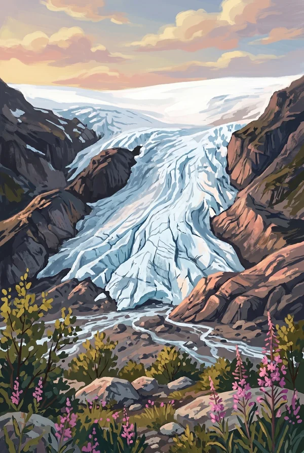
Exit Glacier
The park's one road-accessible glacier, pouring off the Harding Icefield above Seward. Markers along the approach show where the ice stood in decades past, so the short walk to the face doubles as a record of retreat. The trail beside it climbs to the icefield rim, one of the great hard day-hikes in Alaska, which is reason enough for some people to make this their stamp.
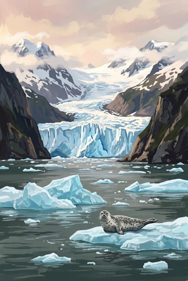
Aialik Bay Tidewater Glacier
A wall of blue ice meeting the sea at the head of Aialik Bay, calving with cracks like artillery while harbor seals ride the floating fragments. Tidewater glaciers are the park's signature act, the icefield delivering ice straight to the ocean, and waiting quietly in a boat for the next collapse is the standard Kenai Fjords memory.
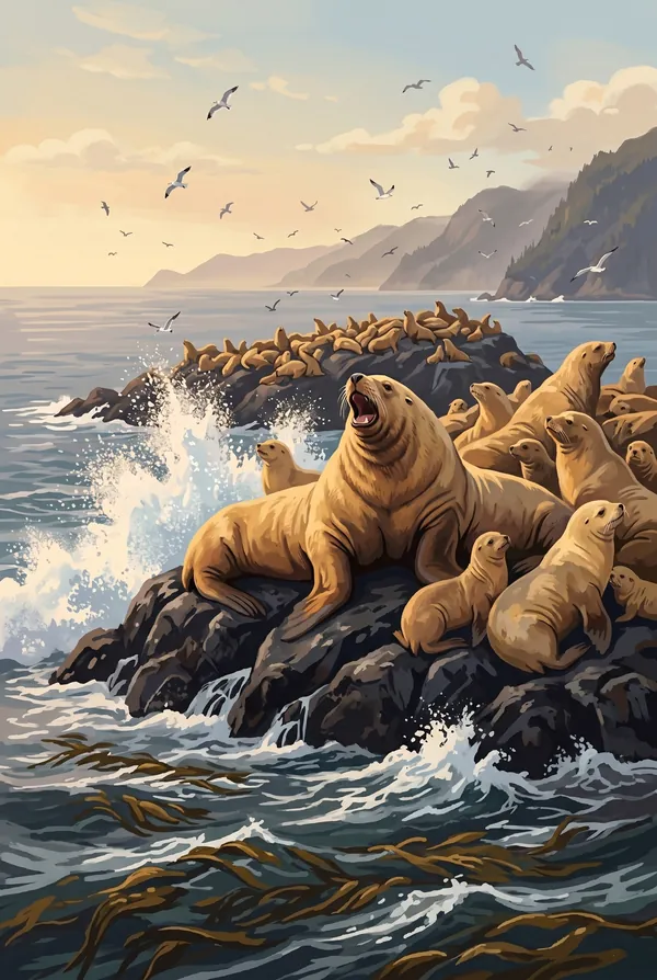
Steller Sea Lions on Rocky Haul-Out
The largest sea lions in the world stacked on bare rock in the fjords, males the size of small cars roaring over territory while swells break below. Their western population fell by most of its numbers within living memory, so a crowded haul-out is good news you can hear from half a mile off. A stamp for people who rank wildlife over scenery.
How to record your Kenai Fjords visit
Free, and it works whether you are standing there now or remembering a trip from years ago.
1
Check In at the park
Open ParkStamp inside the park boundary and check in. The app confirms you are actually there and logs the date.
2
Or Stamp It later
Already been? Pick the date yourself. Trips from decades ago count the same as last weekend.
3
Or scan your photos
Let ParkStamp read the dates and locations off photos already on your phone. Most people find parks they had forgotten.
Kenai Fjords, asked and answered
Quick answers, for people planning a trip and people remembering one.
When is the best time to visit Kenai Fjords?
June through August, when the fjord boat tours run daily, humpbacks are feeding in the bays, and the seabird colonies are packed. Late June through early September also gives the best odds of a snow-free climb beside Exit Glacier toward the icefield rim. May and September are quieter and moodier, with rougher water on the Gulf. Expect rain in any month; the icefield's snowfall has to come from somewhere.
How many days do you need at Kenai Fjords?
Two days covers the park's two halves: one on a boat deep into Aialik Bay or the outer fjords for the tidewater glaciers, whales and sea lions, and one on land at Exit Glacier: either the easy walks near the face or the long, steep day up the Harding Icefield Trail, which climbs roughly 3,500 feet to a view of ice past the horizon.
How busy is Kenai Fjords?
Kenai Fjords National Park logged 425,369 visits in 2025, the 45th busiest of the 63 national parks. That makes it one of the quieter national parks, and crowds are rarely the problem.
What does the Kenai Fjords stamp show?
The lead Kenai Fjords design is Exit Glacier. The park's one road-accessible glacier, pouring off the Harding Icefield above Seward. Markers along the approach show where the ice stood in decades past, so the short walk to the face doubles as a record of retreat. The trail beside it climbs to the icefield rim, one of the great hard day-hikes in Alaska, which is reason enough for some people to make this their stamp. The other two designs are Aialik Bay Tidewater Glacier and Steller Sea Lions on Rocky Haul-Out.
Is the Kenai Fjords stamp free?
Recording your Kenai Fjords visit is always free: check in at the park, add an old trip, or let the photo scan find it. The full-color art is the paid part, $3.99 one-time with three Kenai Fjords designs to choose from, and the first stamp you collect in ParkStamp is free.
Can I add a Kenai Fjords trip from years ago?
Yes. Open Kenai Fjords in ParkStamp, tap Stamp It, and set the date yourself; a visit from decades ago counts the same as last weekend. If you still have photos from the trip, the photo scan can find and date it from their location tags, without your photos ever leaving your phone.
Do I have to be at Kenai Fjords to get the stamp?
No. Check In is for when you are standing inside Kenai Fjords, and it confirms you are actually there. Stamp It records any past visit on your honor, with your dates. Both are free and put the same stamp in your StampBook.
Start your StampBook with Kenai Fjords
Free on iOS and Android. Your first stamp is on us.