A wilderness island in Lake Superior that belongs to Michigan but sits closer to Canada, with no roads, no cars and no bridge. It is one of the least visited national parks in the country, and the site of the longest-running predator-prey study in the world, which has been watching the same wolves and moose since 1958.
Isle Royale is one of 63 national parks in ParkStamp. Every park in the app carries original stamp designs drawn in the WPA poster tradition, and each one illustrates a specific real place, somewhere you can actually stand.
Logging the visit is free. Check in on the island, add a crossing you made years back, or let the app work out dates and locations from the photos sitting on your phone.
The real NPS boundary, with the roads and towns you would actually use to get there.
Isle Royale, for people who count parks
Forty-five miles of island, four thousand years of copper, and a boat ride either way.
People have been coming here for the metal far longer than for the wilderness. Isle Royale carries some of the purest native copper on the continent, and Indigenous miners were hammering it out of pits on the island roughly 4,500 years ago, trading it across a large part of North America. Nineteenth-century mining companies tried three separate booms on the same deposits and gave up each time; the pits from both eras are still there under the moss.
The park took a decade to assemble. Congress authorized it on March 3, 1931, and then came nine years of buying out landholdings, fishing camps and resort operations on a remote island in the middle of the Depression. Isle Royale National Park was formally established on April 3, 1940. In 1976 nearly all of it, about 99 percent of the land, was designated wilderness, which made official what the lake had already enforced.
The lake is the fact that governs everything else. The island is about 45 miles long and 9 miles wide, ringed by some 400 smaller islands, and reachable only by boat or floatplane across water that can turn dangerous in an afternoon. There is no winter season to speak of; the crossings stop in the fall and the island sits empty under the snow until spring. The visitors who do come stay for days rather than hours, which makes Isle Royale near the bottom of the park system in headcount and near the top in time actually spent.
One piece of trivia is too good to skip. Siskiwit Lake is the largest lake on the island, and it has islands of its own. Ryan Island, the biggest of them, is the largest island in the largest lake on the largest island in the largest freshwater lake in the world by area. There is no prize for going. People go anyway.
Two big mammals, one small gene pool, and the longest ecological experiment on Earth.
The whole large-mammal cast arrived recently, and on its own. Moose showed up around the early 1900s, most likely by swimming; wolves crossed an ice bridge from the mainland in the late 1940s. There are no bears and no deer. That accidental simplicity, one big predator and one big prey animal on an island neither can easily leave, is why scientists have been counting both species every year since 1958, the longest continuous study of a predator and its prey anywhere in the world.
The study's biggest lesson has been humility. Sixty-plus years of data show the two populations never settling into the tidy balance textbooks once predicted: disease, hard winters, ticks and accident keep rewriting the graph. The starkest chapter was genetic. As warming winters made ice bridges rare, no new wolves arrived, inbreeding compounded, and by the late 2010s the population was down to two closely related animals. Beginning in 2018 the Park Service flew in wolves from the mainland to rebuild the population, a rare, deliberate intervention in a wilderness managed mostly by leaving it alone.
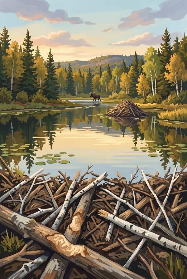
Beavers run the interior. Their dams turn the island's creases into ponds and meadows, which feed the moose, which feed the wolves; the aerial surveys count beaver lodges along with everything else. Moose wade in deep to eat aquatic plants, which are rich in the sodium their winter browse lacks. The standing-in-a-pond moose photograph is the animal doing chemistry, not posing.
Around all of it, Lake Superior. The water stays cold enough year-round to keep the island cool, foggy and slow to warm, and loons, otters and lake trout do well in it. The shipwrecks ringing the island are part of the park too, preserved by the same cold that shapes everything living here.
The Isle Royale designs
Pick the one that matches the park you actually saw.
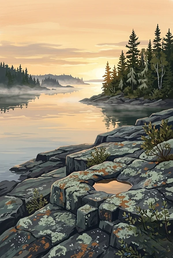
Rock Harbor
The sheltered channel at the island's northeast end where most visits begin, a long lane of water guarded from Lake Superior by a screen of barrier islands. Boats and floatplanes come and go, and the shoreline trail toward Scoville Point is many people's first hour of the park. For anyone who has made the crossing, this is the image of arrival.
Beaver Pond
The interior of the island in one scene: a dammed pond, standing dead timber, and the good odds of a moose in the shallows eating sodium-rich aquatic plants. Beaver engineering builds the wetlands that feed the moose that feed the wolves, so this quiet kind of place is the actual machinery of the famous study.
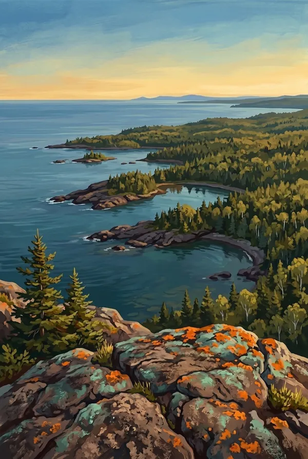
Lookout Louise
A short, steep climb from Tobin Harbor past Hidden Lake to one of the best views on the island: the ridgelines dropping away into the fingered channels and scattered islands of the northeast archipelago, with Canada on the horizon. It earns its reputation as the finest overlook on Isle Royale, and most visitors never stand there.
How to record your Isle Royale visit
Free, and it works whether you are standing there now or remembering a trip from years ago.
1
Check In at the park
Open ParkStamp inside the park boundary and check in. The app confirms you are actually there and logs the date.
2
Or Stamp It later
Already been? Pick the date yourself. Trips from decades ago count the same as last weekend.
3
Or scan your photos
Let ParkStamp read the dates and locations off photos already on your phone. Most people find parks they had forgotten.
Isle Royale, asked and answered
Quick answers, for people planning a trip and people remembering one.
When is the best time to visit Isle Royale?
July and August, when Lake Superior is at its calmest, the crossings are most reliable, and the thimbleberries ripen along the trails. Early summer means wildflowers, moose calves and serious blackflies; late August into September trades warmth for quiet water, fall color starting on the ridges, and the best odds of hearing wolves. There is no winter visiting to plan around; the island empties when the lake turns.
How many days do you need at Isle Royale?
Plan in days, not hours; the crossing alone takes a good chunk of one. Three or four days lets you base at Rock Harbor, climb to Lookout Louise, and paddle or hike the northeast shore. Walking the Greenstone Ridge end to end takes most of a week. Isle Royale visitors stay longer than any other park's, and the boat schedule is why.
How busy is Isle Royale?
Isle Royale National Park logged 29,091 visits in 2025, the 60th busiest of the 63 national parks. That makes it one of the quieter national parks, and crowds are rarely the problem.
What does the Isle Royale stamp show?
The lead Isle Royale design is Rock Harbor. The sheltered channel at the island's northeast end where most visits begin, a long lane of water guarded from Lake Superior by a screen of barrier islands. Boats and floatplanes come and go, and the shoreline trail toward Scoville Point is many people's first hour of the park. For anyone who has made the crossing, this is the image of arrival. The other two designs are Beaver Pond and Lookout Louise.
Is the Isle Royale stamp free?
Recording your Isle Royale visit is always free: check in at the park, add an old trip, or let the photo scan find it. The full-color art is the paid part, $3.99 one-time with three Isle Royale designs to choose from, and the first stamp you collect in ParkStamp is free.
Can I add a Isle Royale trip from years ago?
Yes. Open Isle Royale in ParkStamp, tap Stamp It, and set the date yourself; a visit from decades ago counts the same as last weekend. If you still have photos from the trip, the photo scan can find and date it from their location tags, without your photos ever leaving your phone.
Do I have to be at Isle Royale to get the stamp?
No. Check In is for when you are standing inside Isle Royale, and it confirms you are actually there. Stamp It records any past visit on your honor, with your dates. Both are free and put the same stamp in your StampBook.
Start your StampBook with Isle Royale
Free on iOS and Android. Your first stamp is on us.