Acadia was donated, not purchased. And the postcards are wrong about the sunrise, though not as wrong as you might think.
Acadia is one of 63 national parks in ParkStamp, and like every park it has original stamp designs drawn in the WPA poster tradition. Each one is an illustration of a specific place you can go stand.
Recording the visit is free. Check in at the park, add a trip from years ago, or let the app read the dates off photos already on your phone.
The real NPS boundary, with the roads and towns you would actually use to get there.
Acadia, for people who count parks
Three names, one anglophile family, and 45 miles of road built to keep cars out.
It has had three names. Sieur de Monts National Monument on July 8, 1916. Lafayette National Park on February 26, 1919. Acadia National Park on January 19, 1929. If you see a list saying Acadia was established in 1919, that list is technically naming a park that was called something else at the time.
February 26, 1919 was a double. Congress established Lafayette and the Grand Canyon on the same day, which is why the two of them trade places on every "which came first" list ever published.
The 1929 rename came down to two sisters. A financier named John Godfrey Moore had bought over 2,000 acres on the Schoodic Peninsula. After his death his daughters were willing to donate it, roughly five percent of the eventual park, but they were anglophiles and refused to attach their gift to a park named for a French hero. George Dorr got the name dropped, and Schoodic came in.
Nobody appropriated money for this park. It was assembled from donated private land. The Hancock County Trustees of Public Reservations, founded in 1901 by Harvard's president emeritus Charles W. Eliot, gathered the parcels. Dorr, called the father of Acadia, spent his own inheritance buying land until it ran out in the early 1930s. He served as superintendent until he died in 1944 at 90, and took a salary of one dollar a month for the first years.
Rockefeller built 45 miles of road so cars could not use them. Motor vehicles were authorized across Mount Desert Island in 1915, and John D. Rockefeller Jr., an accomplished horseman, responded by laying out a carriage network on the eastern half of the island where they would never go. Built 1913 to 1940, sixteen feet wide, three graded layers of broken stone over a crowned bed engineered for Maine rain, seventeen individually designed stone bridges, and the big irregular granite coping stones along the edges that everyone calls Rockefeller's teeth. Cars have been banned from them since the first day and still are.
About the sunrise. Cadillac Mountain is the first place in the continental US to see the sun for part of the year, roughly October into early March. For most of the rest of the year it is Mars Hill or West Quoddy Head, further up the Maine coast. The year-round claim on the postcards is not correct. Cadillac is 1,530 feet, the highest point within 25 miles of the Atlantic shore between Nova Scotia and Mexico.
A falcon that came back after 35 years, and a shoreline that is part of the park.
Peregrine falcons, gone for a generation. The last known nesting pair in Acadia was recorded in 1956. By the mid-1960s DDT had stopped peregrines breeding across the entire eastern United States. The park joined the reintroduction program in 1984 and released 22 chicks from a cliff above Jordan Pond over three years. The first successful nest came in 1991, a 35-year gap. Since then the park has produced more than 160 chicks. Three pairs nested in 2024. The Precipice, Jordan Cliffs and Valley Cove trails close every spring for them, and going in anyway is a federal offense.
The tidepools, which most national parks do not have. Acadia protects a working rocky intertidal shoreline: blue mussels, periwinkles, barnacles, hermit crabs, green crabs, sea stars, green sea urchins and small anemones, all living in a zone that floods and drains twice a day. The window is an hour and a half either side of low tide.
338 bird species recorded, which is why the Park Service calls this one of the premier birding areas in the country. The park runs a Hawk Watch on the Cadillac North Ridge Trail in fall where visitors help count migrating raptors.
Harbor and gray seals offshore, pupping in late spring. Harbor seals have dog-like heads with V-shaped nostrils; gray seals have horse-like heads with parallel ones. Whales are a boat trip, not a shoreline sighting, whatever the brochures suggest.
The Acadia designs
Pick the one that matches the park you actually saw.
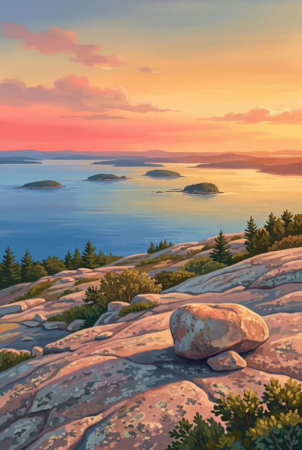
Cadillac Mountain
A bare pink granite dome, 1,530 feet, the highest point on Mount Desert Island and within 25 miles of the Atlantic between Nova Scotia and Mexico. It was called Green Mountain until 1918. The summit road is metered in peak season and the sunrise slots go fast, even though the first-in-America claim only holds for part of the year; check nps.gov before you plan a dawn drive.
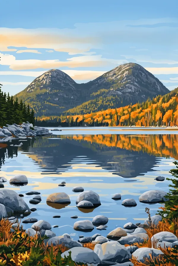
Jordan Pond
A glacial tarn, 187 acres and 150 feet deep, with water clear enough to see 44 feet down and occasionally 61, the clearest measurements in Maine. It is Seal Harbor's drinking water, so no swimming and no wading. The Bubbles frame the view from the south end, and a boulder of a completely different granite sits perched on the edge of South Bubble, carried 19 miles by ice and left there. The tea house on the lawn has been serving popovers since the 1890s.
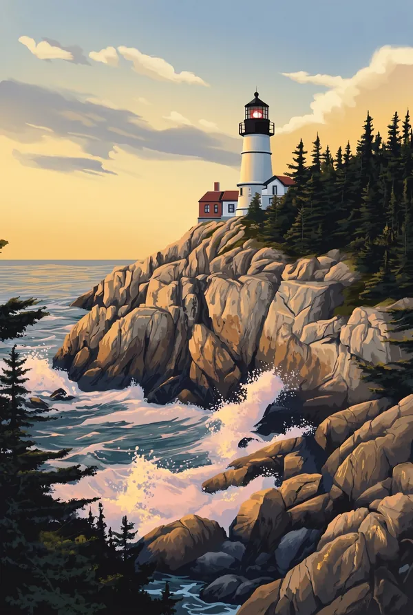
Bass Harbor Head Light
On the southwestern tip of the island, on a granite headland, and probably the most photographed lighthouse in Maine. Congress authorized it in 1858. It still carries the fourth-order Fresnel lens installed in 1902 and it still shows a red light. The Park Service took ownership of the station in July 2020, but the Coast Guard still runs the light, because it is a working aid to navigation and not a monument.
How to record your Acadia visit
Free, and it works whether you are standing there now or remembering a trip from years ago.
1
Check In at the park
Open ParkStamp inside the park boundary and check in. The app confirms you are actually there and logs the date.
2
Or Stamp It later
Already been? Pick the date yourself. Trips from decades ago count the same as last weekend.
3
Or scan your photos
Let ParkStamp read the dates and locations off photos already on your phone. Most people find parks they had forgotten.
Acadia, asked and answered
Quick answers, for people planning a trip and people remembering one.
When is the best time to visit Acadia?
September into mid-October: summer's crowds thin, the Atlantic is as warm as it gets, and fall color over pink granite is the postcard Maine actually sells. High summer is fine and full. Winter is honest North Atlantic weather, wind-scoured, mostly empty, and stranger and lovelier than the season gets credit for.
How many days do you need at Acadia?
Two days: one for the Park Loop Road, Sand Beach, Thunder Hole, and Cadillac Mountain, one for the carriage roads or the quiet western half of the island. Add a boat trip if you can. The park was assembled by people who arrived by water, and it still makes the most sense from it.
How busy is Acadia?
Acadia National Park logged 4.08 million visits in 2025, the 7th busiest of the 63 national parks. That makes it one of the busiest parks in the system, and early mornings are the quiet hours.
What does the Acadia stamp show?
The lead Acadia design is Cadillac Mountain. A bare pink granite dome, 1,530 feet, the highest point on Mount Desert Island and within 25 miles of the Atlantic between Nova Scotia and Mexico. It was called Green Mountain until 1918. The summit road is metered in peak season and the sunrise slots go fast, even though the first-in-America claim only holds for part of the year; check nps.gov before you plan a dawn drive. The other two designs are Jordan Pond and Bass Harbor Head Light.
Is the Acadia stamp free?
Recording your Acadia visit is always free: check in at the park, add an old trip, or let the photo scan find it. The full-color art is the paid part, $3.99 one-time with three Acadia designs to choose from, and the first stamp you collect in ParkStamp is free.
Can I add a Acadia trip from years ago?
Yes. Open Acadia in ParkStamp, tap Stamp It, and set the date yourself; a visit from decades ago counts the same as last weekend. If you still have photos from the trip, the photo scan can find and date it from their location tags, without your photos ever leaving your phone.
Do I have to be at Acadia to get the stamp?
No. Check In is for when you are standing inside Acadia, and it confirms you are actually there. Stamp It records any past visit on your honor, with your dates. Both are free and put the same stamp in your StampBook.
Start your StampBook with Acadia
Free on iOS and Android. Your first stamp is on us.