The river this park is named for caught fire in 1969, and the embarrassment helped produce the Clean Water Act and the EPA. Thirty-one years later the valley upstream became Ohio's only national park, the only one in the system that started life as a national recreation area.
Cuyahoga Valley is one of 63 national parks in ParkStamp, and every park in the app gets original stamp designs drawn in the WPA poster tradition. Each one illustrates a specific real place inside the park, somewhere you can actually go stand.
Recording your visit costs nothing. Check in while you're in the valley, log a trip from years back, or let the app pull the dates and places off photos already sitting on your phone.
The real NPS boundary, with the roads and towns you would actually use to get there.
Cuyahoga Valley, for people who count parks
A burning river, an 1827 canal, and a park invented to keep two cities apart.
The river burned, repeatedly. The Cuyahoga caught fire at least a dozen times between the 1860s and 1969, its surface so thick with oil and industrial waste that a spark from a passing train could set it alight. The famous June 1969 fire in Cleveland was actually one of the smaller ones: it was out in under half an hour, no photograph of it exists, and Time magazine illustrated the story with a picture of the much worse 1952 fire. It hit a nerve anyway. The burning river became shorthand for what America had done to its water, and it helped push through the Clean Water Act and the creation of the EPA.
Before the fires, the canal. The Ohio & Erie Canal opened through this valley in 1827 and turned Ohio from frontier into economy, hauling wheat and whiskey between Lake Erie and the interior until railroads finished it off and a 1913 flood buried it for good. The old towpath, where mules once dragged the boats, is now the Towpath Trail, the spine of the park. You can still walk past watered stretches of the original channel and a working lock.
The park exists because two cities were growing toward each other. By the 1960s the rural valley between Cleveland and Akron was the obvious place for both to sprawl, and locals wanted it kept green. Congressman John Seiberling, an Akron native, pushed the bill through, and President Ford signed the Cuyahoga Valley National Recreation Area into law on December 27, 1974, over the objections of a Park Service that did not think a valley with roads, towns and a burned river in it was park material.
The upgrade came in a spending bill. On October 11, 2000 the recreation area was redesignated Cuyahoga Valley National Park, quietly, in an appropriations act. Nothing on the ground changed. What has changed since is the crowd: the park now logs around three million visits a year, putting it among the dozen busiest in the system (more than most of the famous western names), because 60 million people live within a day's drive and the valley sits directly between two of their cities.
A recovery measured in eagles, beavers and fish that came back.
Bald eagles, on a river that burned within living memory. In 2006 a pair built a nest in the Pinery Narrows, the first recorded in Cuyahoga County in more than 70 years. That first nest failed. The birds came back, and in 2007 they fledged an eaglet, the same summer the bald eagle came off the federal endangered species list. Eagles eat fish, so an eagle nest over the Cuyahoga is really a statement about the water.
Beaver Marsh used to be a junkyard. Beavers were trapped out of Ohio in the 1800s and only worked their way back into the valley in the decades before the park matured. When volunteers hauled an auto salvage yard out of the old canal bed near Ira, returning beavers dammed what was left, and the flooded wreck of the canal turned into the richest wildlife site in the park: otters, herons, turtles stacked on logs, all watched from a boardwalk across the open water.
The fish are the real census. Stretches of the lower Cuyahoga were once close to lifeless; surveys in the recovered river now turn up dozens of species, including steelhead trout, and great blue herons, absent for decades, returned to build rookeries of stick nests in the sycamores along the water. For a park whose founding story is pollution, the wildlife list is the scoreboard.
The Cuyahoga Valley designs
Pick the one that matches the park you actually saw.
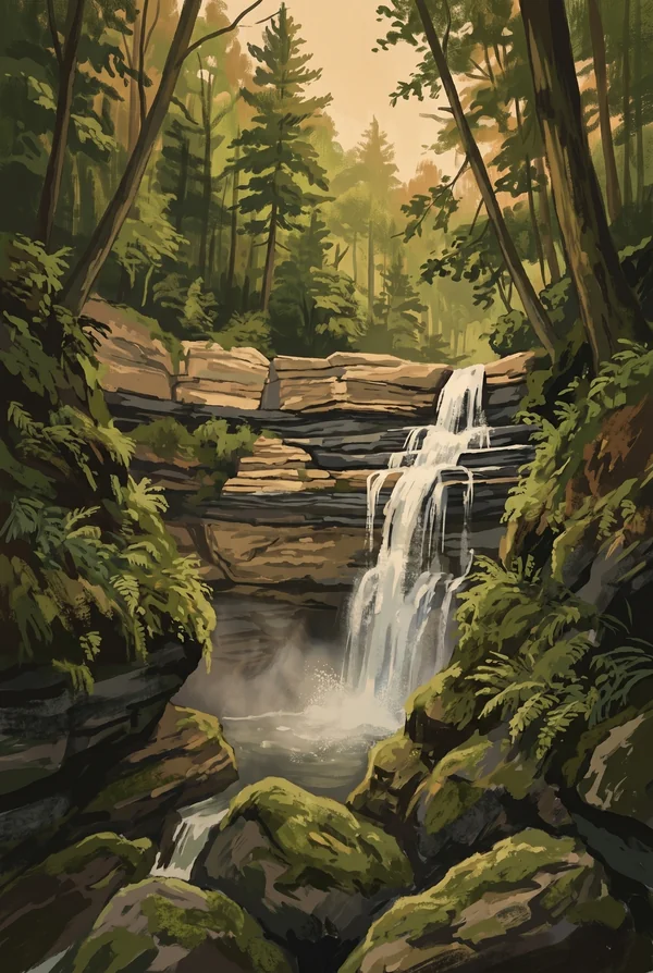
Brandywine Falls
A 60-foot bridal-veil waterfall, the park's signature image: a hard sandstone lip over soft shale that erodes out from underneath, so the water slides down a staircase of ledges instead of free-falling. A village of mills grew at its brink in the early 1800s and vanished; the boardwalk now descends into the gorge to put you at eye level with the falls.
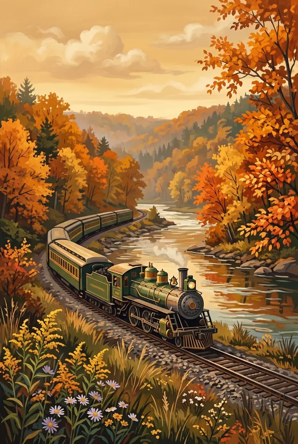
Scenic Railroad
One of the few national parks with a working railroad running through the middle of it. The excursion train follows the Valley Railway line, built in 1880 to haul coal from the Tuscarawas Valley to Cleveland, and rolls beside the river and the Towpath Trail the length of the park. Pick it for the anachronism: a coal-era railroad reborn as the calmest way through a national park.
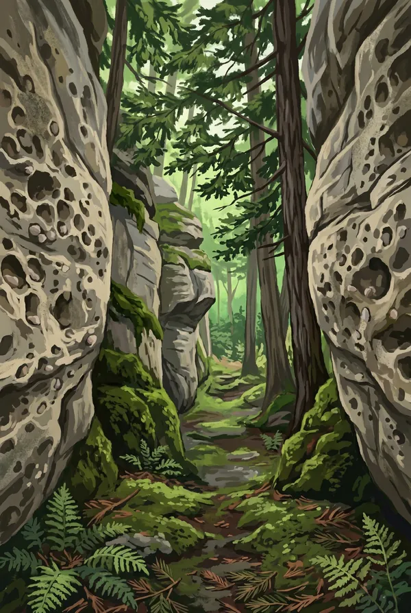
The Ledges
Cliffs of Sharon Conglomerate, sandstone studded with white quartz pebbles laid down by rivers around 320 million years ago, split into mossy corridors and cool crevices that shelter hemlocks well south of their usual range. The west-facing overlook at the top is the park's established sunset spot, a bare rock shelf looking out over an unbroken roll of forest.
How to record your Cuyahoga Valley visit
Free, and it works whether you are standing there now or remembering a trip from years ago.
1
Check In at the park
Open ParkStamp inside the park boundary and check in. The app confirms you are actually there and logs the date.
2
Or Stamp It later
Already been? Pick the date yourself. Trips from decades ago count the same as last weekend.
3
Or scan your photos
Let ParkStamp read the dates and locations off photos already on your phone. Most people find parks they had forgotten.
Cuyahoga Valley, asked and answered
Quick answers, for people planning a trip and people remembering one.
When is the best time to visit Cuyahoga Valley?
Mid-to-late October, if you can pick one window: the valley is an unbroken hardwood forest and turns all at once. Spring runs the waterfalls hardest, with Brandywine and Blue Hen at full volume in March and April. Summer is green, humid and busiest on the Towpath; deep winter freezes Brandywine Falls into a column of ice worth the cold walk.
How many days do you need at Cuyahoga Valley?
One full day covers the essentials: Brandywine Falls, the Ledges, a stretch of the Towpath Trail and Beaver Marsh toward dusk, when the otters and beavers actually show up. A second day adds the scenic railroad, the Everett Covered Bridge and more towpath miles; this is a park built for repeat visits more than long expeditions.
How busy is Cuyahoga Valley?
Cuyahoga Valley National Park logged 3.03 million visits in 2025, the 11th busiest of the 63 national parks. That puts it in the middle of the pack: busy at the famous spots, quiet a mile past them.
What does the Cuyahoga Valley stamp show?
The lead Cuyahoga Valley design is Brandywine Falls. A 60-foot bridal-veil waterfall, the park's signature image: a hard sandstone lip over soft shale that erodes out from underneath, so the water slides down a staircase of ledges instead of free-falling. A village of mills grew at its brink in the early 1800s and vanished; the boardwalk now descends into the gorge to put you at eye level with the falls. The other two designs are Scenic Railroad and The Ledges.
Is the Cuyahoga Valley stamp free?
Recording your Cuyahoga Valley visit is always free: check in at the park, add an old trip, or let the photo scan find it. The full-color art is the paid part, $3.99 one-time with three Cuyahoga Valley designs to choose from, and the first stamp you collect in ParkStamp is free.
Can I add a Cuyahoga Valley trip from years ago?
Yes. Open Cuyahoga Valley in ParkStamp, tap Stamp It, and set the date yourself; a visit from decades ago counts the same as last weekend. If you still have photos from the trip, the photo scan can find and date it from their location tags, without your photos ever leaving your phone.
Do I have to be at Cuyahoga Valley to get the stamp?
No. Check In is for when you are standing inside Cuyahoga Valley, and it confirms you are actually there. Stamp It records any past visit on your honor, with your dates. Both are free and put the same stamp in your StampBook.
Start your StampBook with Cuyahoga Valley
Free on iOS and Android. Your first stamp is on us.