Congaree is not a swamp, whatever the old name said. It is a river floodplain that goes underwater about ten times a year, and those floods built the largest old-growth bottomland hardwood forest left in the American Southeast. The trees are champions, literally: this forest holds one of the densest collections of national champion trees anywhere.
Congaree is one of 63 national parks in ParkStamp, and like the rest it has original stamp designs in the WPA poster tradition, each one an illustration of a particular real place inside the park.
The record-keeping is free. Check in under the canopy, add a visit from years back, or let the app read dates and locations out of the photos your phone already holds.
The real NPS boundary, with the roads and towns you would actually use to get there.
Congaree, for people who count parks
Saved first by mud, then by a newspaperman.
The floods are the whole story. When the Congaree and Wateree rivers rise, a sheet of water spreads across the floodplain and drops its load of nutrient-rich sediment, roughly ten times a year in most years. That subsidy is why the trees here grow so tall: the canopy averages far higher than a typical eastern forest, with loblolly pines pushing past 160 feet, and the park holds one of the highest concentrations of champion trees in North America. Naturalists have compared its structure to that of far more famous forests out west.
The mud saved it first. A Chicago lumberman, Francis Beidler, bought vast tracts of this bottomland in the late 1800s, but logging ground that flooded ten times a year proved barely workable, and after about a decade the operation stopped. The land then simply sat in family hands for half a century, uncut not out of principle but out of economics, which is how an old-growth forest survived within twenty miles of a state capital.
Then it needed saving on purpose. Harry Hampton, an editor at The State newspaper in Columbia, spent the 1950s and 60s arguing in print that the Beidler tract was nationally significant and ought to be preserved. When rising timber prices made logging attractive again in the 1970s, a grassroots campaign took up his cause, and Congress created Congaree Swamp National Monument in 1976, buying out the timber rights.
The name got fixed in 2003. On November 10, 2003, the monument became Congaree National Park and the word "Swamp" was dropped: partly for accuracy, since a true swamp holds standing water year-round and this is a floodplain that drains, and partly, park supporters admitted, because the word was scaring visitors away. South Carolina's only national park is still one of the least visited in the system, which on a quiet weekday under the big trees feels less like a problem than a feature.
Fireflies that blink in unison, and a forest that runs on high water.
For about two weeks a year, the fireflies synchronize. In late May and early June, Photuris frontalis males flash in near-perfect unison, waves of simultaneous light rolling through the dark understory. Congaree is one of only a handful of places in the country where synchronous fireflies occur, and the display has become the park's best-known event. The show belongs to the forest floor, so the rule is simple: feet on the trail, lights off.
The trees are built for the water. Bald cypress rise from wet ground on flared, buttressed trunks, surrounded by woody "knees" poking up from their roots, structures whose exact purpose science still argues about. Water tupelo swell at the base the same way. Between floods, the ground layer teems with crayfish, salamanders and the wading birds that eat them.
The bird sound is woodpeckers, eight species of them. Old growth means standing dead trees, and standing dead trees mean woodpeckers, from the sparrow-sized downy to the crow-sized pileated, whose drumming carries through the forest like someone working an axe. Barred owls call in daylight here, and river otters work Cedar Creek.
Honesty requires mentioning the mosquitoes. The visitor center famously posts a mosquito meter running from 1, "All Clear," to 6, "War Zone." A floodplain forest in a South Carolina summer earns the top of that scale. Come in the cooler months and the meter sits at the bottom; come in July and you were warned by an actual sign.
The Congaree designs
Pick the one that matches the park you actually saw.
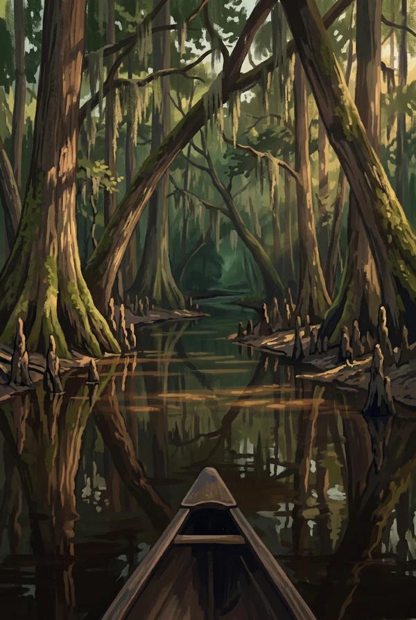
Cedar Creek
The park's blackwater artery: a slow creek stained tea-dark by tannins, running beneath the old-growth canopy as a marked paddling trail. From a canoe you travel at the forest's own speed, past cypress knees, basking turtles and, with luck, a river otter. The stamp for people whose Congaree happened at water level.
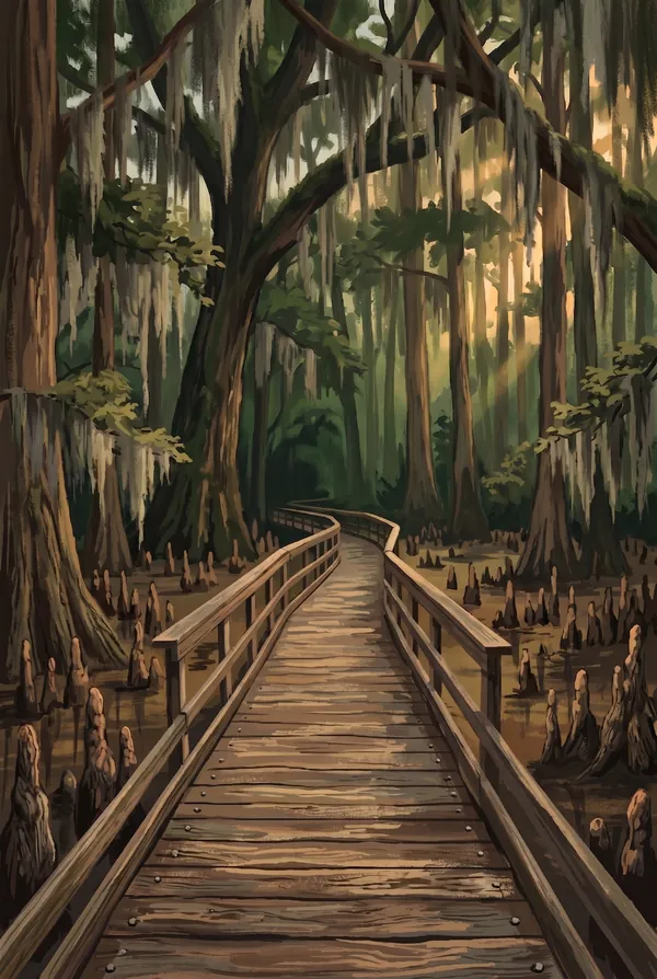
Boardwalk Loop Trail
A 2.4-mile elevated boardwalk beginning at the Harry Hampton Visitor Center, named for the newspaperman who started the fight to save this forest. It threads between champion-class trees and stays passable when the floodplain floods, which is exactly when the park makes the most sense. The way nearly everyone meets Congaree first.
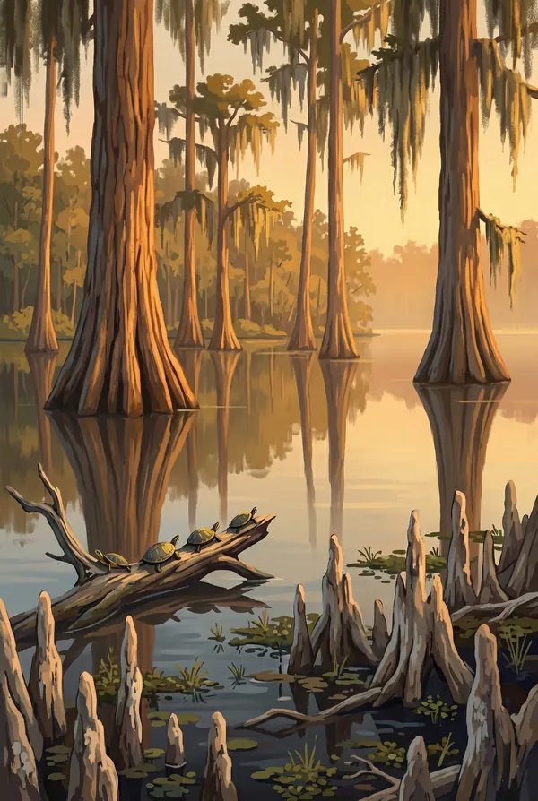
Weston Lake
An oxbow lake, a bend the Congaree River abandoned long ago, now a still, cypress-ringed backwater with an overlook on the boardwalk loop. It is the best single spot to read the floodplain's history: the river that built this forest keeps moving, and it leaves lakes behind like footprints.
How to record your Congaree visit
Free, and it works whether you are standing there now or remembering a trip from years ago.
1
Check In at the park
Open ParkStamp inside the park boundary and check in. The app confirms you are actually there and logs the date.
2
Or Stamp It later
Already been? Pick the date yourself. Trips from decades ago count the same as last weekend.
3
Or scan your photos
Let ParkStamp read the dates and locations off photos already on your phone. Most people find parks they had forgotten.
Congaree, asked and answered
Quick answers, for people planning a trip and people remembering one.
When is the best time to visit Congaree?
Spring and fall, when the air is mild and the mosquito meter behaves. Late May into early June brings the synchronous fireflies, the park's single biggest draw. Winter is underrated: high water often spreads through the forest, the paddling is at its best, and the bare canopy opens up the big trees. Summer is emphatically humid, with the insect count to match; treat it as an early-morning or evening park in July.
How many days do you need at Congaree?
Half a day covers the essentials, meaning the Boardwalk Loop with the Weston Lake overlook at an unhurried pace. A full day adds a longer walk out toward the river on the Weston Lake or Oakridge trails, or better, a guided paddle down Cedar Creek. It sits half an hour from Columbia, so it works as the rare national park you can do properly from a city hotel.
How busy is Congaree?
Congaree National Park logged 287,833 visits in 2025, the 49th busiest of the 63 national parks. That makes it one of the quieter national parks, and crowds are rarely the problem.
What does the Congaree stamp show?
The lead Congaree design is Cedar Creek. The park's blackwater artery: a slow creek stained tea-dark by tannins, running beneath the old-growth canopy as a marked paddling trail. From a canoe you travel at the forest's own speed, past cypress knees, basking turtles and, with luck, a river otter. The stamp for people whose Congaree happened at water level. The other two designs are Boardwalk Loop Trail and Weston Lake.
Is the Congaree stamp free?
Recording your Congaree visit is always free: check in at the park, add an old trip, or let the photo scan find it. The full-color art is the paid part, $3.99 one-time with three Congaree designs to choose from, and the first stamp you collect in ParkStamp is free.
Can I add a Congaree trip from years ago?
Yes. Open Congaree in ParkStamp, tap Stamp It, and set the date yourself; a visit from decades ago counts the same as last weekend. If you still have photos from the trip, the photo scan can find and date it from their location tags, without your photos ever leaving your phone.
Do I have to be at Congaree to get the stamp?
No. Check In is for when you are standing inside Congaree, and it confirms you are actually there. Stamp It records any past visit on your honor, with your dates. Both are free and put the same stamp in your StampBook.
Start your StampBook with Congaree
Free on iOS and Android. Your first stamp is on us.